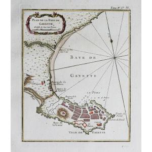
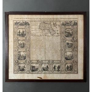
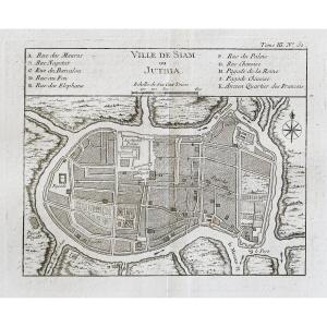
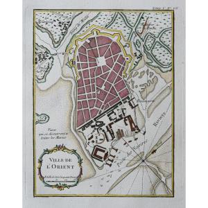
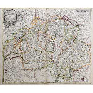
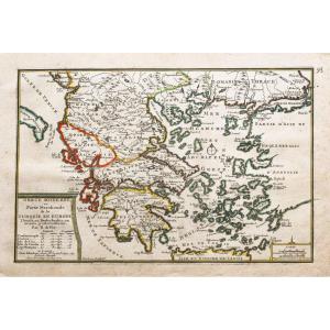
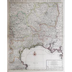
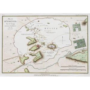
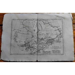
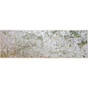
Styles Periods Categories

Old Maps

Old Maps

Other Style

18th Century


Old Map Of Paris

Epreuve originale réalisée en 1782. Pierre-François Tardieu graveur. Très beaux coloris anciens. Fines rousseurs claires dans les marges n’atteignant pas le plan. Excellent état. Format feuille : [...]

Period: 18th century

850 €
paypal


Family Tree Map Prince Of Poland (18th Century)

Family tree map Prince of Poland (18th century) Paper map representing the family tree of the Origin of the Princes and Dukes of the Family of Piaste and Origin of the First Princes and Dukes of Polan[...]

Period: 18th century

425 €

Old Geographic Map Of Savoy

Epreuve originale réalisée en 1782. Antonio Zatta éditeur. Beaux coloris aquarelle. Légères rousseurs et marques du temps dans les marges. Bon état. Format feuille : 55,5 x 41,5 cm. Format gravur[...]

Period: 18th century

220 €
paypal


Map Of Povence - Menton – Monaco – Nice

Carte des Alpes Maritimes – Menton – Monaco – Nice Epreuve originale réalisée en 1758. Villaret auteur. Très bon état. Format feuille : 67,5 x 46 cm. Parfaite Impression cartographiant la vallée d[...]

Period: 18th century

850 €
paypal


Large 18th Century Map Of Texas - Coast Of Louisiana And The Coast Of New Leon - T. Jefferys

Rare and Large 18th Century Map "The Western Coast of Louisiana and The Coast of New Leon" This is the 1794 edition by Laurie & Witthe of Thomas Jeffrys' map. Period proof Good general condition, some[...]

Period: 18th century

2 000 €
paypal


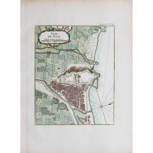
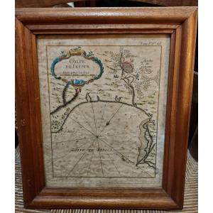
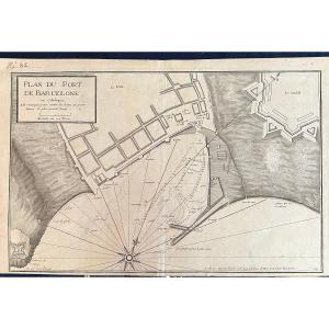
Large 18th Century Map - Saint Lucia - Caribbean - Laurie Et Whittle / Jefferys

Large 18th Century Map - Saint Lucia "St. Lucia done from Surveys and Observations made by the English whilst in their Possession" This is the 1794 edition by Laurie & Witthe of Thomas Jeffrys' map. P[...]

Period: 18th century

800 €
paypal


Large 18th Century Map - Barbados - Laurie Et Whittle / Jefferys

Large 18th Century Map - Barbados "Barbadoes, Surveyed by William Mayo, Engraved and Improved by Thomas Jefferys, Geographer to the King" This is the 1794 edition by Laurie & Witthe of Thomas Jeffrys'[...]

Period: 18th century

800 €
paypal


Old Map Of Mexico – California – Florida

Epreuve originale réalisée en 1702. Nicolas de Fer cartographe. Limites colorées de l’époque. 2 rousseurs dans la marge latérale droite loin du sujet. Bon état. Format feuille : 40 x 29 cm. Forma[...]

Period: 18th century

380 €
paypal


Old Plan Of Port Vendres

Epreuve réalisée en 1780. Moithey graveur. Rousseurs claires au niveau du pli central et dans les mages. Bon état. Format feuille : 69 x 53 cm. Format gravure : 48 x 39,5 cm. Original antique eng[...]

Period: 18th century

300 €
paypal


Old Nautical Chart Of Cancale – Cap Fréhel

Epreuve originale réalisée vers 1760. Bellin cartographe. Coloris aquarelle. Fines rousseurs claires éparses. Très bon état. Format feuille : 47 x 33 cm. Format gravure : 36 x 21 cm. Original an[...]

Period: 18th century

350 €
paypal


Old Geographic Map Of The Cevennes - Montpellier

Diocèse de Montpellier. Epreuve originale réalisée vers 1721-1741. Carel Allard cartographe. Chez Mortier. Limites colorées de l’époque. Mouillures claires dans la marge supérieure loin de la cart[...]

Period: 18th century

490 €
paypal


Old Marine Chart Of Mimizan - Boucaut - The Landes

Epreuve originale réalisée en 1757. Le Rouge cartographe. Beaux coloris aquarelle. Infimes rousseurs du temps dans les marges. Très bon état. Format feuille : 38,5 x 25 cm. Format gravure : 32 x [...]

Period: 18th century

245 €
paypal


Old Marine Map Of Finistère

Epreuve originale réalisée vers 1760. Bellin cartographe. Coloris aquarelle. Fines rousseurs claires éparses. Très bon état. Format feuille : 47 x 33 cm. Format gravure : 33 x 21 cm. Original an[...]

Period: 18th century

245 €
paypal


Ancient Geographical Map Of Brittany – Pays Nantais

Epreuve originale réalisée en 1705. Nicolas De Fer cartographe. Limites colorées de l’époque. Très bon état. Format feuille : 40 x 28 cm. Original antique map of 1705. Gouvernement général de Bre[...]

Period: 18th century

165 €
paypal


Ancient Geographical Map Of Greece

Epreuve originale réalisée en 1705. Nicolas De Fer cartographe. Limites colorées de l’époque. Fines rousseurs dans les marges n’atteignant pas la carte. Bon état. Format feuille : 40 x 28 cm. Ori[...]

Period: 18th century

165 €
paypal


Old Map Of Switzerland

Partie nord des cantons de Berne et de fribourg, les cantons de Lucer, de Soleurre… Epreuve originale réalisée en 1717. Jaillot géographe du Roi Louis XIV auteur. Limites colorées de l’époque. Bon [...]

Period: 18th century

650 €
paypal


Map Of Benelux 18th Century

Map of the Benelux region dating from the 1720s, produced by Iohanne Baptista Homanno Under glass Length (with/without frame): approx. 71 / 58cm Width (with/without frame): approx. 63.5 / 50cm [...]

Period: 18th century

450 €

Map XVIII°, The Captaincy E Narbonne

colored map representing the captaincy of Narbonne. Dimensions: 30.5cm x 40cm

Period: 18th century

200 €
paypal


Old Marine Map Of Martinique

Epreuve originale réalisée en 1758. Bellin cartographe. Beaux coloris aquarelle. Fines rousseurs claires éparses. Bon état. Format feuille : 33 x 25 cm. Format gravure : 32 x 22 cm. Original ant[...]

Period: 18th century

275 €
paypal


Ancient Engraving From Marseille

Epreuve originale réalisée en 1702. Nicolas de Fer graveur. 1 rousseur près du trait de cuivre dans la marge latérale gauche et 1 petit trou de ver dans la marge inférieure loin du sujet. Bon état. [...]

Period: 18th century

330 €
paypal


County And Government Of Provence

Map representing the county and government of Provence, by Samson, royal geographer. 52.5cm x 63.5cm

Period: 18th century

320 €
paypal


Leiden Lugdunum Batavorum Polychrome Engraving 18th Century

Beautiful engraving of the city of Leiden in the Netherlands enhanced with watercolor 18th Century Very good original condition Engraving dimensions: 29.5 cm x 18.5 cm Dimensions with its frame: 36 cm[...]

Period: 18th century

230 €

Old Geographical Map Of Languedoc

Original proof engraved in 1730. Mortier publisher. Colorful boundaries of the time. Oxidation in the right lateral margin not reaching the card. Good condition. Sheet size: 77.5 x 53.5 cm. Engraving [...]

Period: 18th century

450 €
paypal


Ancient Map Of Athens

Epreuve originale réalisée en 1784. Tardieu graveur. Beaux coloris aquarelle. Très bon état. Format feuille : 37,5 x 25,5 cm. Format gravure : 32,5 x 21,5 cm. Original antique plan of 1784 Vou[...]

Period: 18th century

145 €
paypal


Map Of Canada - Rigobert Bonne - 1788

Marine map from the "Encyclopedic Atlas, containing ancient geography, and some maps on the geography of the Middle Ages, modern geography, and maps relating to physical geography", Paris, Hôtel de Th[...]

Period: 18th century

80 €
paypal


Map Of The Society Islands - Rigobert Bonne - 1787

Marine map from the "Encyclopedic Atlas, containing ancient geography, and some maps on the geography of the Middle Ages, modern geography, and maps relating to physical geography", Paris, Hôtel de Th[...]

Period: 18th century

120 €
paypal


Old Geographical Map – Marie-galante Island

Epreuve originale réalisée en 1764. Bellin cartographe. Coloris aquarelle. Rousseurs claires dans les marges n’atteignant pas la carte. Bon état. Format feuille : 34 x 25,5 cm. Format gravure : 2[...]

Period: 18th century

400 €
paypal


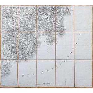
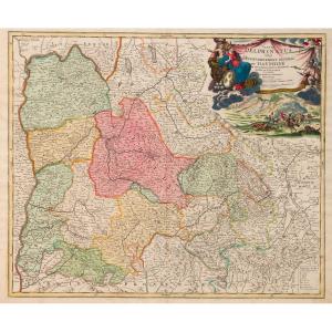
Grande Carta Corografica Degli Stati Di S.m. Re Di Sardegna Del 1772 Di Stagnon E Borgonio

Grande Carta Corografica degli Stati di S.M. Re di Sardegna del 1772 di Stagnon e Borgonio Large and Rare Chorographic Map of the States of H.M. the King of Sardinia in 1683 corrected and augmented[...]

Period: 18th century

4 500 €

Old Map Of The Bay Of Gaeta – Italy

Epreuve originale réalisée en 1764. Bellin géographe. Coloris aquarelle. Rousseurs claires dans les marges. Très bon état. Format feuille : 34 x 24,5 cm. Format gravure : 23 x 18 cm. Original an[...]

Period: 18th century

225 €
paypal


18th Century Map Of The Island Of Madagascar

This map is from the 18th century, no doubt about it. It is beautifully made. Unfortunately, we report numerous traces of humidity and spots of freckles, the card is a little warped at the bottom, a s[...]

Period: 18th century

130 €

Old Map Of The City Of Bangkok – Siam Thailand

Epreuve originale réalisée en 1760. Bellin géographe. Coloris aquarelle. Rousseurs claires dans les marges. Très bon état. Format feuille : 48 x 34 cm. Format gravure : 24 x 18 cm. Original anti[...]

Period: 18th century

295 €
paypal


Old Map Of Lorient – Brittany

Epreuve originale réalisée en 1760. Bellin géographe. Coloris aquarelle. Rousseurs claires dans les marges. Très bon état. Format feuille : 33,5 x 24 cm. Format gravure : 23 x 19 cm. Original an[...]

Period: 18th century

250 €
paypal


Old Geographical Map Of Switzerland

Divisée en ses 13 cantons et ses alliés. Epreuve originale réalisée en 1782. Bonne cartographe. Limites colorées à l’aquarelle. Petits trous de ver près de Zurich. Restauration ancienne dans la mar[...]

Period: 18th century

275 €
paypal


Old Map – Government Of Provence And Generality Of Aix

Epreuve originale réalisée en 1705. Nicolas de Fer géographe. Beaux coloris aquarelle. Très bon état. Format feuille : 40,5 x 27,5 cm. Format gravure : 34,5 x 23,5 cm. Original antique map of 170[...]

Period: 18th century

175 €
paypal


Old Plan Of Bourges

Plan of the town and suburbs of Bourges, capital of the province of Berri. Original proof made in 1705. Nicolas de Fer cartographer. 1 small wormhole under the title block. Good condition. Sheet size:[...]

Period: 18th century

155 €
paypal


Ancient Geographic Map – The Earth At The Time Of The Gospel

Epreuve originale réalisée vers 1750. Anonyme. Une partie de la marge latérale gauche rapportée anciennement. 1 pli ancien dans l’angle inférieur gauche. Bon état. Format feuille : 46 x 38 cm. Fo[...]

Period: 18th century

245 €
paypal


Old Marine Map Of The Philippines

Epreuve originale réalisée vers 1760. Coloris aquarelle. Rousseurs éparses. Bon état. Format feuille : 35 x 25 cm. Format gravure : 22 x 19,5 cm. Original antique chart of 1760 Vous pouvez co[...]

Period: 18th century

200 €
paypal


Old Geographical Map Of Santo Domingo

Epreuve originale gravée en 1750. Robert de Vaugondy cartographe. Limites colorées de l’époque. Légère oxydation classique dans les marges n’atteignant pas la carte. Très bon état. Format feuille [...]

Period: 18th century

375 €
paypal


Old Geographical Map – Duchy Of Burgundy

Grande épreuve originale réaliséeen 1720, datée 1780 lorsque Dezauche rachète les cuivres à la Maison Delisle. Gravée sur 2 feuillets joints. Guillaume De L’Isle cartographe, Dezauche géographe succe[...]

Period: 18th century

660 €
paypal


Old Map Of Metz

Epreuve originale réalisée en 1720. Bodenhr graveur. Fines rousseurs et un trou ancien sur 2mm dans légende du tableau de gauche. Etat correct. Format feuille : 31 x 19,5 cm. Format gravure : 26 x[...]

Period: 18th century

115 €
paypal


Old Geographical Map Of The English Channel

La Manche ou le Canal au septentrion duquel se trouve le Royaume d’Angleterre et au Midi les côtes de Bretagne et de Normandie. Epreuve originale réalisée vers 1700. Nicolas de Fer cartographe. Limi[...]

Period: 18th century

350 €
paypal


Old Map Of Porrentruy And Basel – Cassini

Epreuve originale de Cassini réalisée en 1764. Editée chez Auvray en 1790. Entoilées d’époque et montées en 15 sections. Beaux coloris anciens. 1 rousseur dans la mer. Très bon état. Format feuil[...]

Period: 18th century

300 €
paypal


Old Geographical Map Of The Island Of Cayenne

Original map engraved in 1760. Bellin geographer. Watercolor colors. Fine light foxing in the margins not reaching the map. Very good state. Sheet size: 48.5 x 33.5 cm. Engraving format: 34 x 25 cm. O[...]

Period: 18th century

280 €
paypal


18th Century Watercolor Map Of The Ile De Ré By Le Rouge 1746

Lightly watercolored map from 1746 by Le Rouge, representing the Ile de Ré. Slight stains on the paper which do not affect the quality of this card. Pitchpin style oak frame with net 33 cm x 27 cm

Period: 18th century

390 €

Old Geographical Map Of Provence

Epreuve originale réalisée en 1708. Nicolas de Fer cartographe. Limites colorées de l’époque. Restauration d’un manque de papier sur 1 cm au niveau de la ville Le Tourrennet, avec légende manuscrite[...]

Period: 18th century

480 €
paypal


Rigobert Bonne (1727-1795) Map Of The Canary Islands With The Island Of Madeira And Porto Santo

Map of the Canary Islands, with the island of Madeira and that of Porto Santo Color engraving after Rigobert Bonne engineer and hydrographer of the Navy 32 x 21 cm

Period: 18th century

450 €

Old Geographical Map Of Switzerland - Tyrol

Epreuve originale réalisée en 1750. Robert de Vaugondy cartographe. Seconde édition de 1790. Beaux coloris aquarelle. Mouillure claire dans le bas des marges latérales n’atteignant pas la carte. B[...]

Period: 18th century

170 €
paypal


Old Geographical Map Of France

Epreuve originale réalisée en 1747. De la Feuille éditeur. Beaux coloris anciens. 1 rousseur dans l’encadré représentant la ville de Paris. Très bon état. Format feuille : 30 x 20,5 cm. Format gr[...]

Period: 18th century

225 €
paypal


Old Map Of Neufchatel – Vallangin – Switzerland

Original map engraved around 1750. Sauerbery engraver. Formerly lined on Japanese paper. Good condition. Sheet size: 36 x 24.5 cm. Engraving format: 33 x 22.5 cm. Original antique map around 1750. M[...]

Period: 18th century

195 €
paypal


Old Handwritten Map 18th Century Dunkirk 1781 North Fortifications

Old handwritten map (18th century): DUNKERQUE 1781, First Sheet of the Project - PLAN OF DUNKERQUE which indicates the Repairs proposed by the various Articles of the Project for 1781. Pen and ink was[...]

Period: 18th century

800 €

Old Geographical Map Of Cambrai - Cambresis

Epreuve originale réalisée en 1690. Vincenzo Coronelli cartographe. Belle épreuve bien contrastée. Format feuille : 66,5 x 49,5 cm. Format gravure : 61 x 45,5 cm. Original antique map of 1690. Be[...]

Period: 18th century

300 €
paypal


Old Plan Of Halle – Germany

Epreuve originale réalisée vers 1720. Homann cartographe. Très beaux coloris anciens. 2 oxydations dans la légende du panorama et au niveau de Diemnitz. Bon état. Format feuille : 61 x 51 cm. For[...]

Period: 18th century

390 €
paypal


Old Geographical Map Of Switzerland

Epreuve originale réalisée vers 1720. Valck cartographe. Limites colorées de l’époque. Marge supérieure coupée au cuivre. Oxydation au niveau du pli central. Etat correct. Format feuille : 61 x 5[...]

Period: 18th century

300 €
paypal


Old Geographical Map Of The Diocese Of Béziers

Original proof made around 1740. Covens et Mortier publishers. Guillaume DeLisle geographer. Colorful boundaries of the time. Beautiful old colors. 1 reinforcement in the upper margin at the title lev[...]

Period: 18th century

320 €
paypal


Old Geographical Map Of Alsace

Epreuve originale réalisée vers 1720. P. Schenk auteur. Limites colorées de l’époque. 2 renforts au dos de la carte dans l’angle inférieur gauche et pli central droit. Bon état. Format feuille : 5[...]

Period: 18th century

285 €
paypal


Map Of The City Of Vienna And Its Surroundings

Interesting plan which shows the defenses and surroundings of the capital of the Habsburg Empire around 1742. The course of the Danube, which has not yet been tamed, with its numerous arms and islands[...]

Period: 18th century

380 €

Old Geographical Map Of Provence

Large épreuve originale réalisée en 1707. Hubert Jaillot cartographe. Limites colorées de l’époque. 1 pincement ancien de papier dans l’angle supérieur gauche. Très bon état. Format feuille : 79 x[...]

Period: 18th century

950 €
paypal


Old Map Of Nice

Epreuve originale réalisée vers 1750. Bellin cartographe. Rousseurs claires éparses dans les marges. Coloris aquarelle. Très bon état. Format feuille : 34 x 25 cm. Format cuivre : 23 x 18 cm. Or[...]

Period: 18th century

290 €
paypal


Old Geographical Map Of Portugal

Epreuve originale réalisée vers 1720. Baptist Homann cartographe. Beaux coloris anciens. Très bon état. Format feuille : 63,5 x 51 cm. Format gravure : 57 x 49,5 cm. Original antique map of 1720.[...]

Period: 18th century

490 €
paypal


Maritime Map Gulf Of Frejus By Jacques Nicolas Bellin 1764

Beautiful 18th century maritime map representing the Gulf of Frejus. This engraving enhanced with gouache comes from a Maritime Atlas by Jacques Nicolas Bellin in 1764. Some foxing. Dimensions at sigh[...]

Period: 18th century

200 €

Subscribe to newsletter
line
facebook
pinterest
instagram