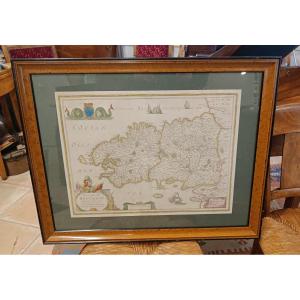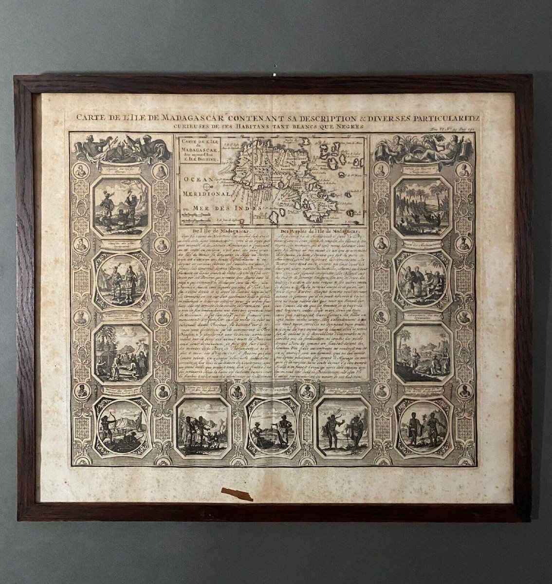
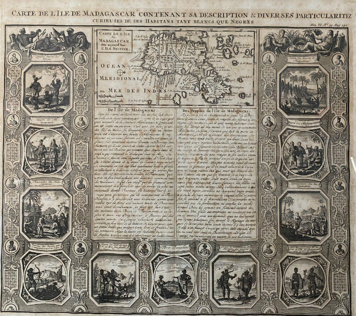

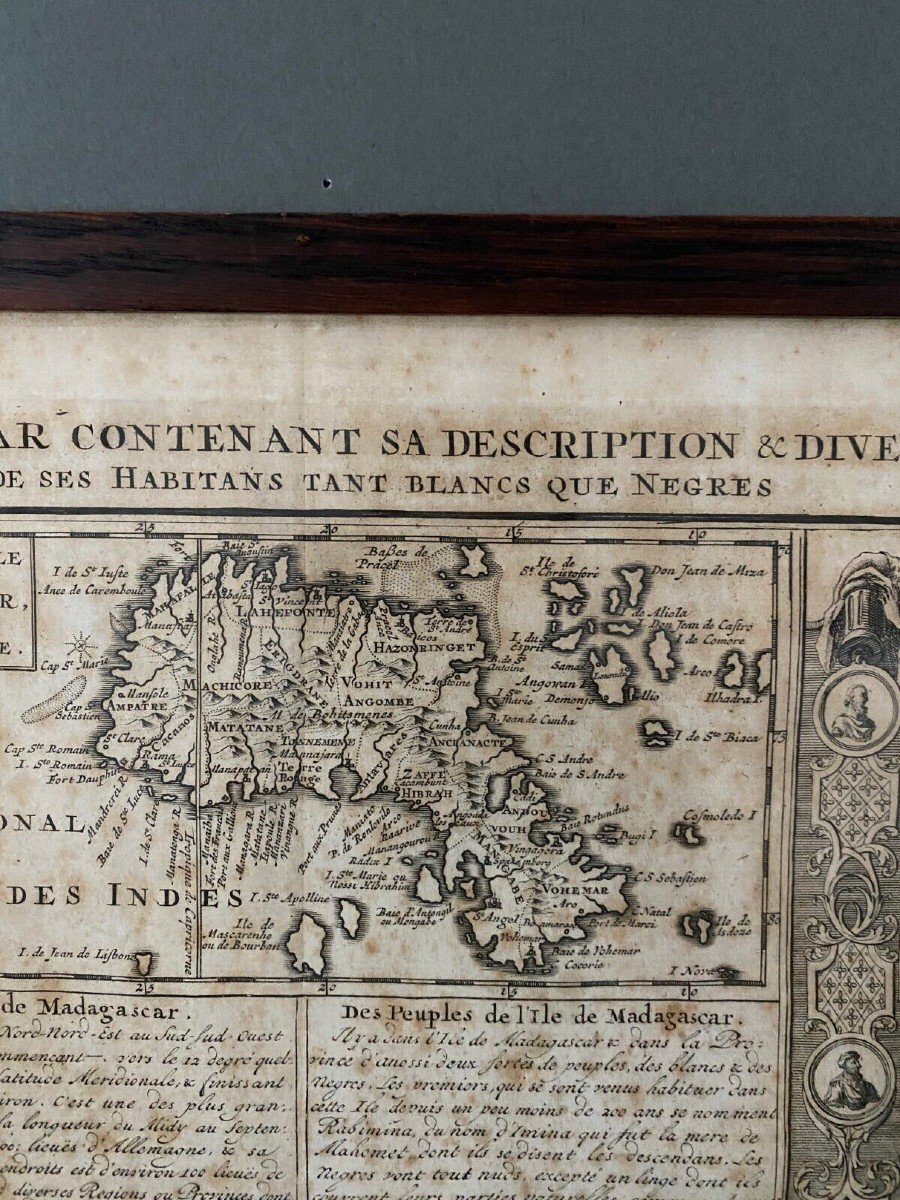


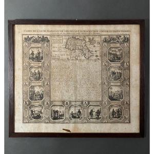


18th Century Map Of The Island Of Madagascar
This map is from the 18th century, no doubt about it. It is beautifully made. Unfortunately, we report numerous traces of humidity and spots of freckles, the card is a little warped at the bottom, a small piece of paper is present, the wooden frame is damaged and the glass is moving, note that the tape is peeling off . It is sold as is, acceptable, but not perfect. Our photos allow you to appreciate the quality of the work. For the condition, please detail the photos. Do not hesitate to zoom in. The photos are an integral part of the description. Dimensions: - Frame Height: 47.4 cm Width: 54.7 cm Thickness: 1 cm - View Height: 43.5 cm Width: 50.9 cm E: A6528
130 €
Period: 18th century
Style: Other Style
Condition: En l'etat
Material: Paper
Width: 54,7 cm
Height: 47,4 cm
Depth: 1 cm
Reference (ID): 1311953
Availability: In stock
Print