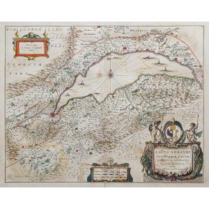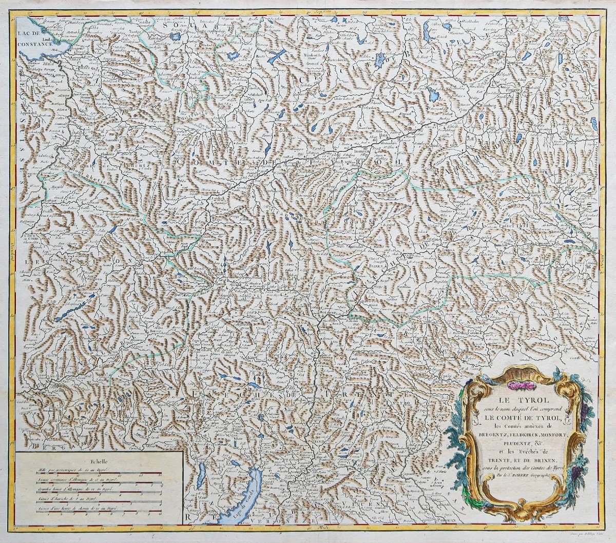
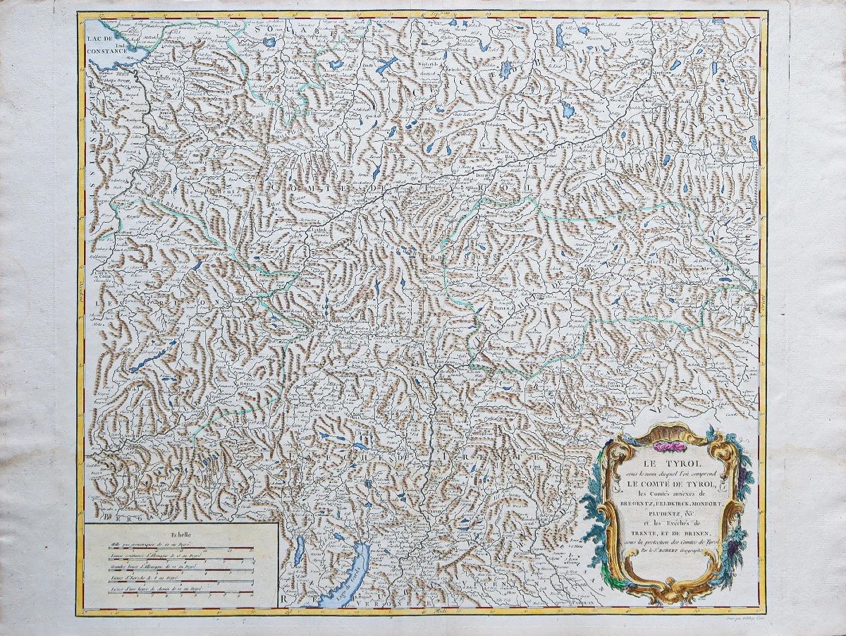
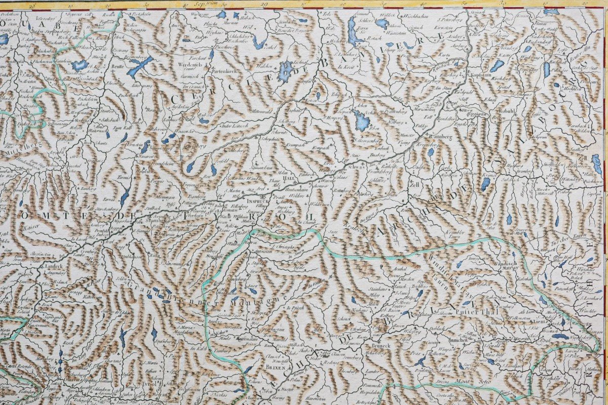
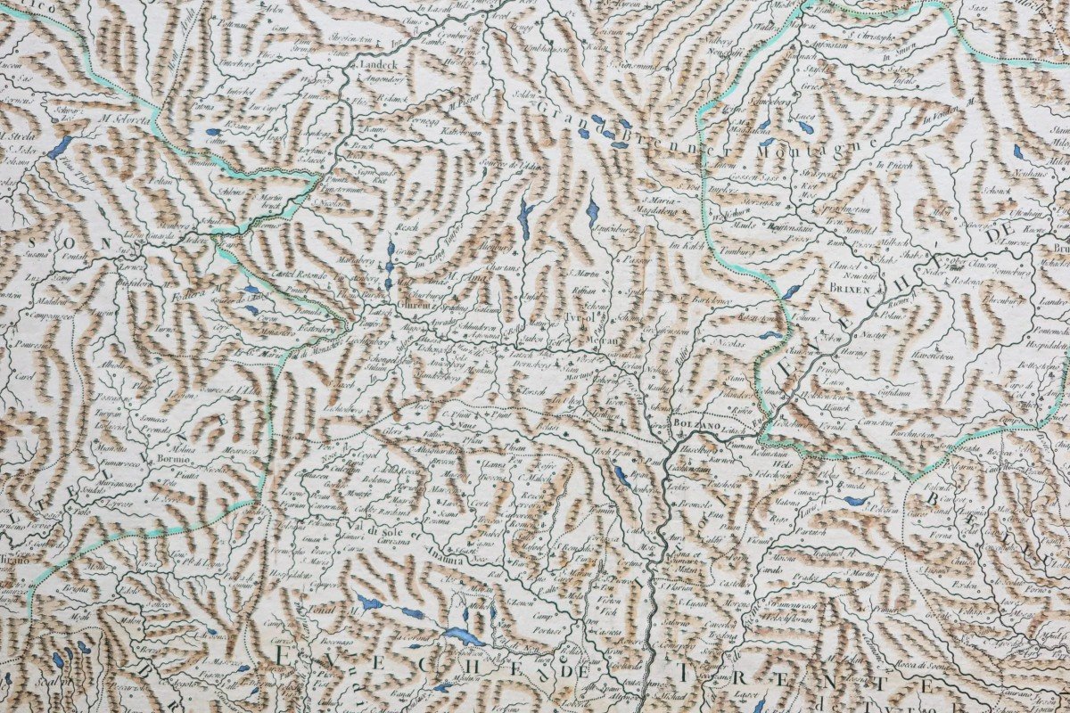


Old Geographical Map Of Switzerland - Tyrol
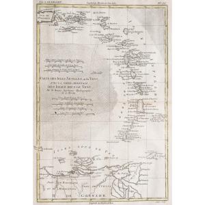
Epreuve originale réalisée en 1750. Robert de Vaugondy cartographe.
Seconde édition de 1790.
Beaux coloris aquarelle.
Mouillure claire dans le bas des marges latérales n’atteignant pas la carte.
Bon état.
Format feuille : 67,5 x 50,5 cm.
Format cuivre : 58 x 49 cm.
Original antique map of 1750.
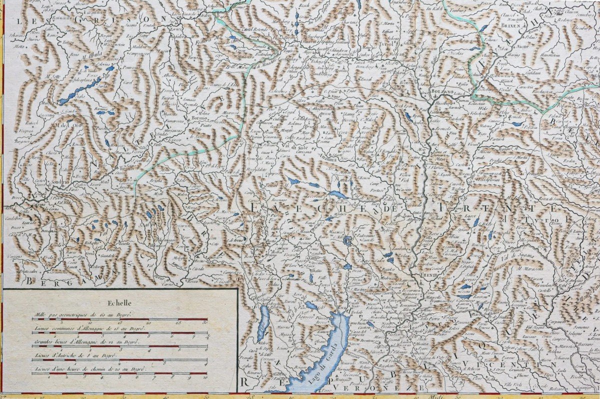
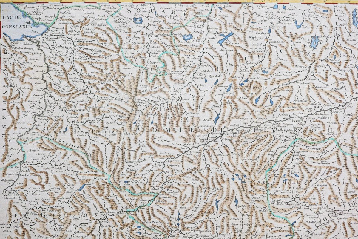
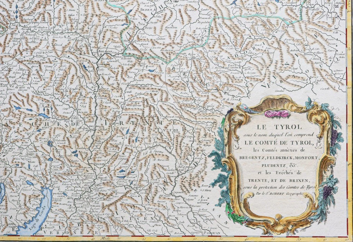
Le Tyrol sous le nom duquel l’on comprend le comté du Tyrol. Les comtés annexes de Bregentz, Feldkirck, Montfort, Pludentz etc…
Echelle des mesures.
Vous pouvez consulter l’ensemble des cartes, livres et gravures disponibles sur votre région en cliquant sur le lien de notre site internet spécialisé en archives anciennes géographiques :
https://cartes-livres-anciens.com/categorie-produit/cartes-geographiques-anciennes-original-antique-maps/europe/suisse/
Règlement sécurisé par carte bancaire sur notre site internet en cliquant sur le lien ci-dessous :
https://cartes-livres-anciens.com/produit/cartes-geographiques-anciennes-original-antique-maps/europe/suisse/carte-geographique-ancienne-du-tyrol/
Toutes nos cartes et gravures sont accompagnées d’un certificat d’authenticité.
Gilles Robert de Vaugondy, dit Robert de Vaugondy, né en 1688 et mort en 1766, est un géographe et cartographe français.
Petit-fils de Nicolas Sanson, il est nommé géographe du roi. Il est le père du géographe et cartographe Didier Robert de Vaugondy (1723-1786), avec lequel il compose une collection de carte sur le Monde, parue en 1757.
Original proof made in 1750. Robert de Vaugondy cartographer. Second edition from 1790. Beautiful watercolor colors. Light watering at the bottom of the side margins not reaching the map. Good condition. Sheet size: 67.5 x 50.5 cm. Copper format: 58 x 49 cm. Original antique map of 1750. Tyrol by which name we understand the county of Tyrol. The annexed counties of Bregentz, Feldkirck, Montfort, Pludentz etc… Scale of measurements. You can consult all the maps, books and engravings available in your region by clicking on the link to our website specializing in ancient geographical archives: https://cartes-livres-anciens.com/categorie-produit/cartes-gegraphiques -Ancienes-original-antique-maps/europe/suisse/ Secure payment by credit card on our website by clicking on the link below: https://cartes-livres-anciens.com/produit/cartes-gegraphiques-Ancienes -original-antique-maps/europe/suisse/ancient-geographic-map-of-tyrol/ All our maps and engravings are accompanied by a certificate of authenticity. Gilles Robert de Vaugondy, known as Robert de Vaugondy, born in 1688 and died in 1766, is a French geographer and cartographer. Grandson of Nicolas Sanson, he was appointed geographer to the king. He is the father of the geographer and cartographer Didier Robert de Vaugondy (1723-1786), with whom he composed a collection of maps of the World, published in 1757.
Seconde édition de 1790.
Beaux coloris aquarelle.
Mouillure claire dans le bas des marges latérales n’atteignant pas la carte.
Bon état.
Format feuille : 67,5 x 50,5 cm.
Format cuivre : 58 x 49 cm.
Original antique map of 1750.
Le Tyrol sous le nom duquel l’on comprend le comté du Tyrol. Les comtés annexes de Bregentz, Feldkirck, Montfort, Pludentz etc…
Echelle des mesures.
Vous pouvez consulter l’ensemble des cartes, livres et gravures disponibles sur votre région en cliquant sur le lien de notre site internet spécialisé en archives anciennes géographiques :
https://cartes-livres-anciens.com/categorie-produit/cartes-geographiques-anciennes-original-antique-maps/europe/suisse/
Règlement sécurisé par carte bancaire sur notre site internet en cliquant sur le lien ci-dessous :
https://cartes-livres-anciens.com/produit/cartes-geographiques-anciennes-original-antique-maps/europe/suisse/carte-geographique-ancienne-du-tyrol/
Toutes nos cartes et gravures sont accompagnées d’un certificat d’authenticité.
Gilles Robert de Vaugondy, dit Robert de Vaugondy, né en 1688 et mort en 1766, est un géographe et cartographe français.
Petit-fils de Nicolas Sanson, il est nommé géographe du roi. Il est le père du géographe et cartographe Didier Robert de Vaugondy (1723-1786), avec lequel il compose une collection de carte sur le Monde, parue en 1757.
Original proof made in 1750. Robert de Vaugondy cartographer. Second edition from 1790. Beautiful watercolor colors. Light watering at the bottom of the side margins not reaching the map. Good condition. Sheet size: 67.5 x 50.5 cm. Copper format: 58 x 49 cm. Original antique map of 1750. Tyrol by which name we understand the county of Tyrol. The annexed counties of Bregentz, Feldkirck, Montfort, Pludentz etc… Scale of measurements. You can consult all the maps, books and engravings available in your region by clicking on the link to our website specializing in ancient geographical archives: https://cartes-livres-anciens.com/categorie-produit/cartes-gegraphiques -Ancienes-original-antique-maps/europe/suisse/ Secure payment by credit card on our website by clicking on the link below: https://cartes-livres-anciens.com/produit/cartes-gegraphiques-Ancienes -original-antique-maps/europe/suisse/ancient-geographic-map-of-tyrol/ All our maps and engravings are accompanied by a certificate of authenticity. Gilles Robert de Vaugondy, known as Robert de Vaugondy, born in 1688 and died in 1766, is a French geographer and cartographer. Grandson of Nicolas Sanson, he was appointed geographer to the king. He is the father of the geographer and cartographer Didier Robert de Vaugondy (1723-1786), with whom he composed a collection of maps of the World, published in 1757.
170 €
Period: 18th century
Style: Other Style
Condition: Good condition
Material: Paper
Reference (ID): 1233654
Availability: In stock
Print