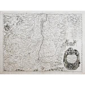
Map Of Benelux 18th Century
Map of the Benelux region dating from the 1720s, produced by Iohanne Baptista Homanno
Under glass
Length (with/without frame): approx. 71 / 58cm
Width (with/without frame): approx. 63.5 / 50cm
Good condition,
Secure shipping within the EU (20€)
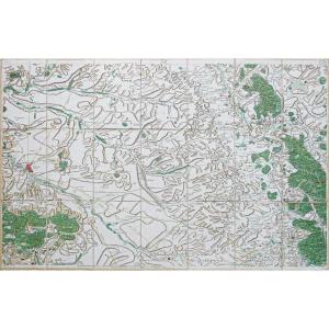
Under glass
Length (with/without frame): approx. 71 / 58cm
Width (with/without frame): approx. 63.5 / 50cm
Good condition,
Secure shipping within the EU (20€)
450 €
Period: 18th century
Style: Other Style
Condition: Good condition
Material: Paper
Reference (ID): 1369320
Availability: In stock
Print