


Normandy - Map Of Falaize And Guibray - C. 1800
Artist: Blondeau
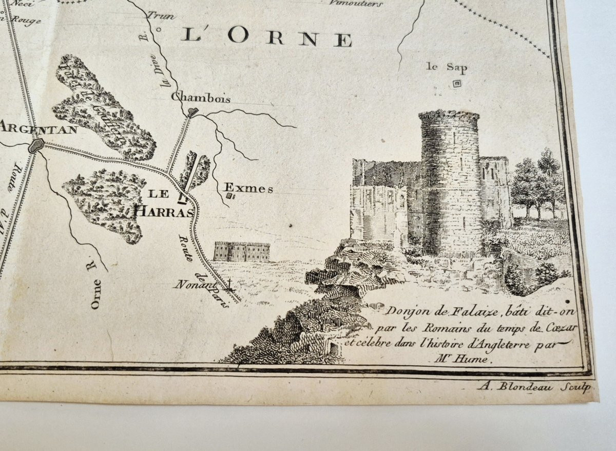
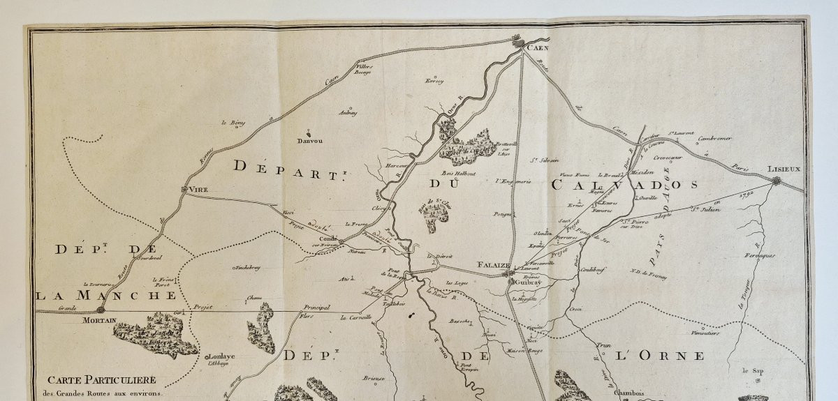
[NORMANDY]. BLONDEAU, Alexandre Jean Nicolas. Detailed map of the main roads around Falaise and Guibray, [Paris: ca. 1800]. Copper engraving. Sheet dimensions: 42 x 28 cm. Two contemporary handwritten notes on the map: "adopted". Rare road map of Falaise and its surroundings. The map was engraved by the Parisian engraver Alexandre Jean Nicolas Blondeau (1771-1832), who would be appointed, in 1816, engraver to the king and first engraver of the War Depot. The map also specifies that the inscription is from his wife: "written by Madame Blondeau". Alexandre Blondeau and Marie Jeanne Bellanger were married in 1793. A later version of the map exists, enriched with an illustration of the Château de la Frenaye near Falaise engraved in the upper left corner, and with a different caption accompanying the image of the Falaise keep in the lower right corner. In this version, the artist is identified as "Baron de la Fresnaye," whereas on our map, he is designated as "A. Lafrenaye." This detail allows us to date it to before 1811, the year Noël Urbain André de La Frenaye (1729-1818) was made a Baron of the Empire. His ancestor, Isaac André, a wealthy merchant at the Guibray fair, bought back the Château de la Frenaye at the end of the 17th century. The link with the Guibray fair appears on the map, which shows, in addition to "the main roads around Falaise and Guibray," the "various projects to complete them and make them useful for the trade of the Guibray fair." The Guibray fair, named after a suburb of Falaise in Calvados, was one of the oldest and most important trade fairs in France from the 11th century until the end of the 19th century, when it was reduced to a livestock fair before falling into disuse. No copy of our version is held at the CCFr, which lists 3 copies of 2 later versions (BnF, Caen and at the Calvados Archives).
300 €
Period: 18th century
Style: Other Style
Condition: Good condition
Material: Paper
Reference (ID): 1659747
Availability: In stock
Print