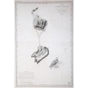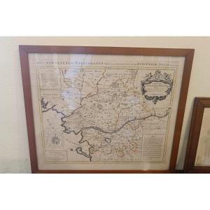


Old Geographical Map Of Santo Domingo
Epreuve originale gravée en 1750. Robert de Vaugondy cartographe.
Limites colorées de l’époque.
Légère oxydation classique dans les marges n’atteignant pas la carte.
Très bon état.
Format feuille : 71,5 x 55,5 cm.
Format gravure : 54,5 x 50 cm.
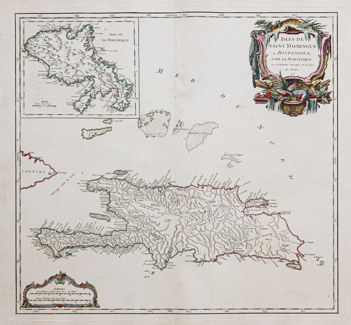
Original antique map of 1750.
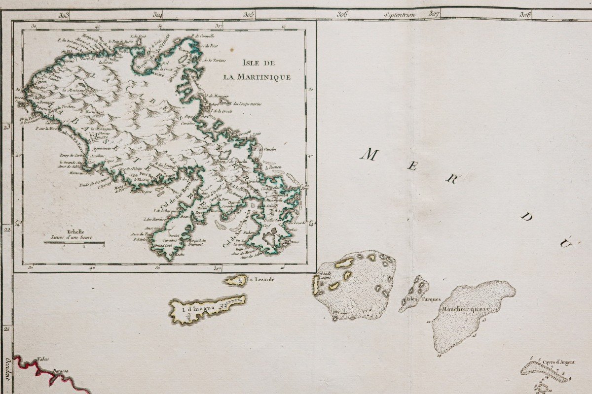
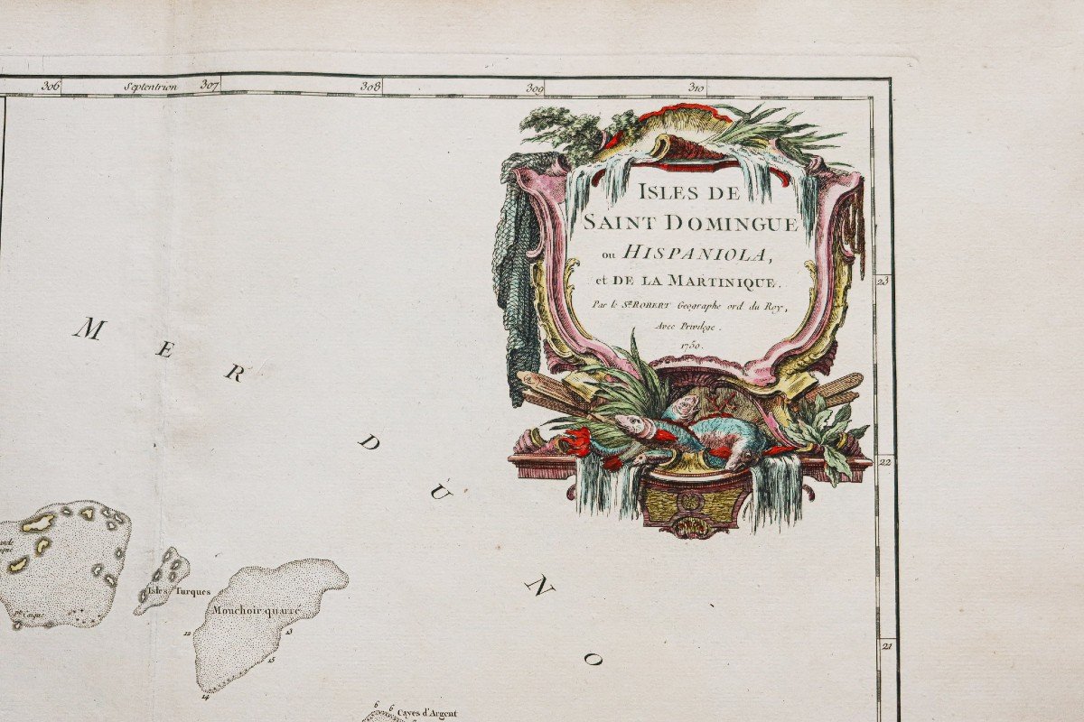
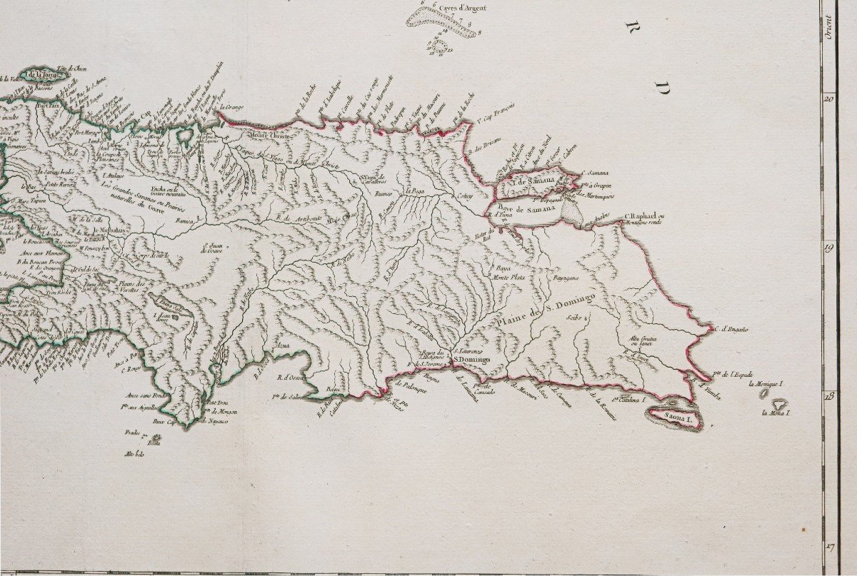
Îles de Saint Domingue ou Hispaniola et de la Martinique.
Excellente carte du géographe Robert de Vaugondy en première édition. Echelle des mesures, cartouche de titre aquarellé.
Vous pouvez consulter l’ensemble des cartes, livres et gravures disponibles sur votre région en cliquant sur le lien de notre site internet spécialisé en archives anciennes géographiques :
https://cartes-livres-anciens.com/categorie-produit/cartes-geographiques-anciennes-original-antique-maps/ameriques/caraibes/
Règlement sécurisé par carte bancaire sur notre site internet en cliquant sur le lien ci-dessous :
https://cartes-livres-anciens.com/produit/cartes-geographiques-anciennes-original-antique-maps/ameriques/caraibes/carte-geographique-ancienne-de-saint-domingue-2/
Toutes nos cartes et gravures sont accompagnées d’un certificat d’authenticité.
Gilles Robert de Vaugondy, dit Robert de Vaugondy, né en 1688 et mort en 1766, est un géographe et cartographe français. En 1757, ils réalisent l’Atlas Universel, considéré comme une autorité pendant de nombreuses années.
Petit-fils de Nicolas Sanson, il est nommé géographe du Roi. Il est le père du géographe et cartographe Didier Robert de Vaugondy (1723-1786), avec lequel il compose une collection de carte sur le Monde, parue en 1757.
Original proof engraved in 1750. Robert de Vaugondy cartographer. Colorful boundaries of the time. Slight classic oxidation in the margins not reaching the card. Very good state. Sheet size: 71.5 x 55.5 cm. Engraving format: 54.5 x 50 cm. Original antique map of 1750. Islands of Santo Domingo or Hispaniola and Martinique. Excellent map by geographer Robert de Vaugondy in first edition. Scale of measurements, watercolor title cartridge. You can consult all the maps, books and engravings available in your region by clicking on the link to our website specializing in ancient geographical archives: https://cartes-livres-anciens.com/categorie-produit/cartes-gegraphiques -Ancienes-original-antique-maps/ameriques/caraibes/ Secure payment by credit card on our website by clicking on the link below: https://cartes-livres-Anciens.com/produit/cartes-gegraphiques-Ancienes -original-antique-maps/americas/caribbean/ancient-geographic-map-of-saint-domingo-2/ All our maps and engravings are accompanied by a certificate of authenticity. Gilles Robert de Vaugondy, known as Robert de Vaugondy, born in 1688 and died in 1766, is a French geographer and cartographer. In 1757, they produced the Universal Atlas, considered an authority for many years. Grandson of Nicolas Sanson, he was appointed geographer to the King. He is the father of the geographer and cartographer Didier Robert de Vaugondy (1723-1786), with whom he composed a collection of maps of the World, published in 1757.
Limites colorées de l’époque.
Légère oxydation classique dans les marges n’atteignant pas la carte.
Très bon état.
Format feuille : 71,5 x 55,5 cm.
Format gravure : 54,5 x 50 cm.
Original antique map of 1750.
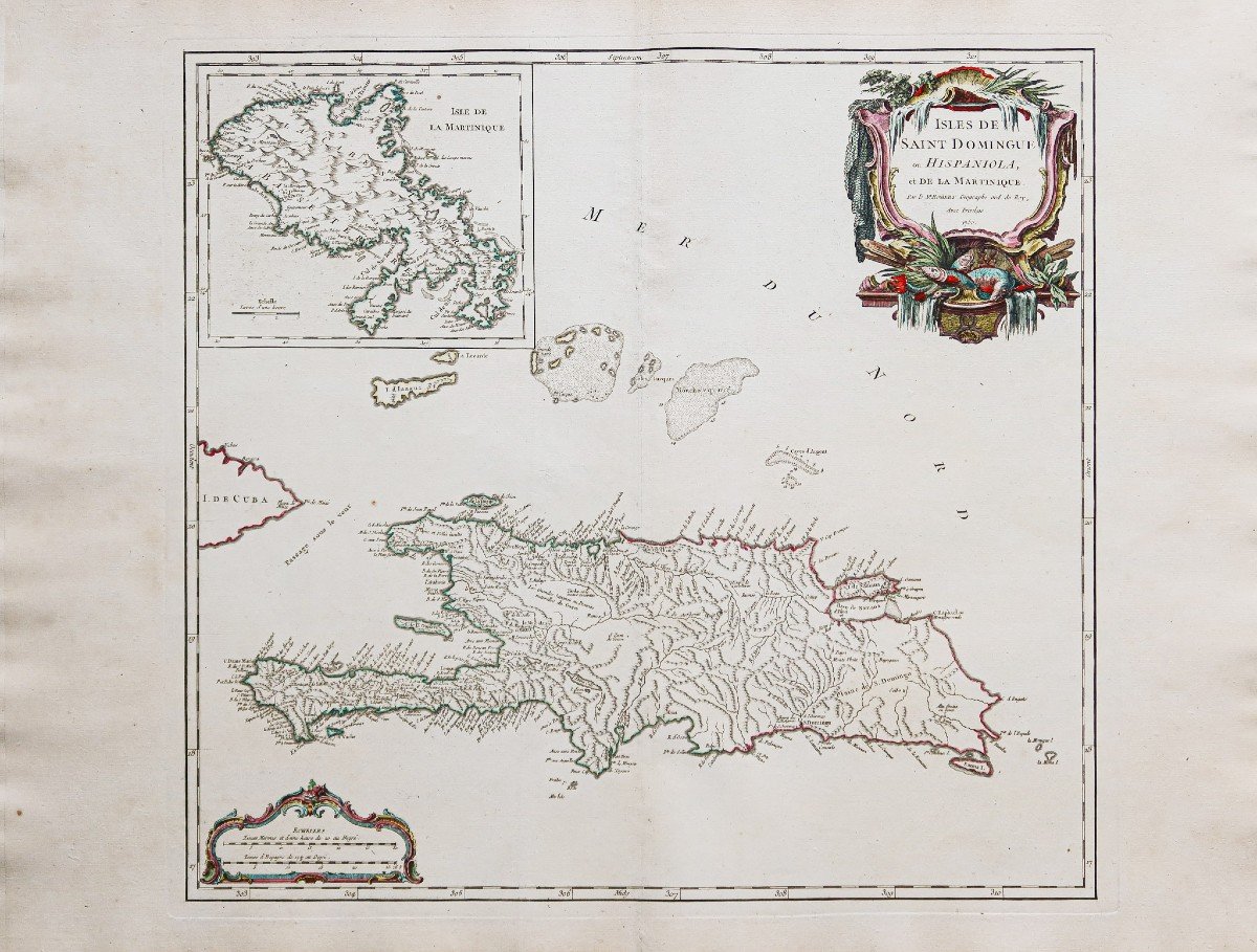
Îles de Saint Domingue ou Hispaniola et de la Martinique.
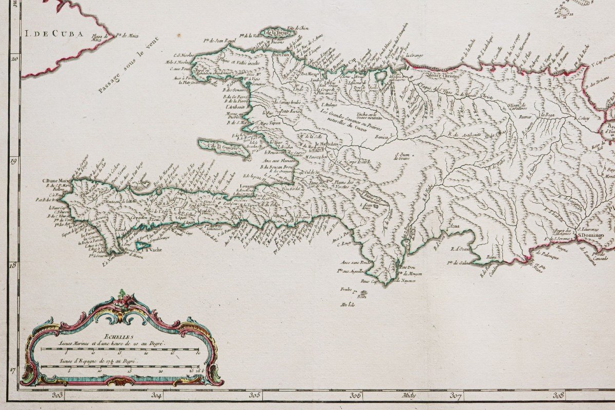
Excellente carte du géographe Robert de Vaugondy en première édition. Echelle des mesures, cartouche de titre aquarellé.
Vous pouvez consulter l’ensemble des cartes, livres et gravures disponibles sur votre région en cliquant sur le lien de notre site internet spécialisé en archives anciennes géographiques :
https://cartes-livres-anciens.com/categorie-produit/cartes-geographiques-anciennes-original-antique-maps/ameriques/caraibes/
Règlement sécurisé par carte bancaire sur notre site internet en cliquant sur le lien ci-dessous :
https://cartes-livres-anciens.com/produit/cartes-geographiques-anciennes-original-antique-maps/ameriques/caraibes/carte-geographique-ancienne-de-saint-domingue-2/
Toutes nos cartes et gravures sont accompagnées d’un certificat d’authenticité.
Gilles Robert de Vaugondy, dit Robert de Vaugondy, né en 1688 et mort en 1766, est un géographe et cartographe français. En 1757, ils réalisent l’Atlas Universel, considéré comme une autorité pendant de nombreuses années.
Petit-fils de Nicolas Sanson, il est nommé géographe du Roi. Il est le père du géographe et cartographe Didier Robert de Vaugondy (1723-1786), avec lequel il compose une collection de carte sur le Monde, parue en 1757.
Original proof engraved in 1750. Robert de Vaugondy cartographer. Colorful boundaries of the time. Slight classic oxidation in the margins not reaching the card. Very good state. Sheet size: 71.5 x 55.5 cm. Engraving format: 54.5 x 50 cm. Original antique map of 1750. Islands of Santo Domingo or Hispaniola and Martinique. Excellent map by geographer Robert de Vaugondy in first edition. Scale of measurements, watercolor title cartridge. You can consult all the maps, books and engravings available in your region by clicking on the link to our website specializing in ancient geographical archives: https://cartes-livres-anciens.com/categorie-produit/cartes-gegraphiques -Ancienes-original-antique-maps/ameriques/caraibes/ Secure payment by credit card on our website by clicking on the link below: https://cartes-livres-Anciens.com/produit/cartes-gegraphiques-Ancienes -original-antique-maps/americas/caribbean/ancient-geographic-map-of-saint-domingo-2/ All our maps and engravings are accompanied by a certificate of authenticity. Gilles Robert de Vaugondy, known as Robert de Vaugondy, born in 1688 and died in 1766, is a French geographer and cartographer. In 1757, they produced the Universal Atlas, considered an authority for many years. Grandson of Nicolas Sanson, he was appointed geographer to the King. He is the father of the geographer and cartographer Didier Robert de Vaugondy (1723-1786), with whom he composed a collection of maps of the World, published in 1757.
375 €
Period: 18th century
Style: Other Style
Condition: Excellent condition
Material: Paper
Reference (ID): 1264425
Availability: In stock
Print