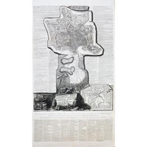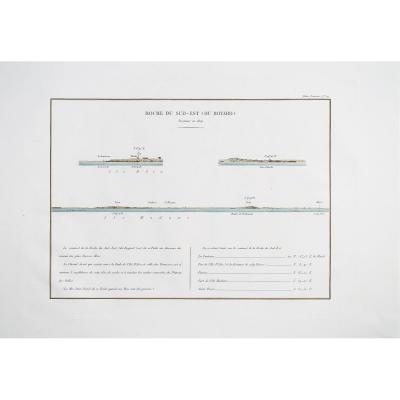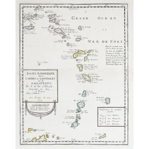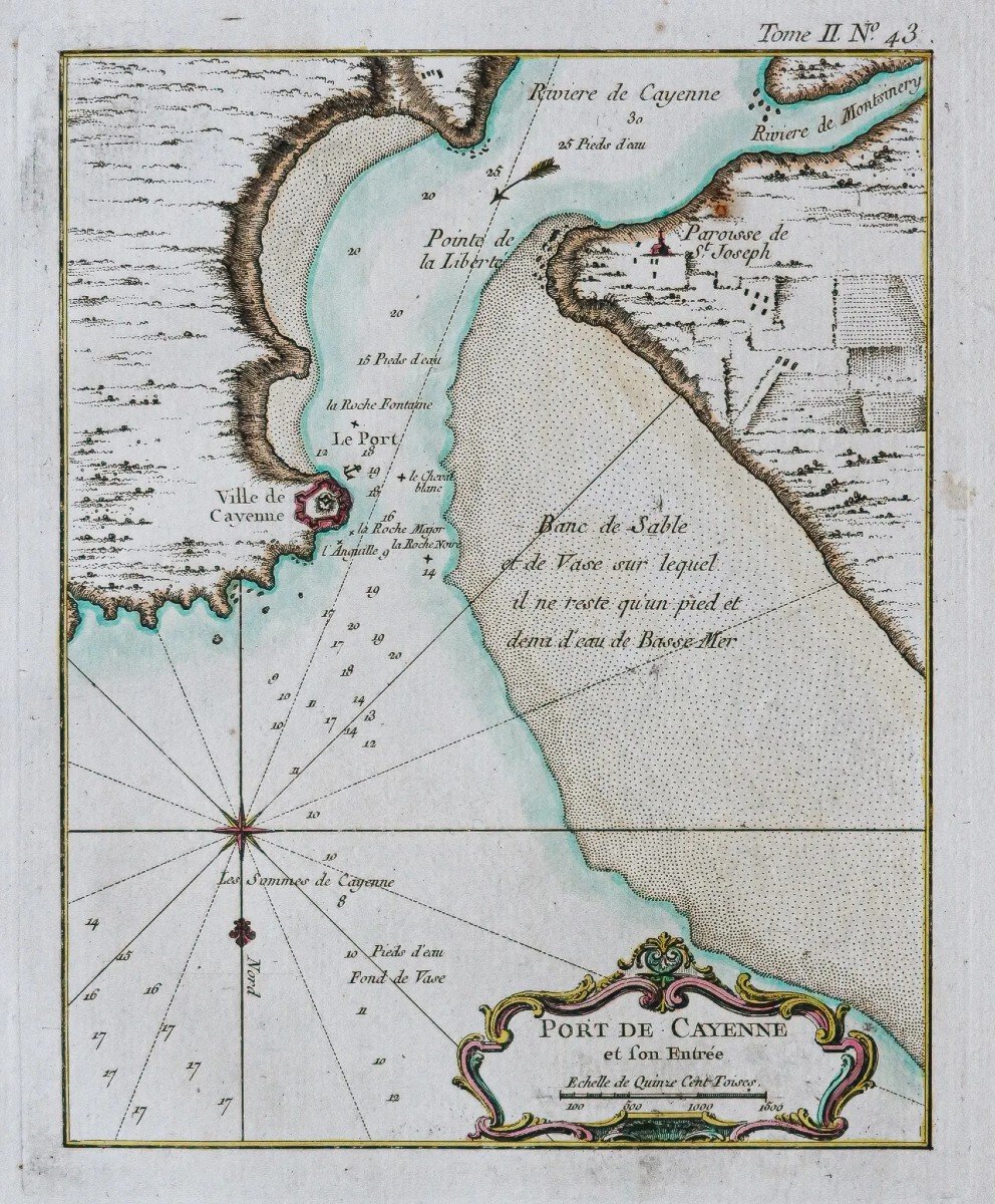
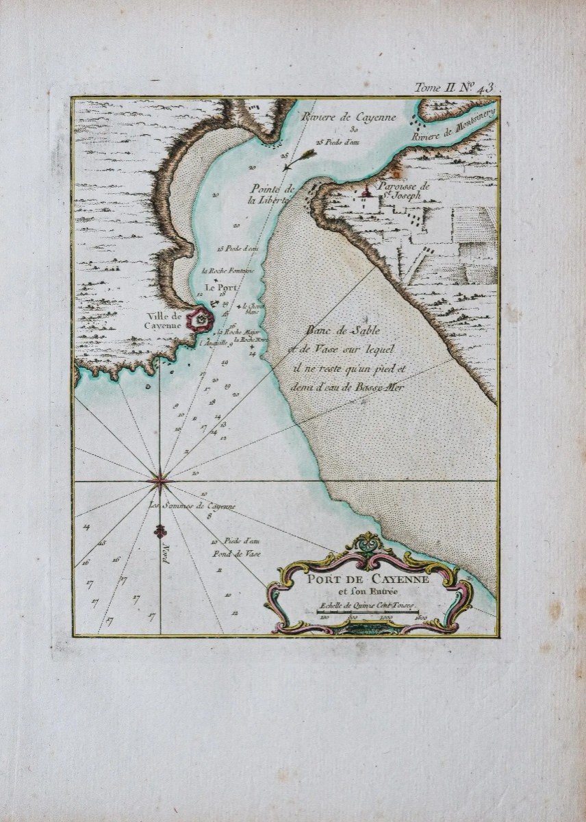
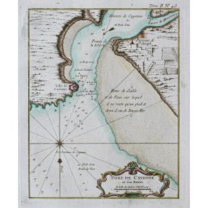

Old Plan Of Cayenne
Epreuve originale réalisée en 1764. Bellin cartographe.
Coloris aquarelle.
Rousseurs claires dans les marges.
Bon état.
Format feuille : 33,5 x 24,5 cm.
Format gravure : 23 x 18,5 cm.
Original antique map of 1764.
Boussole indiquant le nord, échelle des mesures et cartouche de titre décoratif.
Vous pouvez consulter l’ensemble des cartes et gravures disponibles sur votre région en cliquant sur le lien de notre site internet spécialisé en archives anciennes géographiques :
https://cartes-livres-anciens.com/categorie-produit/cartes-geographiques-anciennes-original-antique-maps/ameriques/guyane/
Règlement sécurisé par carte bancaire sur notre site internet en cliquant sur le lien :
https://cartes-livres-anciens.com/produit/cartes-geographiques-anciennes-original-antique-maps/ameriques/guyane/plan-ancien-de-cayenne/
Toutes nos cartes et gravures sont accompagnées d’un certificat d’authenticité.
Jacques-Nicolas Bellin, né à Paris en 1703, mort à Versailles le 21 mars 1772, est un cartographe hydrographe français. En 1721, Bellin est nommé hydrographe du ministère de la Marine suite à la création de l’office hydrographique français et du Dépôt des cartes et plans de la Marine. Membre de l’Académie de Marine et la Royal Society of London. Au cours d’une carrière de 50 ans, il est l’auteur d’un grand nombre de cartes et d’atlas. Ses cartes du Canada et des territoires français de l’Amérique du Nord (Nouvelle-France, Acadie, Louisiane) sont d’une valeur considérable.
Original proof produced in 1764. Bellin cartographer. Watercolor colors. Light foxing in the margins. Good condition. Sheet size: 33.5 x 24.5 cm. Engraving format: 23 x 18.5 cm. Original antique map of 1764. Compass indicating north, measurement scale and decorative title cartouche. You can consult all the maps and engravings available in your region by clicking on the link of our website specializing in ancient geographical archives: https://cartes-livres-anciens.com/categorie-produit/cartes-geographiques-anciennes -original-antique-maps/ameriques/guyane/ Secure payment by credit card on our website by clicking on the link: https://cartes-livres-anciens.com/produit/cartes-geographiques-anciennes-original-antique- maps/americas/guyane/plan-ancien-de-cayenne/ All our maps and engravings are accompanied by a certificate of authenticity. Jacques-Nicolas Bellin, born in Paris in 1703, died in Versailles on March 21, 1772, was a French hydrographer cartographer. In 1721, Bellin was appointed hydrographer of the Ministry of the Navy following the creation of the French hydrographic office and the Depot of maps and plans of the Navy. Member of the Naval Academy and the Royal Society of London. During a 50-year career, he authored a large number of maps and atlases. His maps of Canada and the French territories of North America (New France, Acadia, Louisiana) are of considerable value.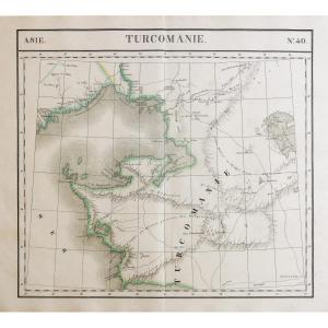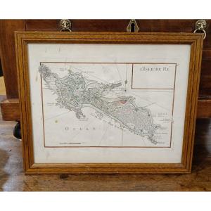
165 €
Period: 18th century
Style: Other Style
Condition: Good condition
Material: Paper
Reference (ID): 966227
Availability: In stock
Print