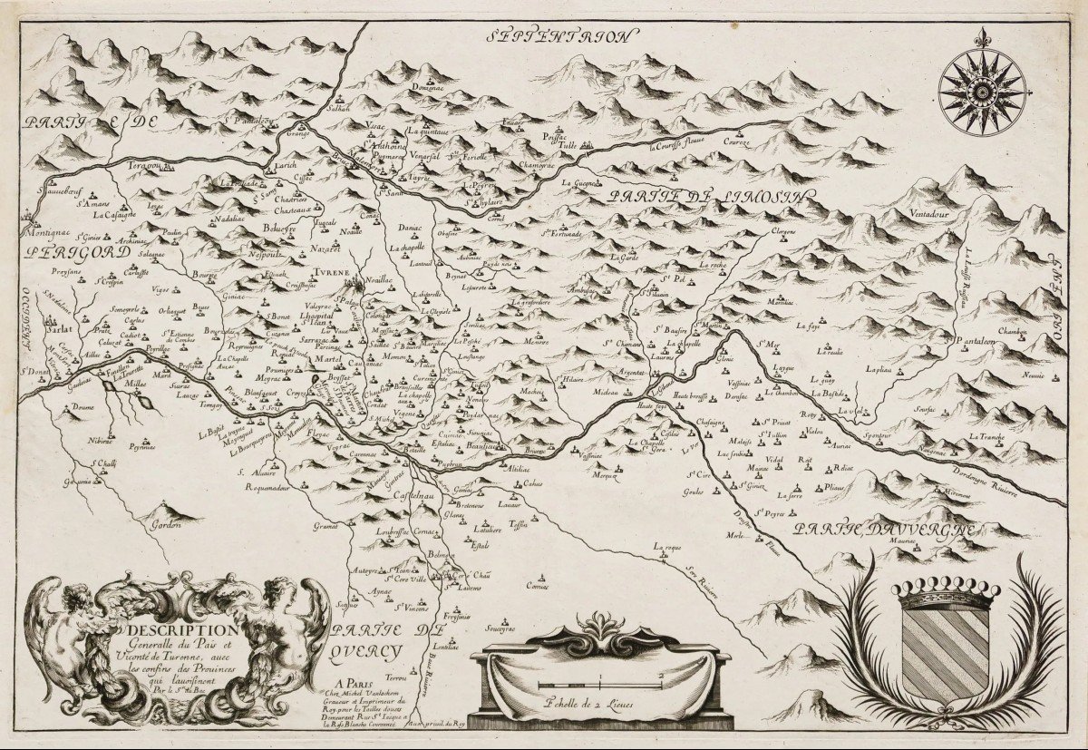
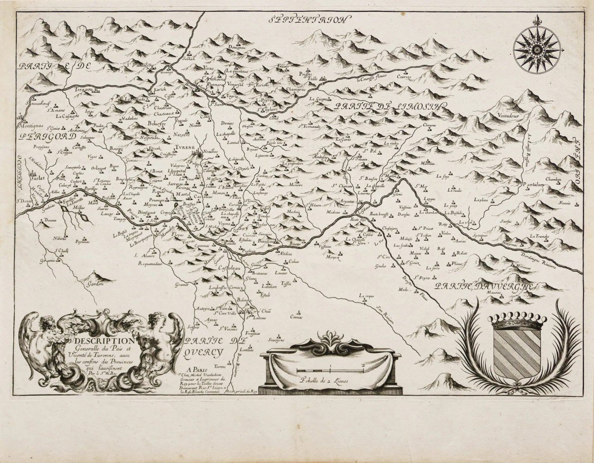


Old Map – Auvergne & Périgord
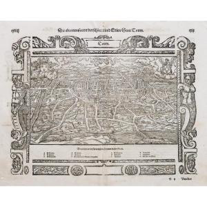
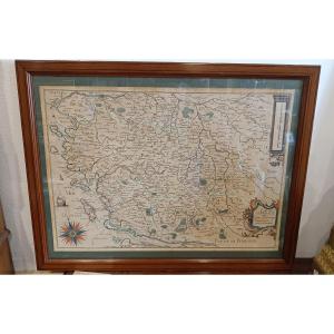
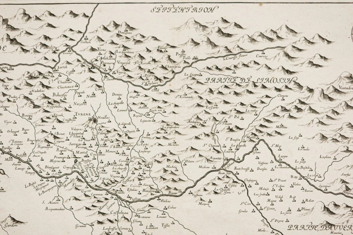
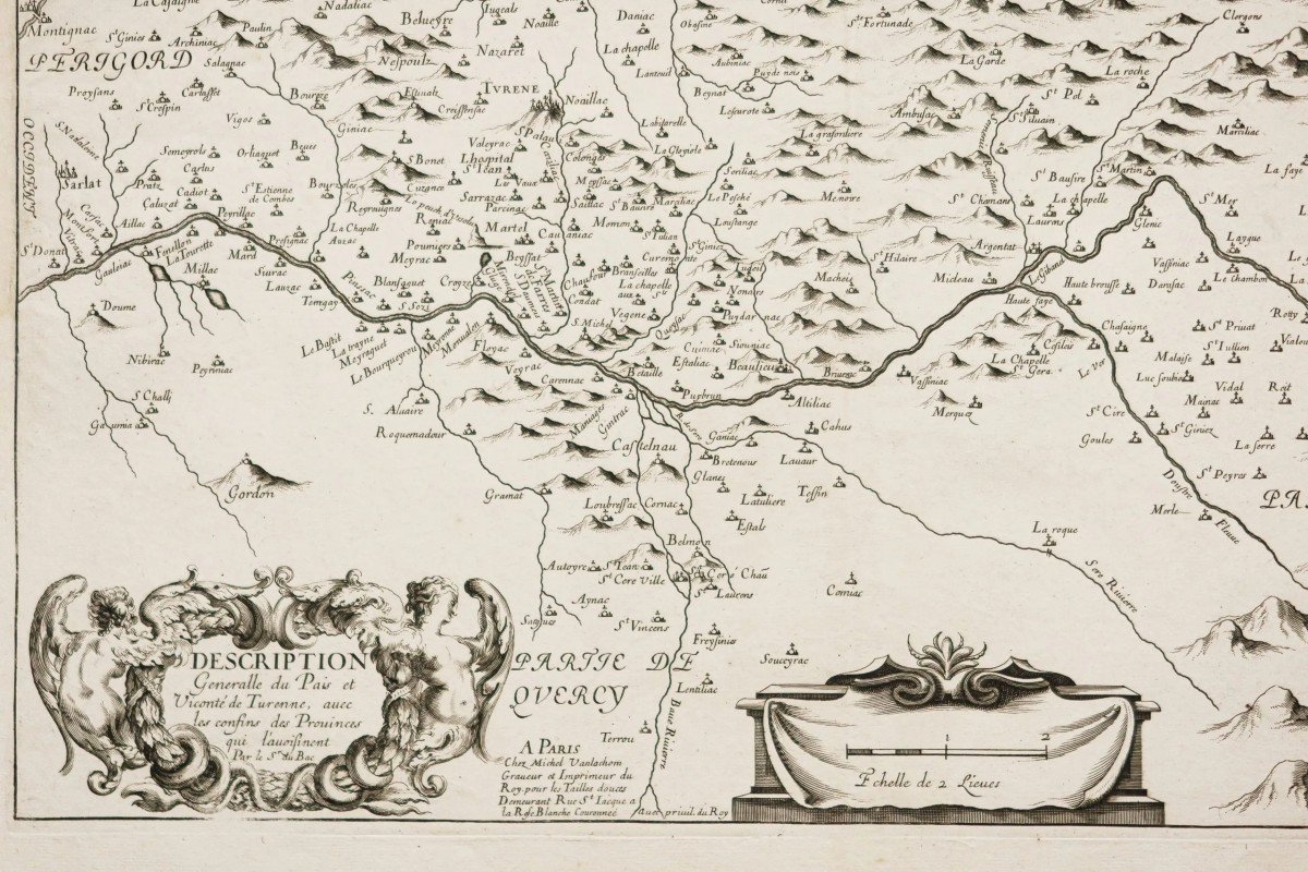
Description générale du pays Vicomté de Turenne, avec les confins des provinces qui l’avoisinent.
Epreuve originale réalisée en 1645. Michel van Lochom graveur.
1 rousseur dans le trait d’encadrement supérieur n’affectant pas la carte.
Très bon état.
Format feuille : 51,5 x 41,5 cm.
Format gravure : 50,5 x 34,5 cm.
Original antique map of 1645.
Rare carte réalisée par le Sieur du Bac, éditée chez Michel Van Lochom graveur et imprimeur du Roy à Paris.
Cartouche de titre décoratif, boussole, échelle des lieux.
Vous pouvez consulter l’ensemble des cartes et gravures disponibles sur votre région en cliquant sur le lien de notre site internet spécialisé en archives anciennes géographiques :
https://cartes-livres-anciens.com/categorie-produit/cartes-geographiques-anciennes-original-antique-maps/france/auvergne-limousin/
Règlement sécurisé par carte bancaire sur notre site internet en cliquant sur le lien :
https://cartes-livres-anciens.com/produit/cartes-geographiques-anciennes-original-antique-maps/france/aquitaine-guyenne-gascogne-perigord/carte-ancienne-auvergne-perigord/
Toutes nos cartes et gravures sont accompagnées d’un certificat d’authenticité.
General description of the country Viscounty of Turenne, with the confines of the neighboring provinces. Original proof made in 1645. Michel van Lochom engraver. 1 foxing in the upper framing line not affecting the map. Very good state. Sheet size: 51.5 x 41.5 cm. Engraving format: 50.5 x 34.5 cm. Original antique map of 1645. Rare map made by Sieur du Bac, published by Michel Van Lochom engraver and printer of the Roy in Paris. Decorative title cartouche, compass, scale of places. You can consult all the maps and engravings available in your region by clicking on the link of our website specializing in ancient geographical archives: https://cartes-livres-anciens.com/categorie-produit/cartes-geographiques-anciennes -original-antique-maps/france/auvergne-limousin/ Secure payment by credit card on our website by clicking on the link: https://cartes-livres-anciens.com/produit/cartes-geographiques-anciennes-original- antique-maps/france/aquitaine-guyenne-gascogne-perigord/carte-ancienne-auvergne-perigord/ All our maps and engravings are accompanied by a certificate of authenticity.
1 200 €
Period: 17th century
Style: Other Style
Condition: Excellent condition
Material: Paper
Reference (ID): 1071768
Availability: In stock
Print