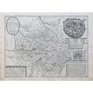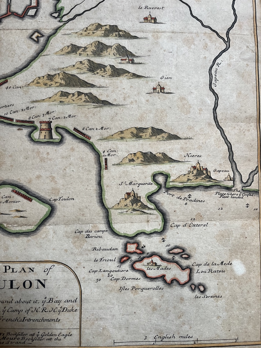


Plan Of The Siege Of Toulon By The English - 18th Century
A significant historical episode of the city of Toulon, the 1707 siege took place in the context of England’s territorial expansion during the War of the Spanish Succession.
Our map, has for legend :
“A New Plan of Toulon, with all the hills round about it, the bay and the place of landing of His Royal Highness (HRH) the Duke of Savoy and the French’s intrenchments.”
This engraving was produced in England between July and August 1707, and was sold by James Levi bookseller at the Golden Eagle, Strand and Anthony Meure bookseller at the Golden Bible, Strand.
A similar engraving, serving the same purpose as ours, is preserved at the Departmental Archives of Var.
https://archives.var.fr/article.php?laref=2667&titre=plan-anglais-du-blocus-de-toulon-par-les-anglo-hollandais-1707-
The piece is generally in good condition. It is mounted on thicker paper and shows a few humidity stains, which are restorable.
Dimensions:
Height: 50.9 cm
Width: 40.9 cm
England, 18th century
For any further information, please contact the gallery.
Period: 18th century
Style: Other Style
Condition: Good condition
Material: Paper
Width: 40,9 cm
Height: 50,9 cm
Reference (ID): 1557843
Availability: In stock