THIS OBJECT WAS SOLD

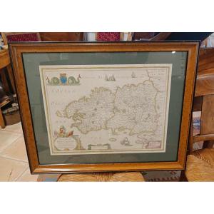
Framed Map Of Poitou, Saintonge, Angoulmois And Aulnix From The 17th Century By Tassin

Sold
Framed Map Of Poitou, Saintonge, Angoulmois And Aulnix From The 17th Century By Tassin
Sold
Framed Map Of Poitou, Saintonge, Angoulmois And Aulnix From The 17th Century By Tassin -photo-2
Sold
Framed Map Of Poitou, Saintonge, Angoulmois And Aulnix From The 17th Century By Tassin -photo-3
Sold
Framed Map Of Poitou, Saintonge, Angoulmois And Aulnix From The 17th Century By Tassin -photo-4
Sold
Framed Map Of Poitou, Saintonge, Angoulmois And Aulnix From The 17th Century By Tassin -photo-1
Sold
Framed Map Of Poitou, Saintonge, Angoulmois And Aulnix From The 17th Century By Tassin -photo-2
Sold
Framed Map Of Poitou, Saintonge, Angoulmois And Aulnix From The 17th Century By Tassin -photo-3
More pictures
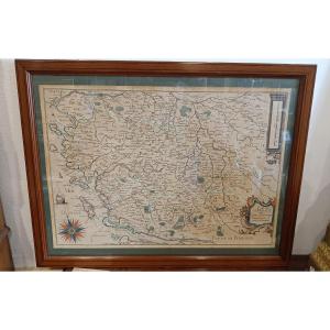
Rare General Map of Poitou, Xaintonge, Angoulmois and the Aulnix region" by Christophe TASSIN from the 17th century around 1634. Map engraved on paper and watercolored from the period (foxing and folds). Beautiful decorations of a boat, a beautiful compass rose and 2 cartouches. We can clearly distinguish the 4 islands: Noirmoutier, Yeu, Ré and Oléron, going from the estuaries of the Loire and the Gironde. Pitchpin frame 59 cm x 46 cm

Explore similar pieces and discover your ideal find:

Old Maps

Old Map Of Normandy
Antique Map Of Catholic Belgium And The 10 Provinces, 1747 By Tobias Maier
Carte Géographique Ancienne De Vérone – Lac De Garde
Hauserman. Old Map Madagascar 1885 Catholic Missions.
Framed Map Of Aveyron: Geographer Levasseur Published By Pélissier 1852
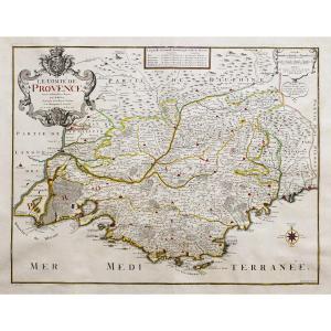
Old Geographical Map Of Provence

88A avenue Joseph Pineau
Noirmoutier en l'île 85330, France

06 13 50 19 76

Follow the dealer

CONTACT

SIGN UP TO OUR NEWSLETTER

facebook
instagram

KRON Frédéric Antiquités
Old Geographical Map Of Provence
1243942-main-65732945ab063.jpg

06 13 50 19 76


*We will send you a confirmation email from info@proantic.com .
Please check your messages, including the spam folder.