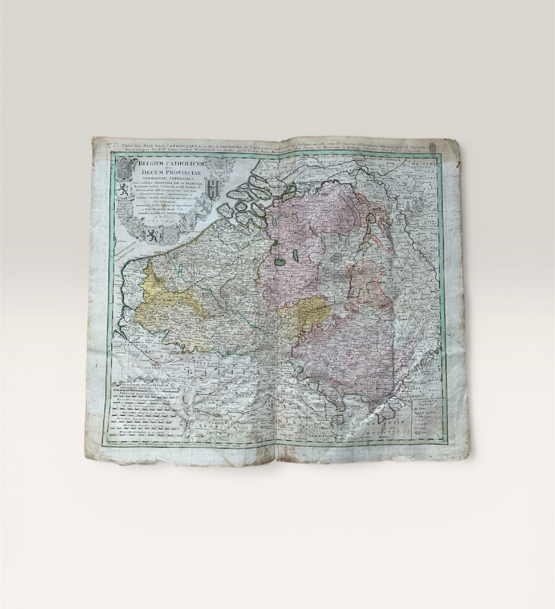
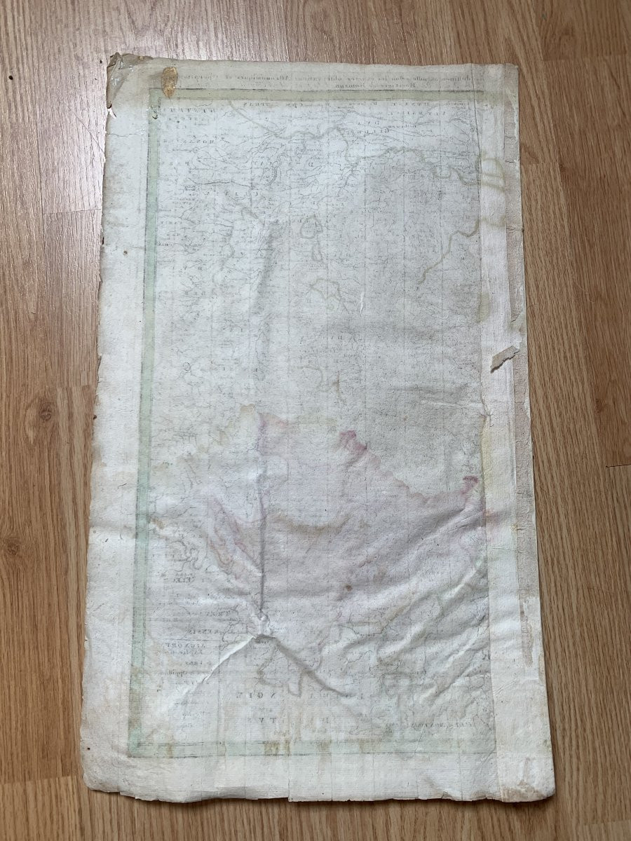
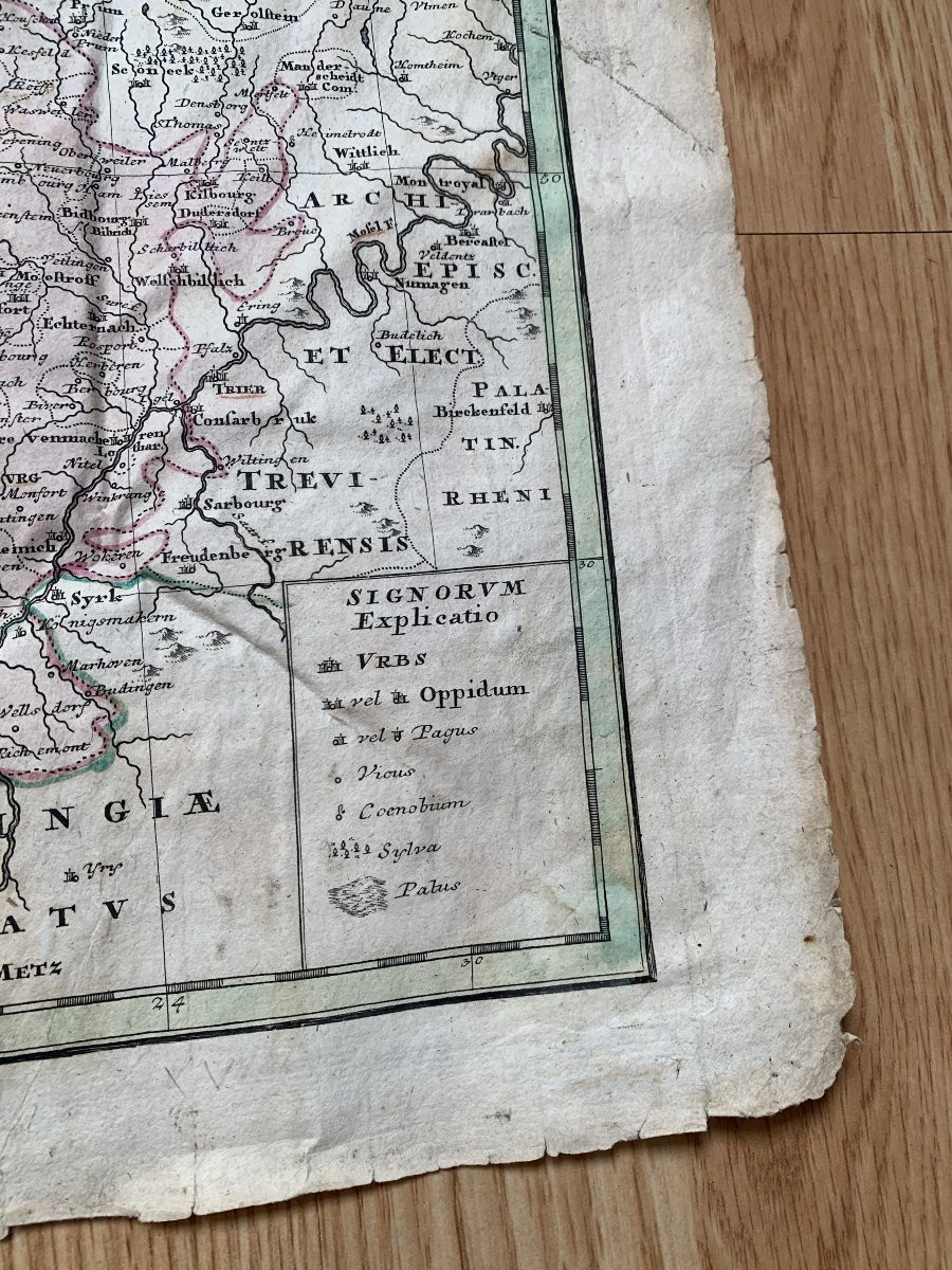
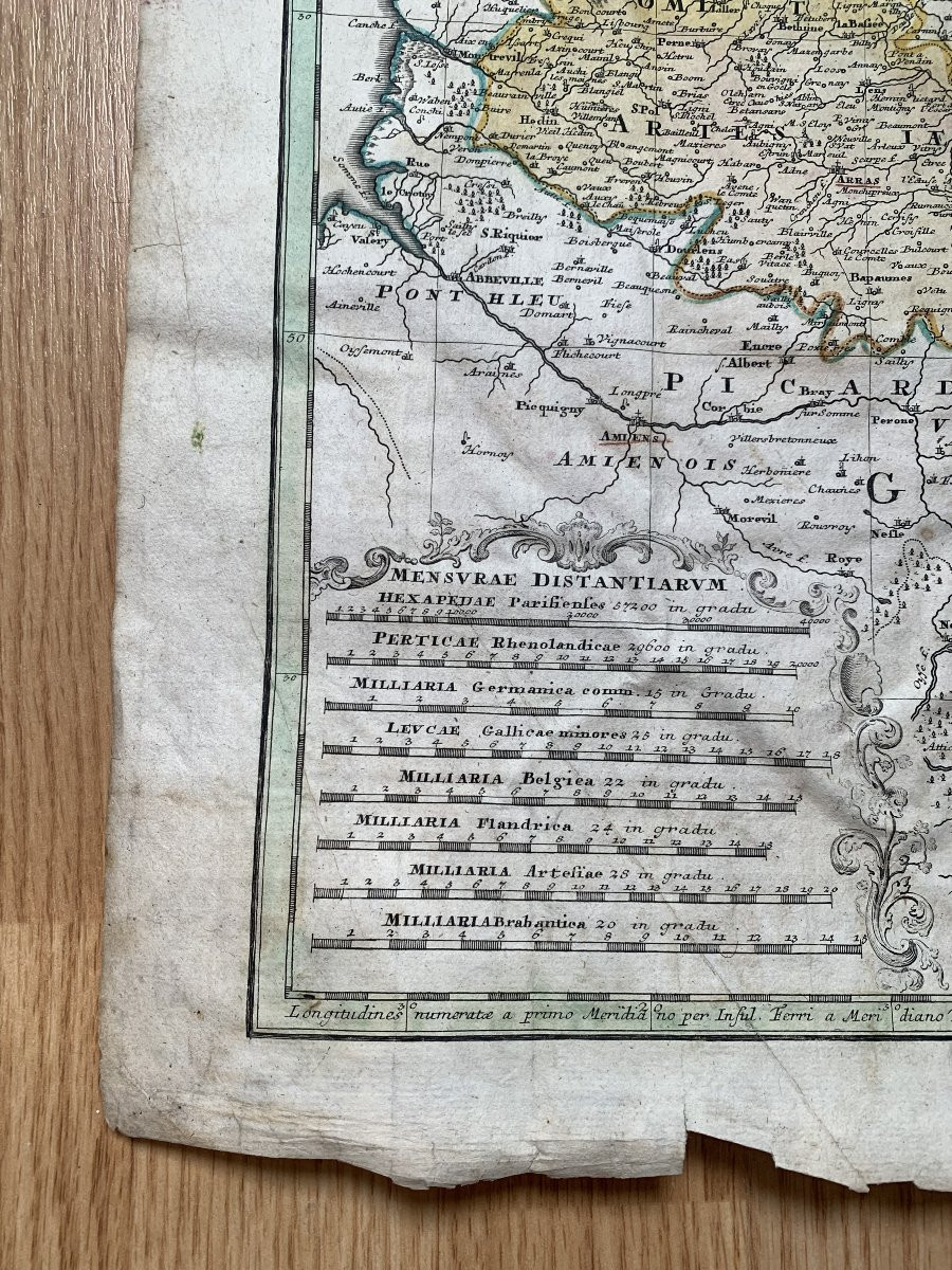
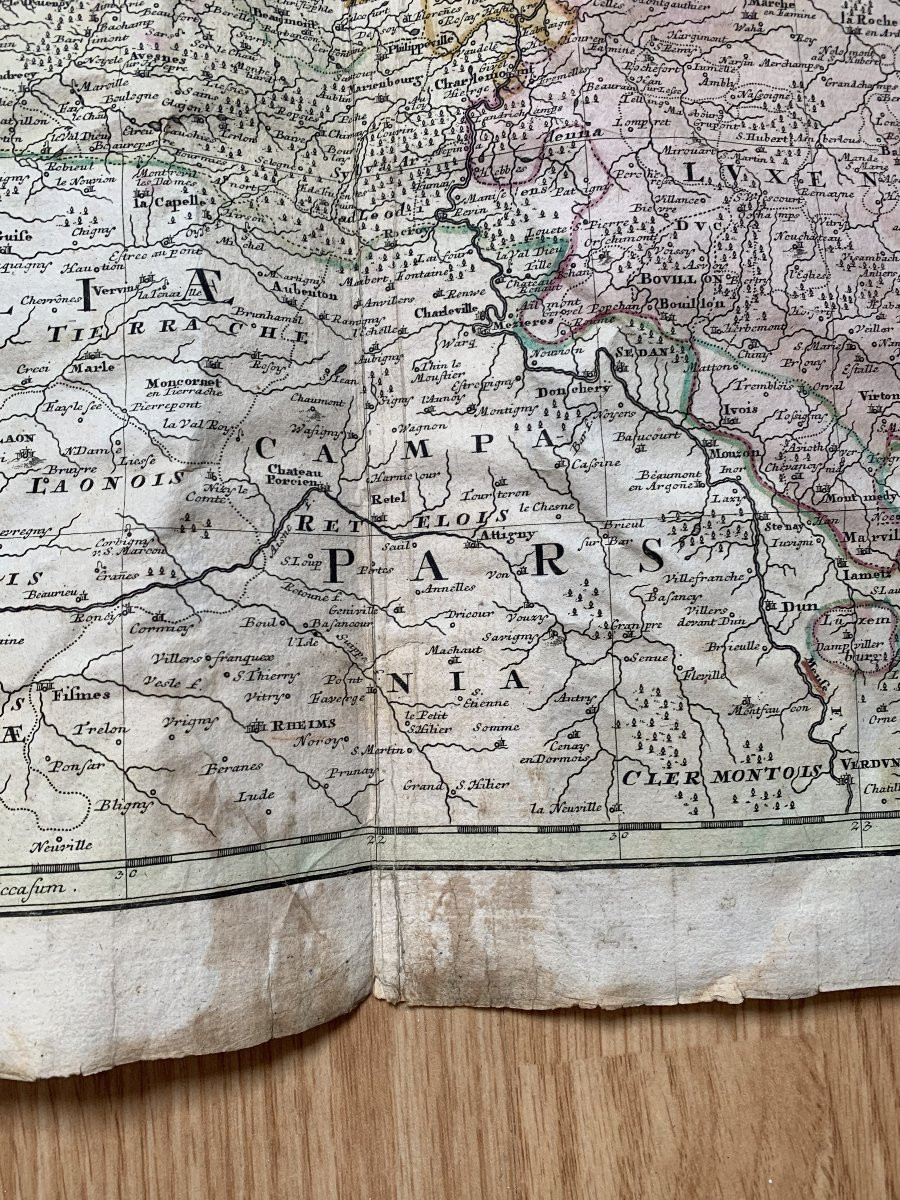
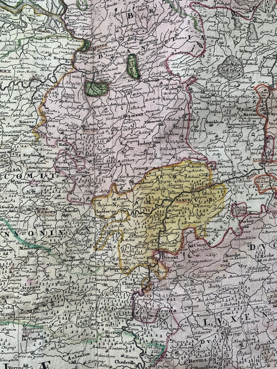
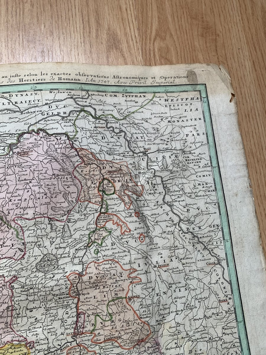
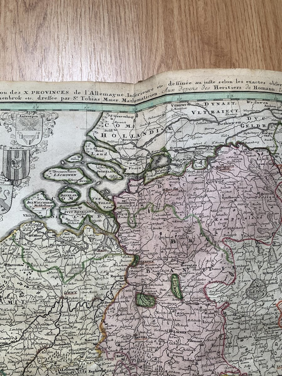
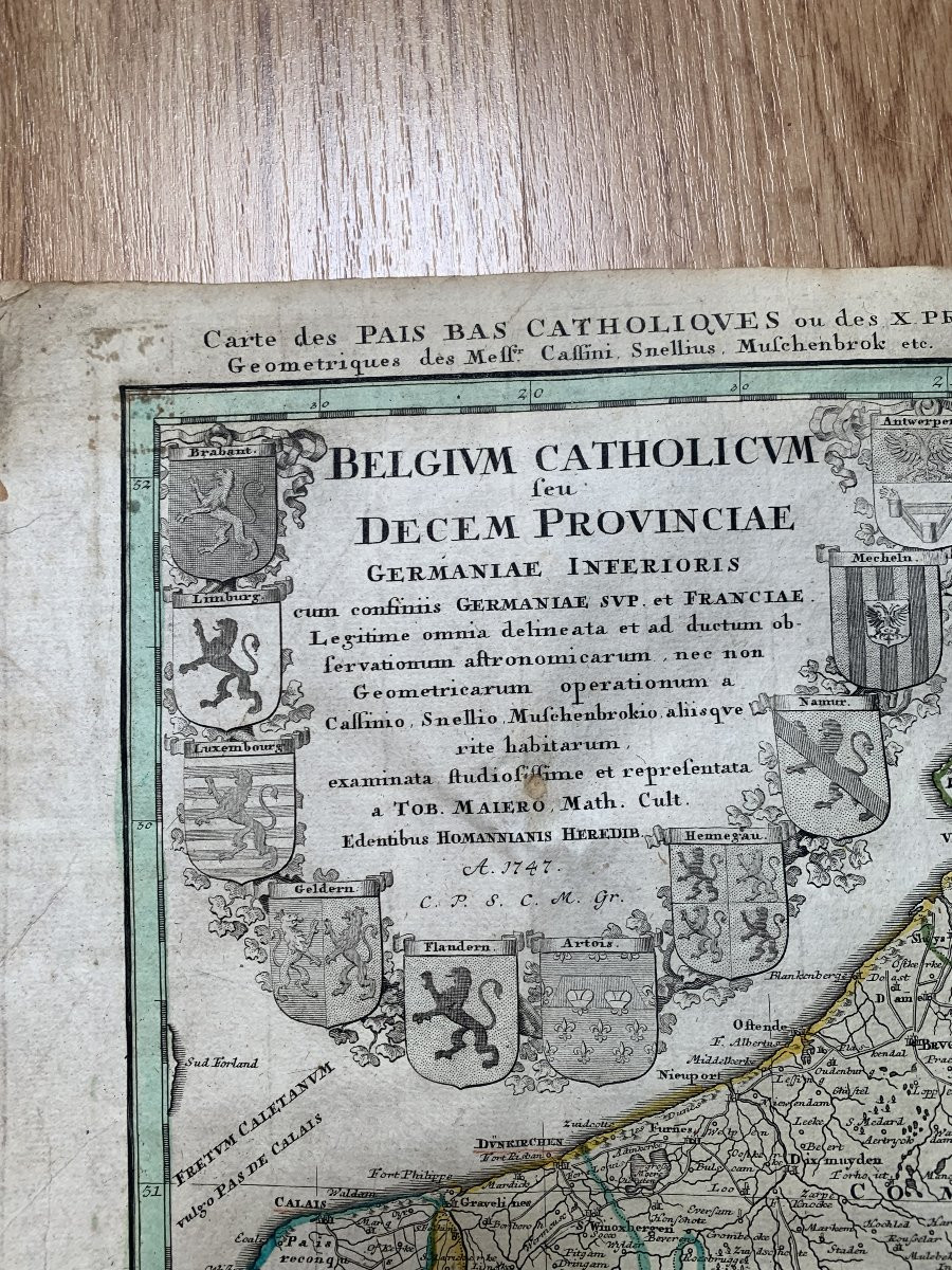


Antique Map Of Catholic Belgium And The 10 Provinces, 1747 By Tobias Maier
Antique map of Catholic Belgium and the 10 Provinces drawn up by Sr. TOBIAS MAIER, aux depens des héritiers de HOMANN, 1747, watercolored provinces including the Duchy of Luxembourg, cartouche with provincial shields,
Dimension : 52 cm x 61 cm
Condition : in its original condition, please note traces of wear and age, a few stains and tears in places (see photos).
Dimension : 52 cm x 61 cm
Condition : in its original condition, please note traces of wear and age, a few stains and tears in places (see photos).
180 €
Period: 18th century
Style: Other Style
Condition: Condition of use
Material: Paper
Length: 61
Height: 52
Reference (ID): 1743275
Availability: In stock
Print