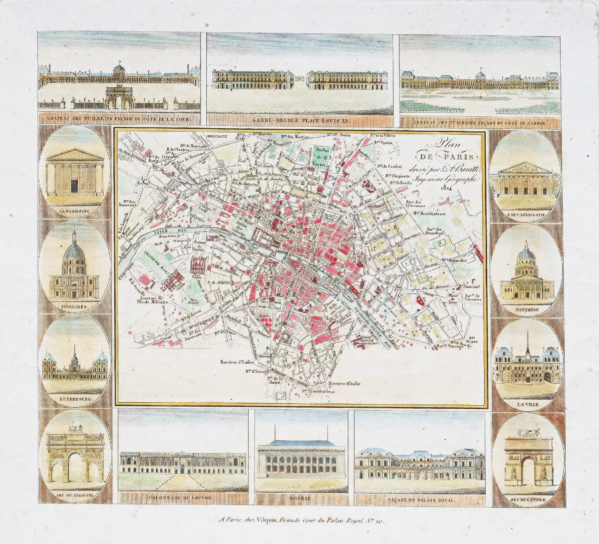
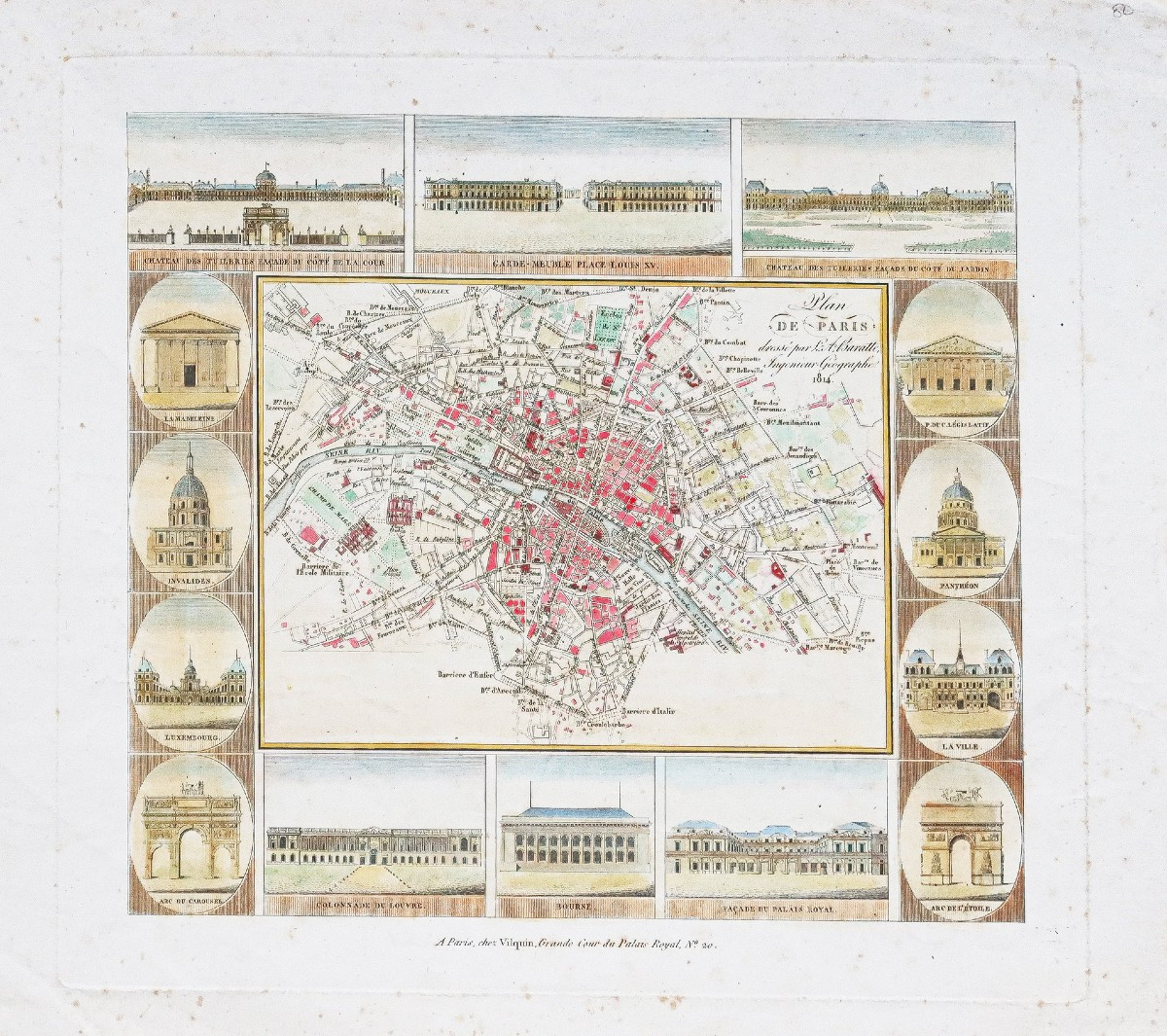


Old Map Of Paris
Epreuve originale réalisée en 1814. L.Baratte géographe.
Fines rousseurs éparses dans les marges.
Coloris aquarelle
Bon état.
Format feuille : 30 x 27 cm.
Format gravure : 25,5 x 23,5 cm.
Original antique map of 1814.
Cartouches décoratifs illustrant les principaux monuments de Paris : Palais royale, Panthéon, Invalides, Bourse, Tuileries
Vous pouvez consulter l’ensemble des cartes, livres et gravures disponibles sur votre région en cliquant sur le lien de notre site internet spécialisé en archives anciennes géographiques :
https://cartes-livres-anciens.com/categorie-produit/cartes-geographiques-anciennes-original-antique-maps/france/paris-plans-maps/
Règlement sécurisé par carte bancaire sur notre site internet en cliquant sur le lien ci-dessous :
https://cartes-livres-anciens.com/produit/cartes-geographiques-anciennes-original-antique-maps/france/paris-plans-maps/plan-ancien-de-paris-18/
Toutes nos cartes et gravures sont accompagnées d’un certificat d’authenticité.
Original print made in 1814. L. Baratte, geographer. Minor scattered foxing in the margins. Watercolor coloring. Good condition. Sheet size: 30 x 27 cm. Image size: 25.5 x 23.5 cm. Original antique map of 1814. Decorative cartouches illustrating the main monuments of Paris: Palais Royal, Panthéon, Invalides, Bourse, Tuileries. You can view all the maps, books, and engravings available for your region by clicking on the link to our website specializing in antique geographical archives: https://cartes-livres-anciens.com/categorie-produit/cartes-geographiques-anciennes-original-antique-maps/france/paris-plans-maps/ Secure payment by credit card on our website by clicking on the link below: https://cartes-livres-anciens.com/produit/cartes-geographiques-anciennes-original-antique-maps/france/paris-plans-maps/plan-ancien-de-paris-18/All our maps and engravings come with a certificate of authenticity.
290 €
Period: 19th century
Style: Other Style
Condition: Good condition
Material: Paper
Reference (ID): 1668244
Availability: In stock
Print