Old Maps
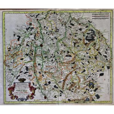
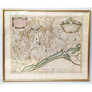
Map Of France Bresse And Lyonnais 17th Century Dutch Engraving Wi[...]
17th century
![]()
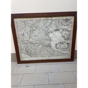
17th Century Map, Duchy Of Savoy Sabaudia Ducatus By Johannes Jan[...]
17th century
![]()
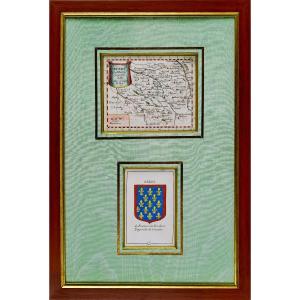
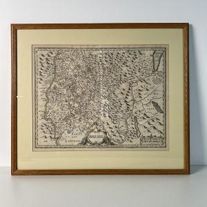
Carte Du Berry Et Son Blason - Rare Engraving - Ep. Mid 17th Cent[...]
17th century
![]()

Large Map Of Paris In 1589 Published In 1705 In A Papier-mâché Fr[...]
18th century


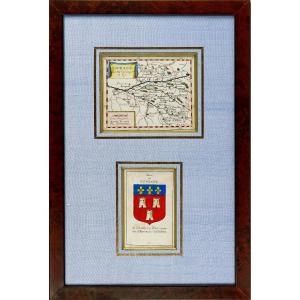
Engraving - Map Of Maine (anjou Touraine) And Its Coat Of Arms - [...]
17th century
![]()


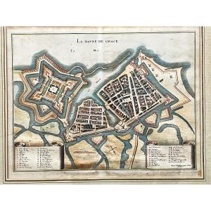
La Havre De Grace (le Hâvre) Print By Jacques Gomboust Around 165[...]
17th century
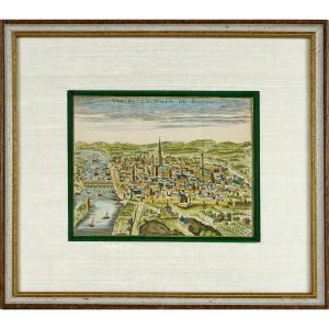
Old Engraving - View Of The City Of Rouen - Ep. Early 18th Centur[...]
18th century
![]()

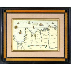
Engraving - Sea Chart From Cancale To The Poterieu Islands - The [...]
17th century
![]()
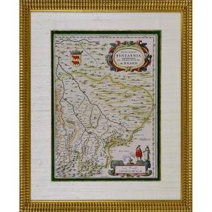
Engraving - Map Of The Principality Of Bearn (south West) By J. B[...]
17th century
![]()

Engraving - Government Of Provins (seine-et-marne - 77) - Ep. 17t[...]
17th century
![]()

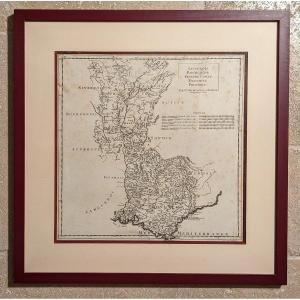
Map Of The Diocese Of Castres Tarn Bishop Of Maupeou Jaillot Cord[...]
18th century


Map Of Paradise On Earth According To Moses, Early 18th Century
18th century


Map Of The City Of Lille, Taken Circa 1708, Superbly Watercolored[...]
18th century
![]()

Nice, The City, The Castle; Map After Nicolas De Fer, 1705.
19th century
![]()
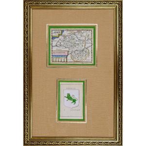
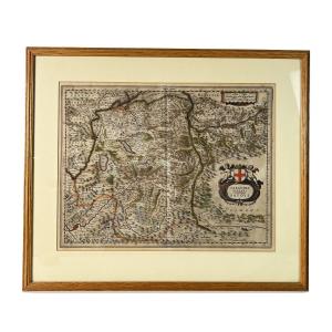
Rare Engraving Of La Rouergue Accompanied By Its Coat Of Arms - E[...]
17th century
![]()

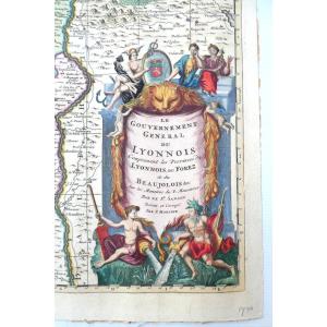
Le Gouvernement General Du Lyonnois, Belle Carte Aquarellée Et Dé[...]
18th century
![]()

Rare Map Of Nivernois With Its Coat Of Arms (nivernais - Morvant [...]
17th century
![]()
Beautiful Map Of The Archbishopric Of Montpellier, (rare), Jaillo[...]
18th century
![]()
Jaillot - Part Of The Bailiwick Of Vosge Or Mirecourt, In The Duc[...]
18th century
![]()

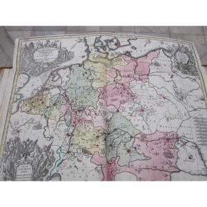
Large Map Of Bavaria By Jean-baptiste Homannum. 18th Century
18th century
Historical Map Of The Roman Empire. By Matthew Setter. 18th Centu[...]
18th century
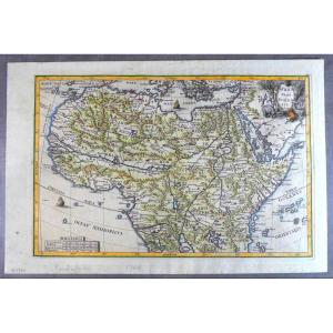
1699, Pretty Jesuit Map Of North Africa, Period Edition And Hand [...]
18th century
![]()


Large Map Of Alsace. By Nicolaun Visscher 60 X 49 Cm. Colorful Fr[...]
17th century
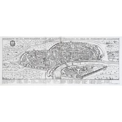
Antique Print- Description Toulouse Université Du Parlement De L[...]
17th century
![]()

Nicolas De La Mare: Seventh Plan Of The City Of Paris 1705
18th century