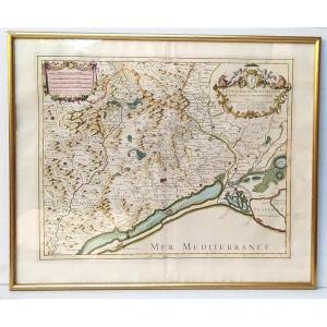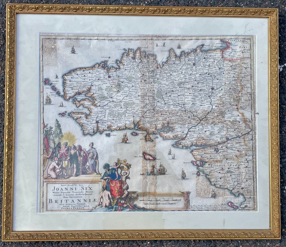


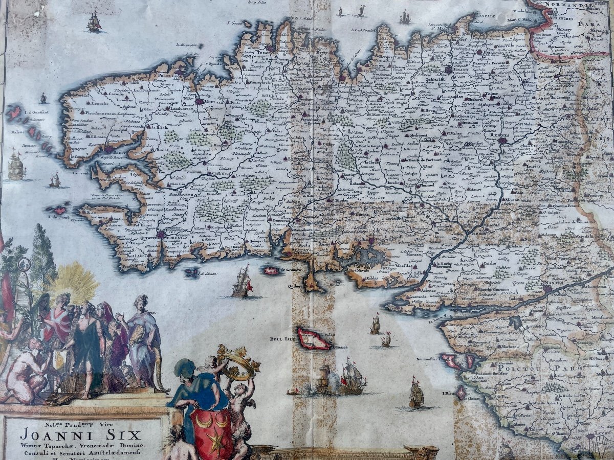


Map Of Brittany, Richly Enhanced Print, Amsterdam, 1694.
Artist: Petrus Persoy (xviie).
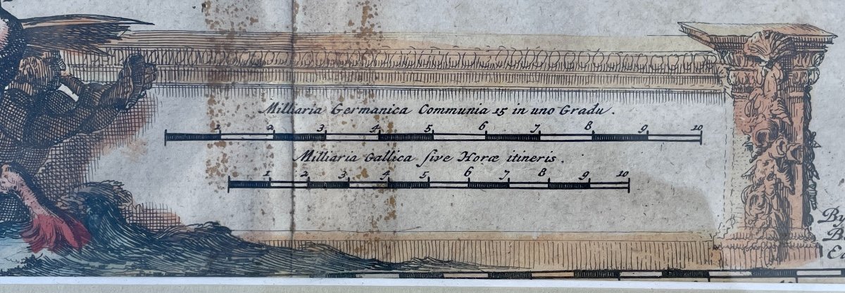
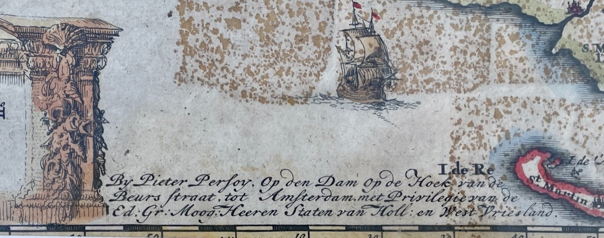
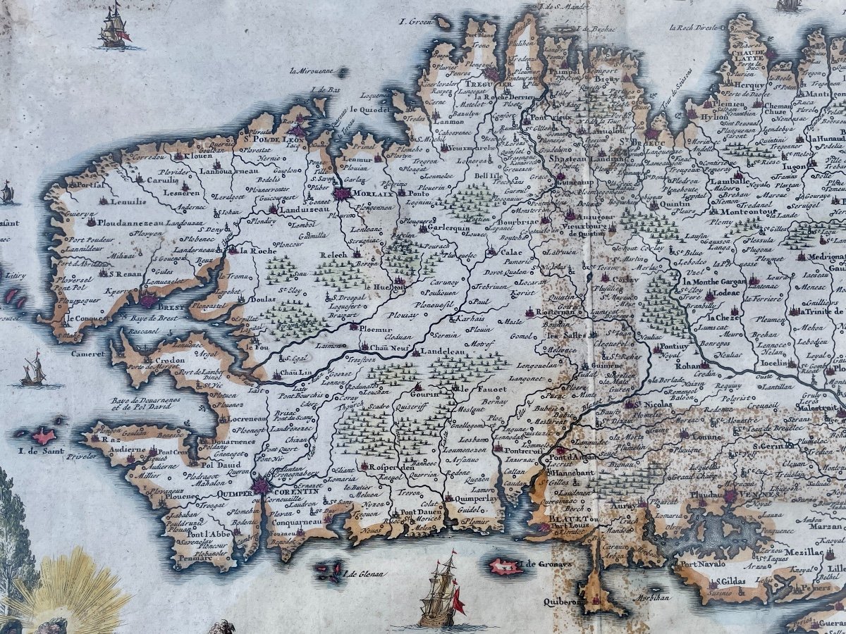
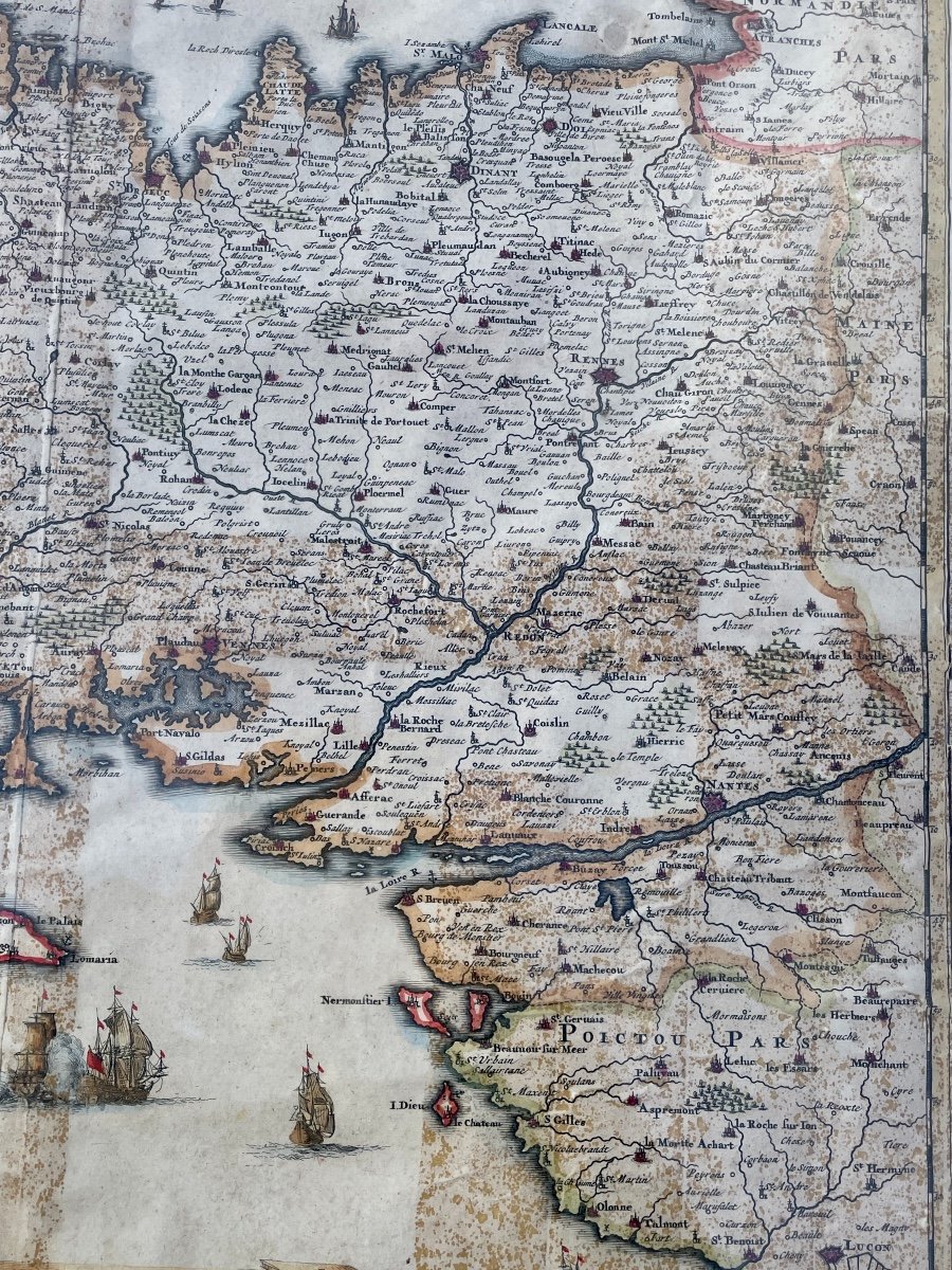
PERSOY, P.Britanniae, Amstedam, 1694. Richly enhanced print on paper. Rare map probably published in a composite atlas. It is dedicated to Jean SIX, Dutch poet and writer by Petrus PERSOY in the year 1694. The cartouche decorated with thirteen figures and the seas of fourteen boats, a naval combat south of Belle-Isle with a fleeing boat. The islands of Houat and Hoedic, nor the seven islands, are not included, although mentioned. Numerous fantasies, particularly in the toponymy. Framed and coaster, gilded wooden stick and composition decorated with a frieze of acanthus leaves. Pits and slight oxidation. Bibliography: Copy reproduced in C. Gaudillat, Ancient maps of Brittany 1582-1800, pl. No. 28.
350 €
Period: 17th century
Style: Louis 14th, Regency
Condition: Good condition
Material: Paper
Width: 57 cm (à vue)
Height: 46 cm (à vue)
Reference (ID): 1223759
Availability: In stock
Print