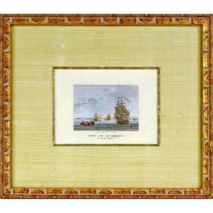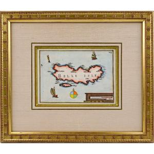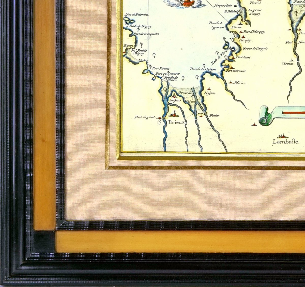


Engraving - Sea Chart From Cancale To The Poterieu Islands - The Bay Of Saint Malo - 18th Century
Artist: Nicolas De Fer
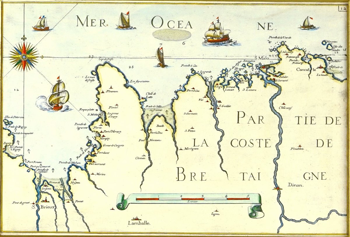
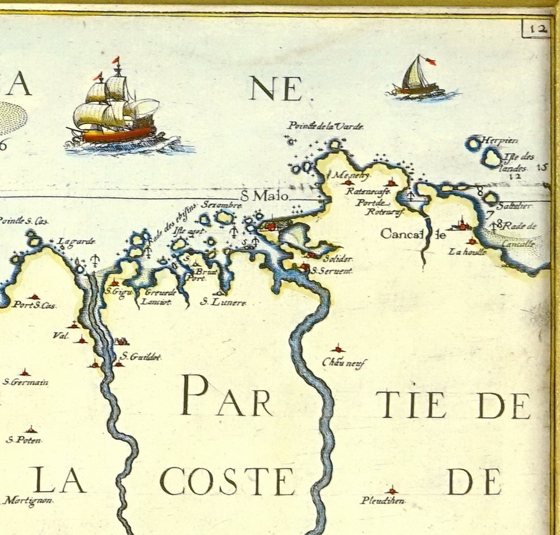
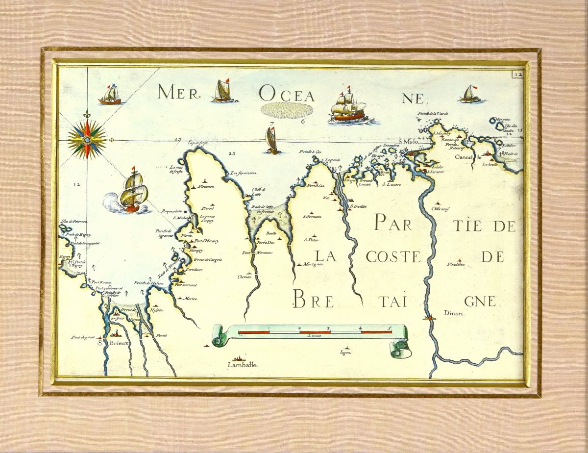
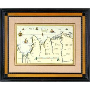
RARE NAUTICAL CHART OF CANCALE TO THE POTERIEU ISLANDS - SAINT MALO BAY - POINTE SAINT CAST - HERQUY - SAINT BRIEUX - Ep. END OF THE 17TH CENTURY PART OF THE BRITTANY COAST - SAINT MALORARE BAY NAUTICAL CHART OF CANCALE TO THE POTERIEU ISLANDS via SAINT MALO BAY - POINTE SAINT CAST - HERQUY - SAINT BRIEUX Original intaglio engraving, in period colors. Beautiful and rare nautical chart by Nicolas de Fer, inspired by the surveys of Christophe Tassin. This map illustrates the expertise of Nicolas de Fer (1646–1720), famous publisher and geographer to the king, renowned for his maps that were both precise and decorative, situated on the border between art and geography. Inspired by the surveys of the cartographer Christophe Tassin, active at the beginning of the 17th century? century, this work reflects the evolution of French cartography towards a better representation of coasts and maritime routes. It testifies to the strategic and economic importance of the Breton coastline in the modern era, both for maritime trade and for the defense of the kingdom of Cancale on the islands of Porterieu, with a very detailed toponymy for the ports, capes and coastal villages (Saint-Brieuc, Plérin, Port-Navalo, Saint-Malo, Cancale, Dinan, etc.), as well as the main rivers. The interior is deliberately left plain, in order to highlight the coastal line. The reliefs are represented by small shaded hills, according to the conventions of the 17th century. At the bottom of the map is a graphic scale in leagues, integrated into a scrolled cartouche in the Baroque style. On the left, a richly colored compass rose, surmounted by a fleur-de-lis, points north upwards. The maritime scene is enlivened by several sailing ships, vividly rendered, typical of naval representations of the time, highlighting both the strategic and commercial interest of this sector of the Atlantic coastline. Dimensions: Frame: Length 51.8 cm - Height 42.5 cm - Width of baguette: 5 cm Condition: PERFECT CONDITION, Period: LATE 17th (CIRCA 1690), Frame: CURRENT - Composed of an old gold beveled border, a very light pink moiré mat, highlighted by an aged gold border. The baguette is made of deep black wood, with a slightly satin finish, and has a finely grooved or fluted pattern. An intermediate border of light wood, in a honey shade.
750 €
Period: 17th century
Style: Louis 14th, Regency
Condition: Perfect condition
Material: Paper
Length: 51.8 cm
Height: 42.5 cm
Reference (ID): 1553931
Availability: In stock
Print