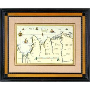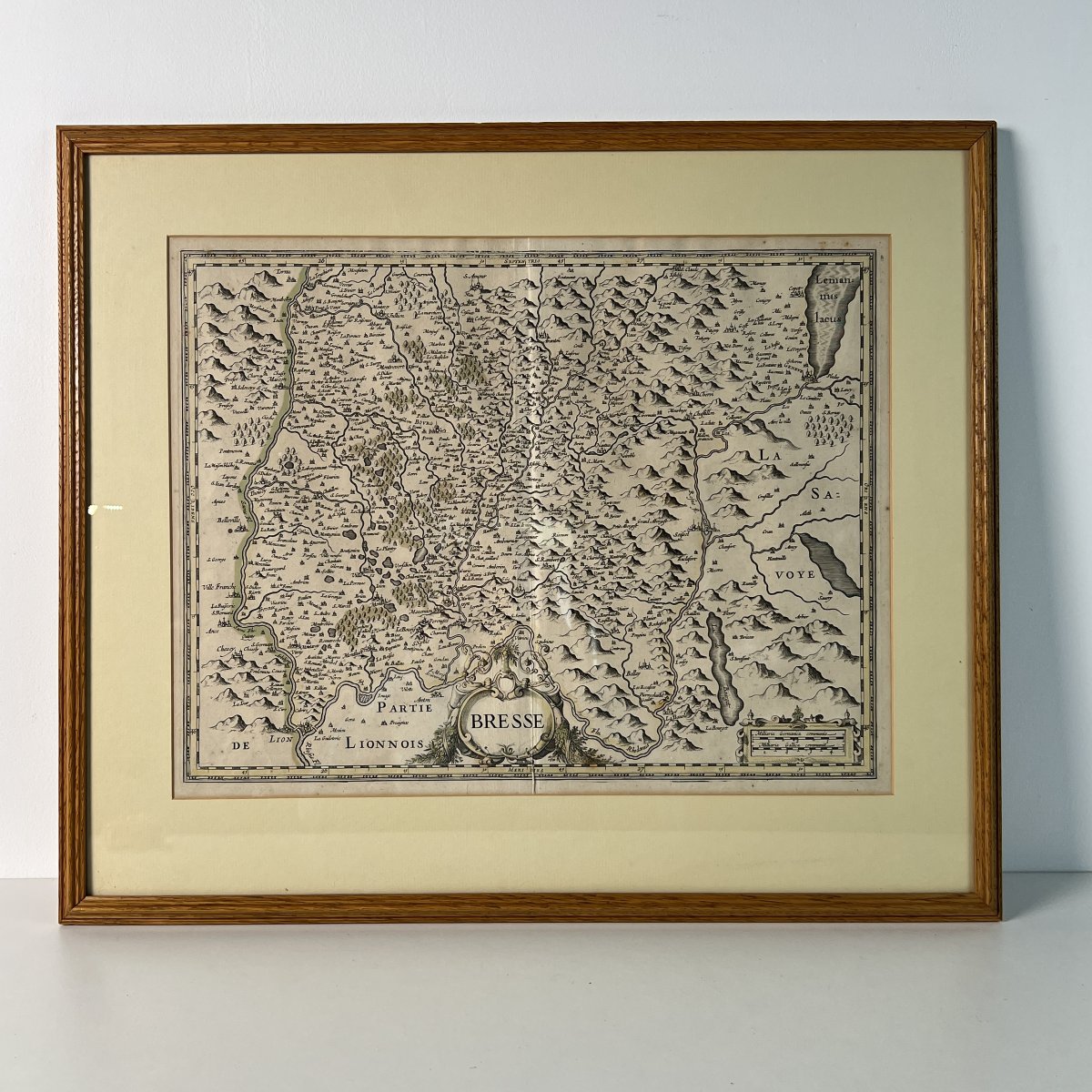
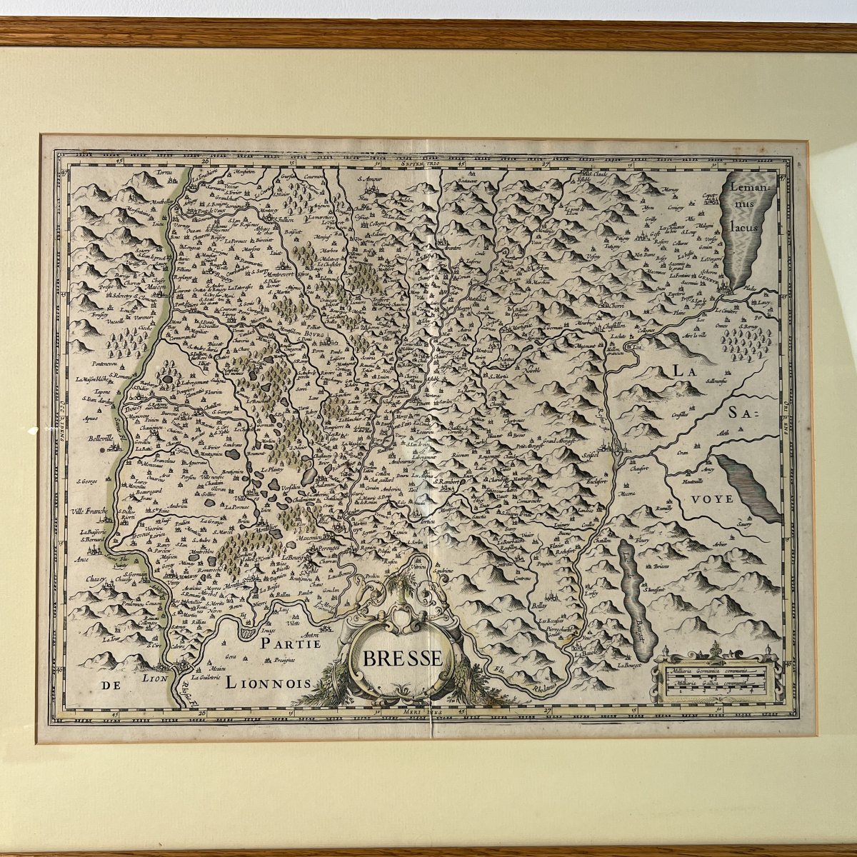


Map Of France Bresse And Lyonnais 17th Century Dutch Engraving Willem Blaeu Johannes Janssonius
Artist: Willem Blaeu
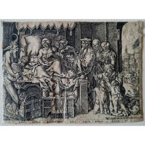
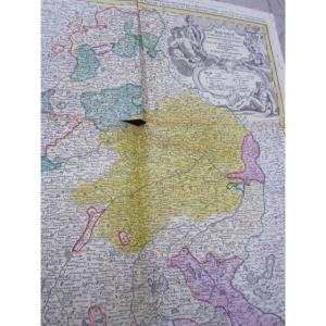
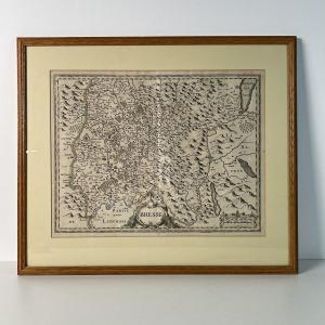
Antique geographical map of Bresse and Lyonnais, 17th-century Dutch copper engraving, framed, Willem Blaeu, Joan Blaeu, Johannes Janssonius, 17th century.
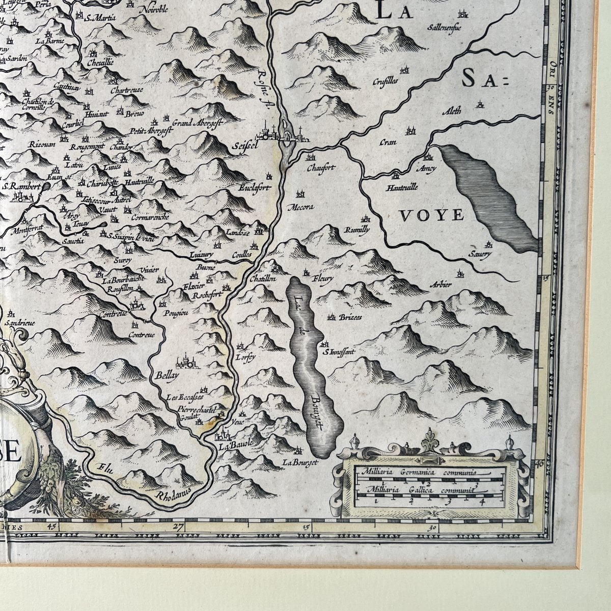
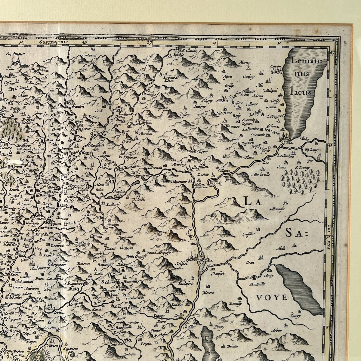
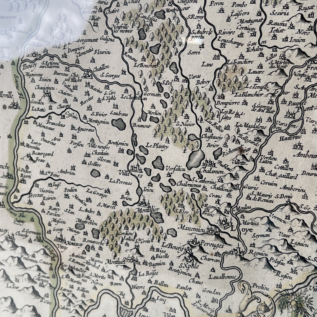
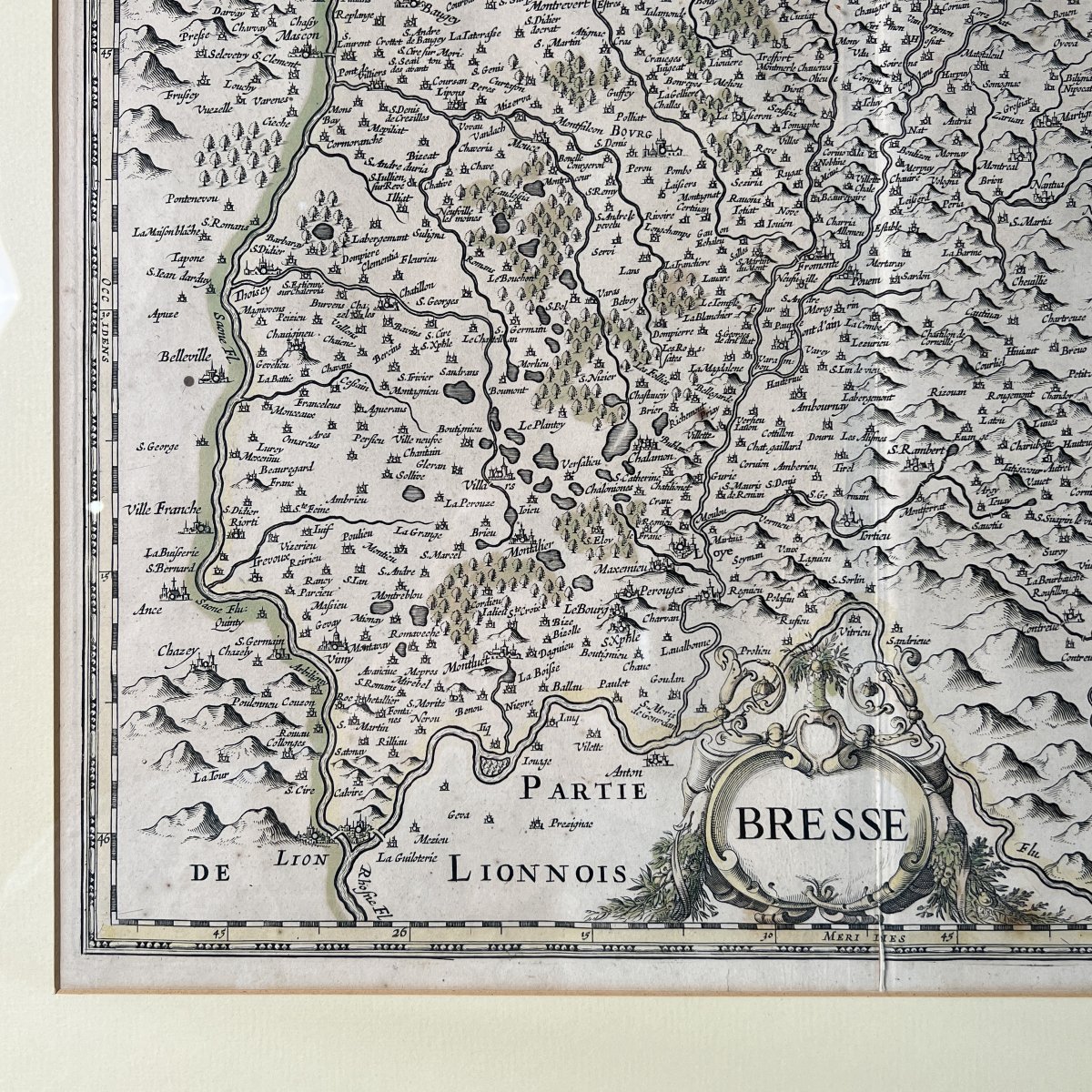
Antique regional geographical map. Intaglio print, copperplate engraving in black ink on paper, hand-coloured. Print taken from a folio atlas, characterized by the structural presence of a vertical central fold. Cartography typical of 17th-century Dutch workshops, attributable to the circle of Willem Blaeu or Johannes Janssonius, circa 1630–1660.
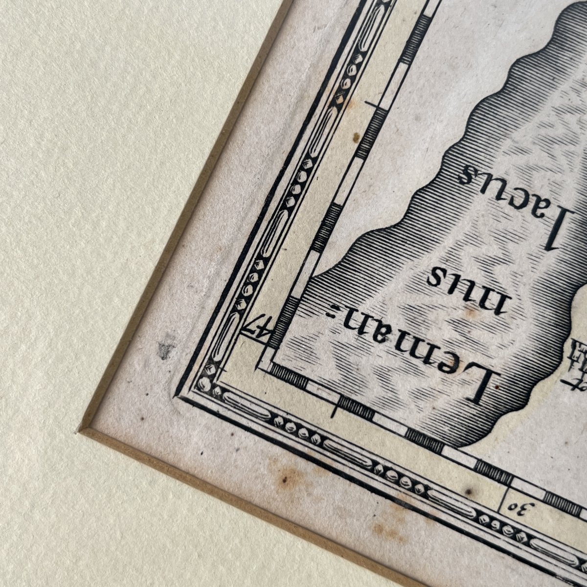
Detailed topographical representation of the Bresse region. The relief is carefully depicted with molehill-style mountains, wooded areas with tree profiles, and hydrographic networks. Lake Geneva, marked “Leman-nus lacus,” appears in the upper right corner, and Lake Bourget in the lower right section. The Lyon area, marked “PARTIE DE LIONNOIS,” is included in the lower left quadrant.
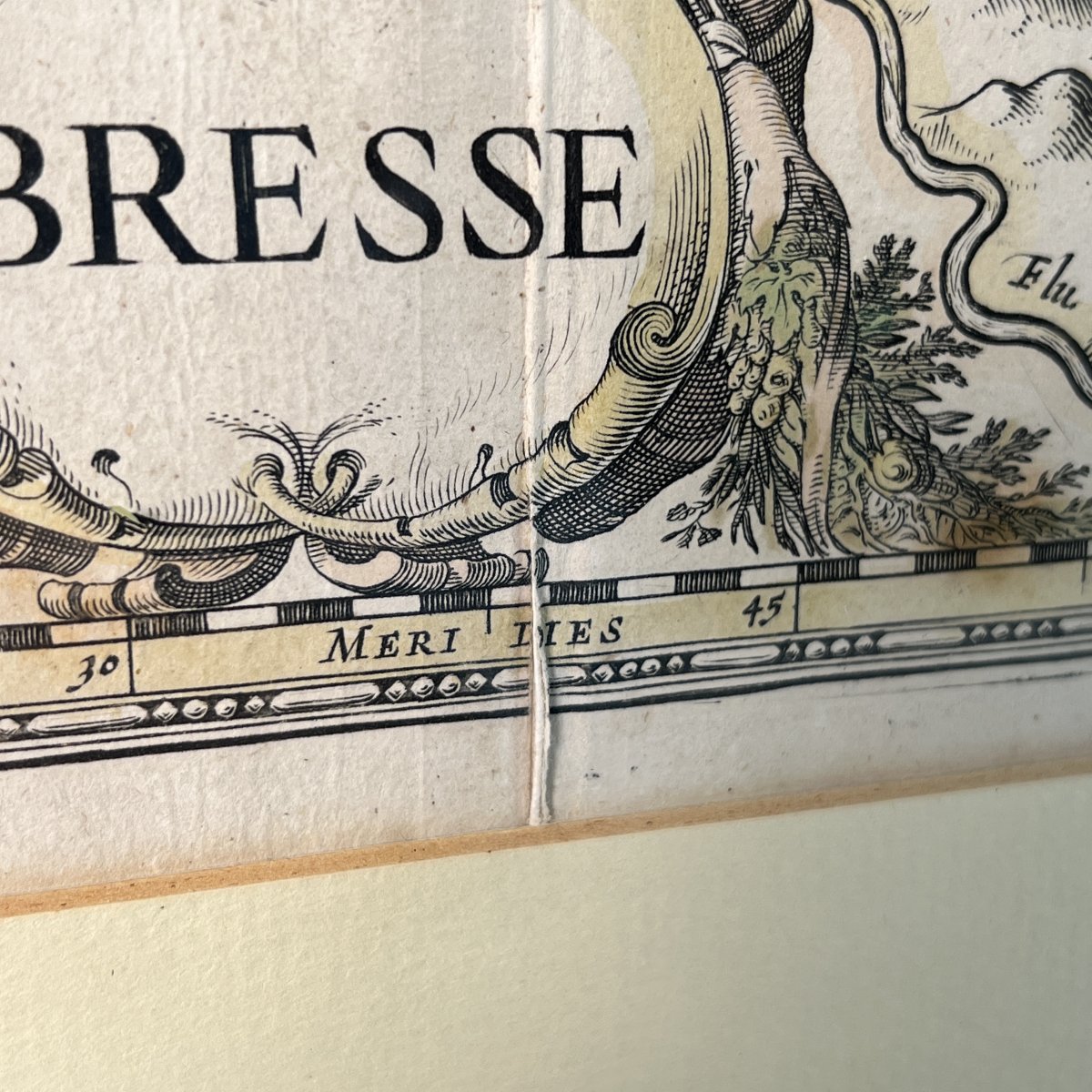
Baroque-style ornamentation. Main title “BRESSE” placed within a rich architectural and vegetal cartouche in the lower central section. Distance scale, “Milliaria Germanica communia / Milliaria Gallica communia,” framed by a geometric motif in the lower right corner. Cardinal points inscribed in Latin in the inner margins of the engraved frame: “Septentrio,” “Meridies,” “Oriens,” and “Occidens.” The plate mark is clearly visible around the edge of the neatline.
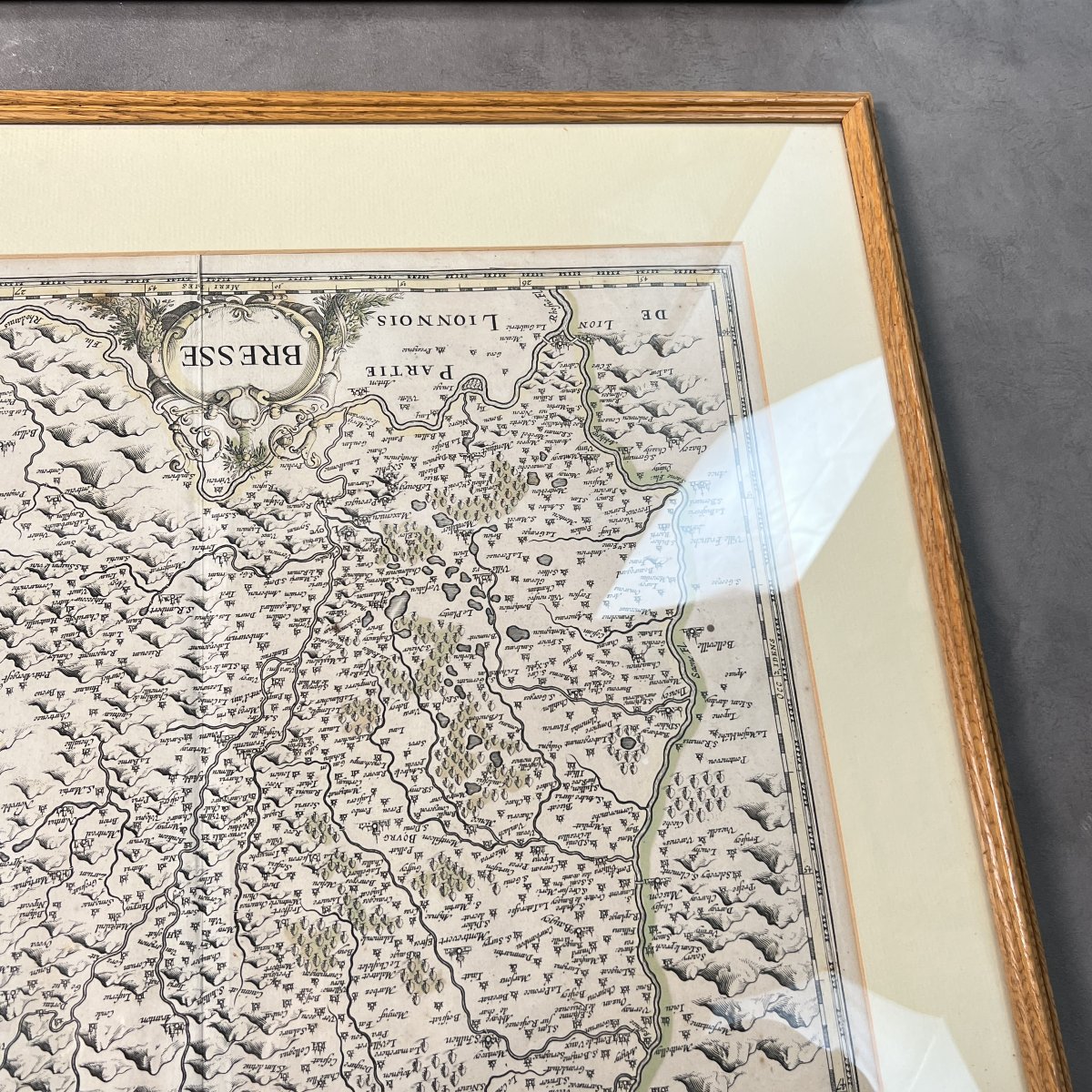
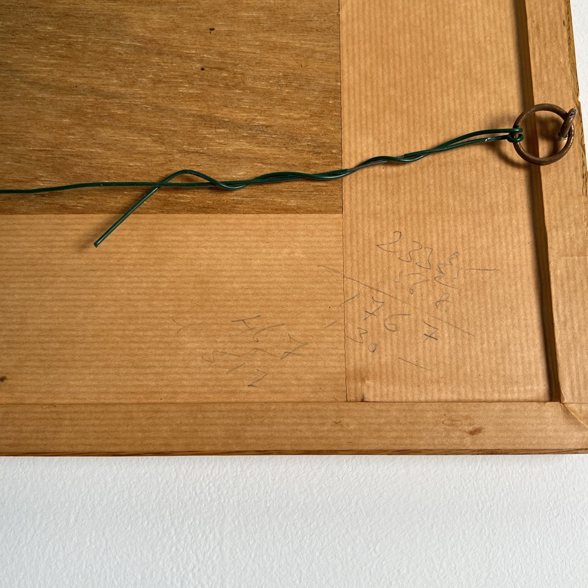
Condition is good for its age. Slightly browned paper with discreet foxing and scattered spotting. Small accidental tear of approximately two centimetres noted in the lower section, located on the central fold at the level of the inscription “Meridies.” Modern mounting under an ivory-toned English bevel mat. Contemporary moulded natural wood frame. Frame back closed with a plywood panel and fitted with a hanging wire. Handwritten numerical inscriptions in pencil on the back of the mount.
Measurements:
• Plate mark dimensions: 49 × 37.5 cm
• Frame dimensions: 67 × 57 cm
Safe and secure shipping:
• France: € 18
• Europe (Schengen area): € 48
• International: € 98
• Does this item pique your interest or curiosity? Feel free to contact us, we would be delighted to discuss it with you. We are available from Monday to Saturday, from 8 a.m. to 7 p.m., at +33 652 43 97 82
We are fluent in English and have been shipping a wide variety of items internationally for many years. Please feel free to contact us with any questions you may have. Excellent customer service, we accept returns up to 14 days, 100% positive customer reviews.
Visit our store to check all our amazing products
Antique regional geographical map. Intaglio print, copperplate engraving in black ink on paper, hand-coloured. Print taken from a folio atlas, characterized by the structural presence of a vertical central fold. Cartography typical of 17th-century Dutch workshops, attributable to the circle of Willem Blaeu or Johannes Janssonius, circa 1630–1660.
Detailed topographical representation of the Bresse region. The relief is carefully depicted with molehill-style mountains, wooded areas with tree profiles, and hydrographic networks. Lake Geneva, marked “Leman-nus lacus,” appears in the upper right corner, and Lake Bourget in the lower right section. The Lyon area, marked “PARTIE DE LIONNOIS,” is included in the lower left quadrant.
Baroque-style ornamentation. Main title “BRESSE” placed within a rich architectural and vegetal cartouche in the lower central section. Distance scale, “Milliaria Germanica communia / Milliaria Gallica communia,” framed by a geometric motif in the lower right corner. Cardinal points inscribed in Latin in the inner margins of the engraved frame: “Septentrio,” “Meridies,” “Oriens,” and “Occidens.” The plate mark is clearly visible around the edge of the neatline.
Condition is good for its age. Slightly browned paper with discreet foxing and scattered spotting. Small accidental tear of approximately two centimetres noted in the lower section, located on the central fold at the level of the inscription “Meridies.” Modern mounting under an ivory-toned English bevel mat. Contemporary moulded natural wood frame. Frame back closed with a plywood panel and fitted with a hanging wire. Handwritten numerical inscriptions in pencil on the back of the mount.
Measurements:
• Plate mark dimensions: 49 × 37.5 cm
• Frame dimensions: 67 × 57 cm
Safe and secure shipping:
• France: € 18
• Europe (Schengen area): € 48
• International: € 98
• Does this item pique your interest or curiosity? Feel free to contact us, we would be delighted to discuss it with you. We are available from Monday to Saturday, from 8 a.m. to 7 p.m., at +33 652 43 97 82
We are fluent in English and have been shipping a wide variety of items internationally for many years. Please feel free to contact us with any questions you may have. Excellent customer service, we accept returns up to 14 days, 100% positive customer reviews.
Visit our store to check all our amazing products
120 €
Period: 17th century
Style: Louis 14th, Regency
Condition: Excellent condition
Material: Paper
Width: 49 cm
Height: 37.5 cm
Reference (ID): 1770528
Availability: In stock
Print