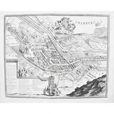
Gravure sur cuivre originale de 1693.
Parfait état.
grand in-folio.
Format feuille : 64 x 53 cm.
Format gravure : 58 x 48 cm.
Original antique map of 1693.
Vous pouvez consulter l’ensemble des [...]
Carte originale gravée en 1879.trace claire dans le titre.Très bon état.Format feuille : 66 x 49 cm.Original antique chart of 1879.Rare collection illustrant les ports de France fin 19 ème siècle.Vous[...]
Carte originale gravée en 1787. Villaret & Philippe cartographes.
Cartouche aquarellé, large tableau explicatif.
Très bon état.
Format feuille : 50 x 33,5 cm.
Format gravure : 41 x 28,5 cm.
Vous [...]
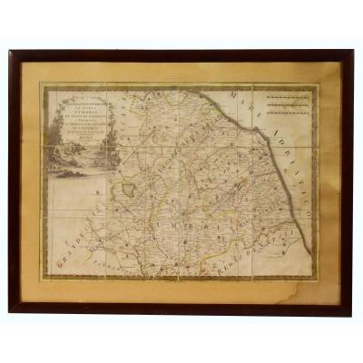
Map of Italy dated 1791, in a mahogany baguette frame and under glass. La Legazione d'Urbino La Marca L'Umbria Lo Stato di Camerino i territori di Perugia e di Orviero Ed il Governo di Citta di Castel[...]
Original proof engraved in 1827.
Very good condition.
Sheet format: 66.5 x 50 cm.
Original antique chart of 1827.
Two years were necessary to carry out all the hydrographic surveys of the island o[...]
Carte originale gravée sur cuivre de 1764. Bellin cartographe.
Coloris aquarelle. 2 infimes petits trous anciens restaurés, dans la partie centrale haute.
Bon état.
Format feuille : 34,5 x 25 cm.
[...]
Map engraved in 1751. Bellin cartographer.
Fine hand coloring .
Very good state.
Sheet format: 32 x 25 cm.
Engraving format: 28.5 x 19 cm.
Original card from 1753.
Possibility of secure paymen[...]
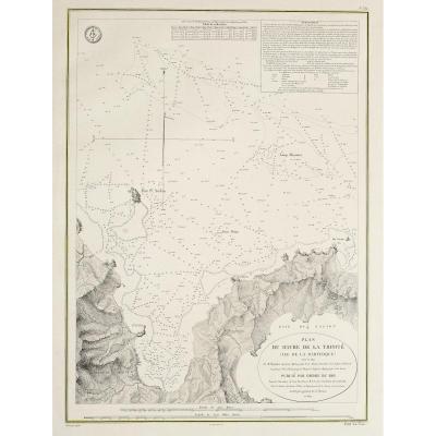
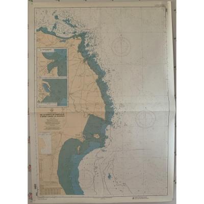
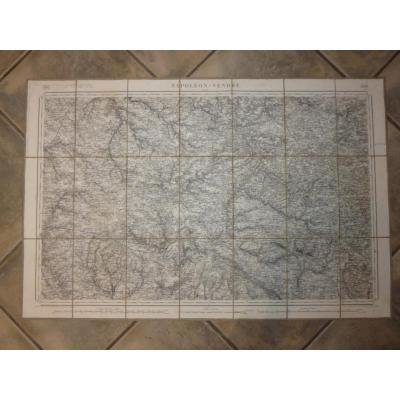
Marine chart. From Pointe de Barfleur to Saint Vaast la Hougue. Hydrographic and Oceanographic Service of the Navy publication 1988 Excellent condition, no tears or stains, just a few wrinkles of the [...]
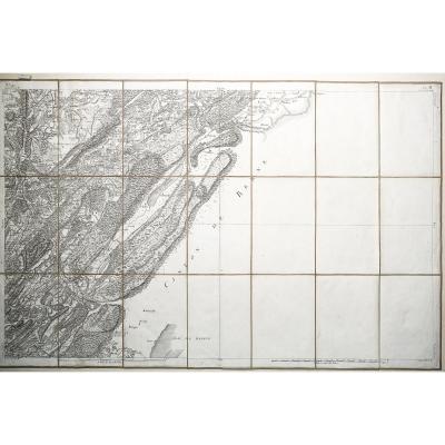
Antique geographic map of Cassini de Thury - N ° 147 - Nozeroy - les Rousses -Original map of Cassini produced in 1759 - 60, published by Andriveau - Goujon around 1815.Period canvas and mounted in 21[...]
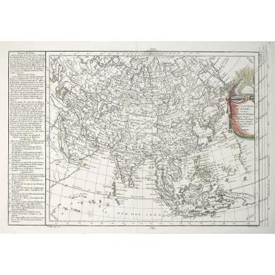
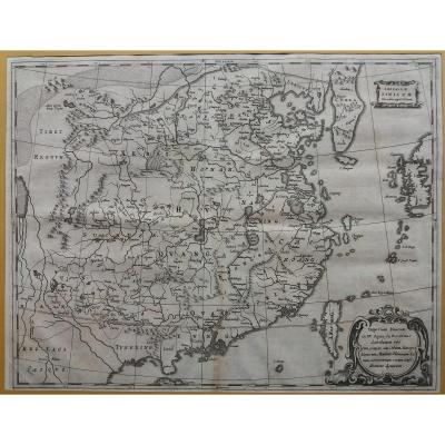
The +: very good state of conservation. Usage: historical and decorative map. Imperium Sinicum. Detailed map of China with cities, lakes, rivers, mountains, neighboring countries and Great Wall. Imper[...]
Epreuve originale gravée en 1628.
Mouillure claire dans la marge latérale gauche n’atteignant pas le sujet.
Bon état.
Format feuille : 53,5 x 41 cm.
Format gravure : 46,5 x 35,5 cm.
Original anti[...]
Beautiful 18th century optics view representing the view of the Arno and the city of Florence; taken out of the door of Saint Fredian. Colored by hand. Note: it is placed on a rigid cardboard and on a[...]
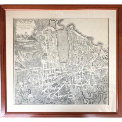
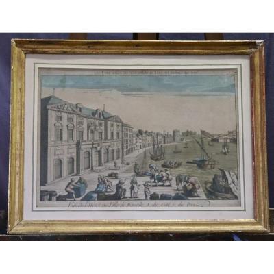
Late eighteenth optical view representing the port of Marseille. It shows in the foreground of people busy for the unloading of ships and on the left the city hall of Marseille. It is written down "vi[...]
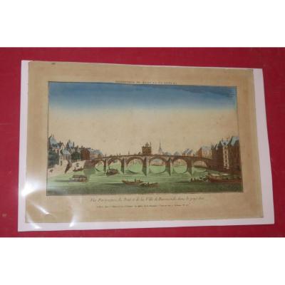
Very beautiful optical view 18th time, representing the "The Bridge of the City of Roermond in the Netherlands". Colored by hand. Note: there is a protective plastic on the engraving. - External dimen[...]
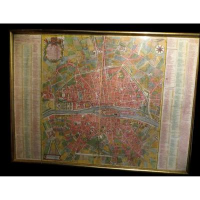
CHEREAU (François, printed by) - COQUART & DELAHAYE (engraved by). New map of Paris drawn up for the convenience of its inhabitants and those who come to this great city, with a historical abbreviatio[...]
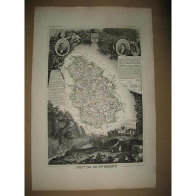
Rare carte du département du rhone d'epoque révolutionnaire.
la creation du département du Rhône date de 1793 suite à la division en deux du département de Rhône et Loire .On peut dater cett[...]
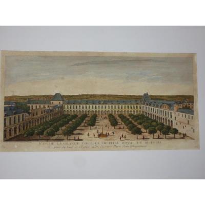
Very beautiful optical engraving 18th time, representing the "View of the Great Court of the Royal Hospital Bicestre"; taken from the top of the églse where we discover Paris in the distance. Colored [...]
Nice and rare eighteenth map showing the islands of the probe steered the ocean, with the island of Borneo, Sumatra and Java. Dated 1749 and directed by Sir Robert Vangondy. Good general condition and[...]
Proantic uses a cookie to analyze traffic and improve its service by using Google Analytics. Data sent to Google Analytics (frequency of visits to the site and pages visited) are anonymous. No other cookie tracks your activity, your personal data is not collected. Thank you for helping us to have better understanding how Proantic is used.


 Le Magazine de PROANTIC
 TRÉSORS Magazine
 Rivista Artiquariato