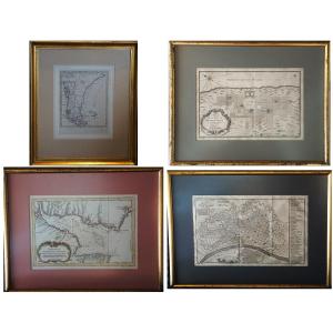


Set Of 4 Antique Maps From The 18th Century / Patagonia / Buenos Aires / Lima / Rio De La Plata
Artist: Jacques-nicolas Bellin (1703–1772)
SET OF FOUR ANTIQUE MAPS FROM THE 18TH CENTURY
SOUTH AMERICA – BUENOS AIRES, LIMA, RIO DE LA PLATA, AND PATAGONIA
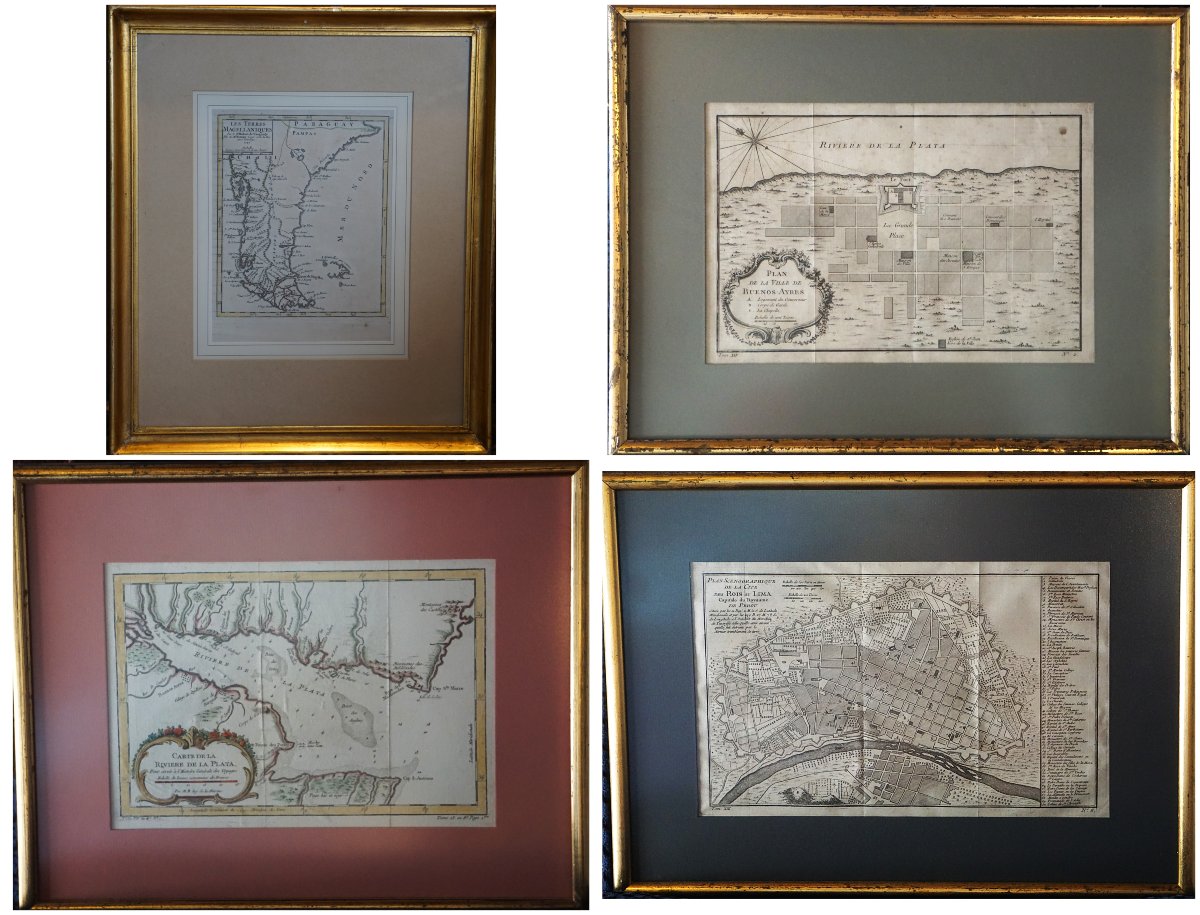
A set of four antique 18th-century maps and plans of South America, featuring the cities of Buenos Aires and Lima, the Río de la Plata estuary, and the Magellanic Lands (present-day Patagonia).
These documents offer insight into the geography, navigation, and major cities of Spanish America during the Age of Enlightenment.
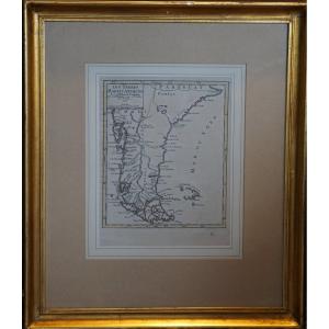
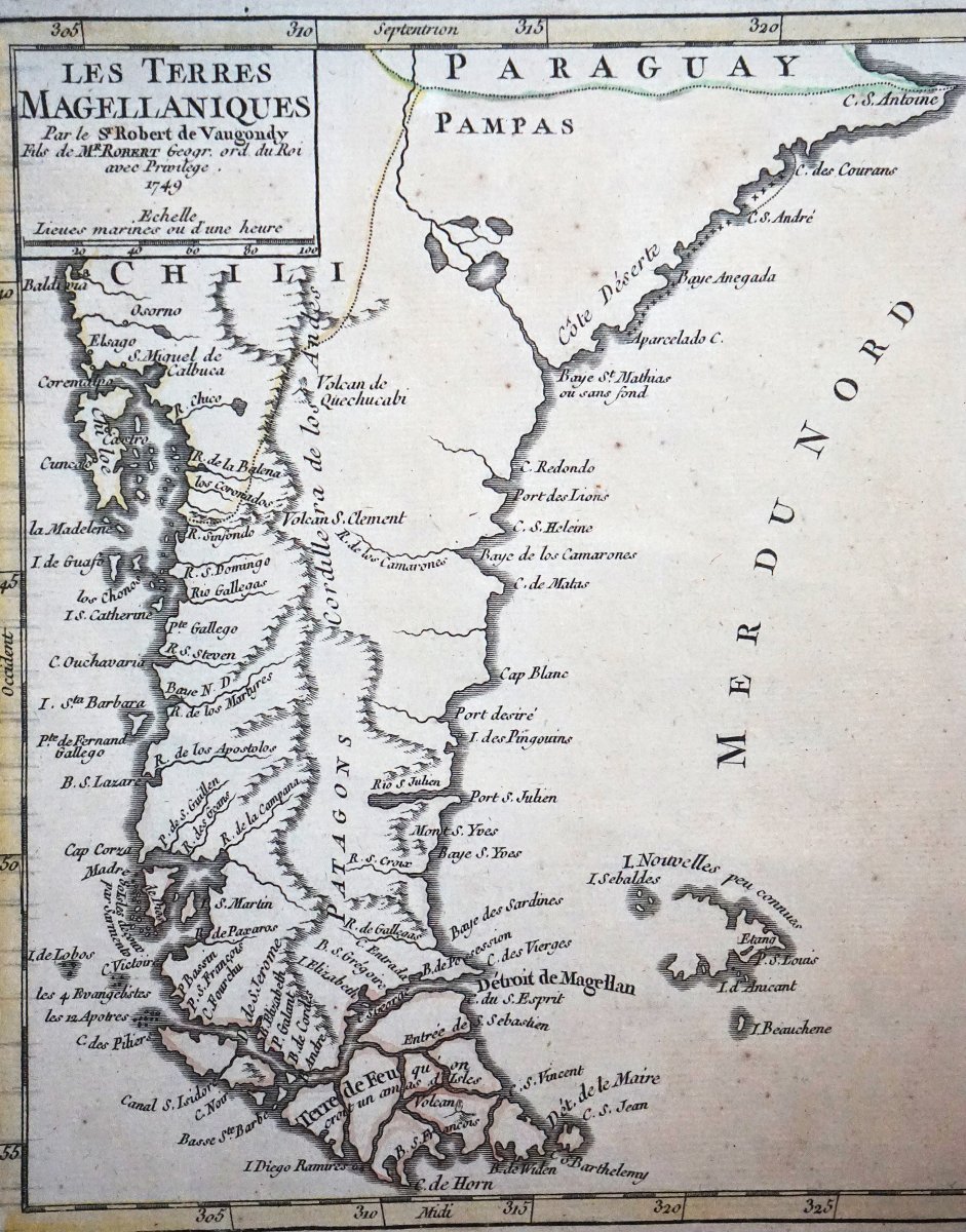
“The Magellanic Lands,” by Robert de Vaugondy, dated 1749, depicts the southern part of the continent, including Patagonia, southern Chile, Tierra del Fuego, and the Strait of Magellan. The depiction of the coastlines, the Andes mountain range, and the islands reflects the geographical knowledge of the time. Dimensions of the print: 22 × 17 cm; with frame: 42 × 36 cm.
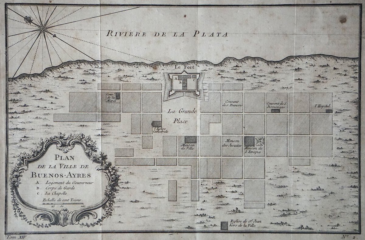
The “Map of the City of Buenos Aires,” attributed to Jacques-Nicolas Bellin (1703–1772), shows the colonial city on the banks of the Río de la Plata. Its grid-like layout is organized around the main square and the fort, with the principal convents and administrative buildings. An ornamental cartouche and a compass rose enhance this mid-18th-century engraving, published in Abbé Prévost’s *Histoire générale des voyages*. Dimensions (image only): 20 × 29 cm; with frame: 34 × 43 cm.
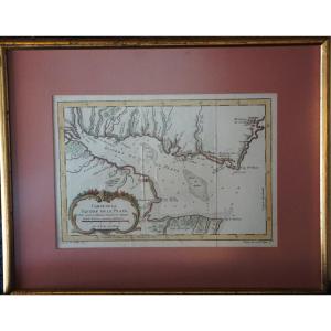
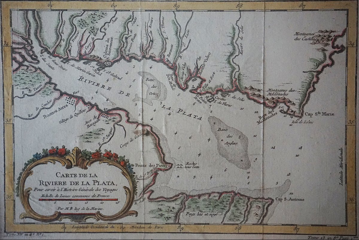
The “Map of the Río de la Plata,” by Jacques-Nicolas Bellin (1703–1772), depicts the estuary between the present-day territories of Argentina and Uruguay. Buenos Aires, Montevideo, Colonia, and Maldonado are shown on the map, along with nautical information regarding shoals and depths. Engraved on copper and enhanced with period colors, it is distinguished by its elegant rocaille cartouche featuring botanical motifs. Dimensions of the print: 21 × 29 cm; with frame: 35 × 44 cm.
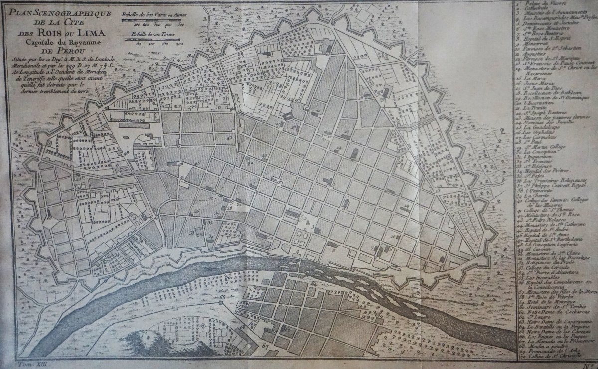
The map of Lima, “City of Kings” and capital of the Kingdom of Peru, attributed to Jacques-Nicolas Bellin (1703–1772), depicts the fortified city, its neighborhoods, the river, and its main monuments, identified in a side legend. Published in the mid-18th century in the *Histoire générale des voyages*, it depicts the city prior to the 1746 earthquake, as specified in its inscription. Dimensions of the engraving: 21 × 34 cm; with frame: 35 × 48 cm.
The piece is in good overall condition, showing old creases and signs of age, with wear on the frame visible in the photographs.
SOUTH AMERICA – BUENOS AIRES, LIMA, RIO DE LA PLATA, AND PATAGONIA
A set of four antique 18th-century maps and plans of South America, featuring the cities of Buenos Aires and Lima, the Río de la Plata estuary, and the Magellanic Lands (present-day Patagonia).
These documents offer insight into the geography, navigation, and major cities of Spanish America during the Age of Enlightenment.
“The Magellanic Lands,” by Robert de Vaugondy, dated 1749, depicts the southern part of the continent, including Patagonia, southern Chile, Tierra del Fuego, and the Strait of Magellan. The depiction of the coastlines, the Andes mountain range, and the islands reflects the geographical knowledge of the time. Dimensions of the print: 22 × 17 cm; with frame: 42 × 36 cm.
The “Map of the City of Buenos Aires,” attributed to Jacques-Nicolas Bellin (1703–1772), shows the colonial city on the banks of the Río de la Plata. Its grid-like layout is organized around the main square and the fort, with the principal convents and administrative buildings. An ornamental cartouche and a compass rose enhance this mid-18th-century engraving, published in Abbé Prévost’s *Histoire générale des voyages*. Dimensions (image only): 20 × 29 cm; with frame: 34 × 43 cm.
The “Map of the Río de la Plata,” by Jacques-Nicolas Bellin (1703–1772), depicts the estuary between the present-day territories of Argentina and Uruguay. Buenos Aires, Montevideo, Colonia, and Maldonado are shown on the map, along with nautical information regarding shoals and depths. Engraved on copper and enhanced with period colors, it is distinguished by its elegant rocaille cartouche featuring botanical motifs. Dimensions of the print: 21 × 29 cm; with frame: 35 × 44 cm.
The map of Lima, “City of Kings” and capital of the Kingdom of Peru, attributed to Jacques-Nicolas Bellin (1703–1772), depicts the fortified city, its neighborhoods, the river, and its main monuments, identified in a side legend. Published in the mid-18th century in the *Histoire générale des voyages*, it depicts the city prior to the 1746 earthquake, as specified in its inscription. Dimensions of the engraving: 21 × 34 cm; with frame: 35 × 48 cm.
The piece is in good overall condition, showing old creases and signs of age, with wear on the frame visible in the photographs.
380 €
Period: 18th century
Style: Louis 15th - Transition
Condition: Excellent condition
Material: Paper
Reference (ID): 1829797
Availability: In stock
Print