Moithey Maurille-antoine Historical Map Of Paris From 1774, 111 Cm By 147 Cm
Artist: Moithey
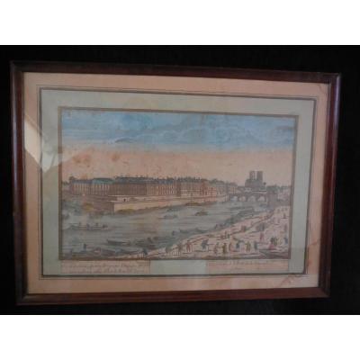
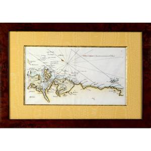
MOITHEY (Maurille-Antoine) Historical map of the city and suburbs of Paris, its growth from Philippe Auguste to the reign of Louis XV. Paris, Moithey, 1774. In 24 sections mounted on canvas and folded, forming a map of 1110 x 1470 mm, First edition. Large map of more than one meter by one meter fifty, framed by a wide garland of flowers. It is decorated with 22 views of royal squares, historic monuments and recent monuments and three small historical maps showing Paris between 1422 and 1643. It offers a fairly accurate outline of the walls of Philippe Auguste, Charles V and Louis XIII. With alphabetical table. The title cartouche is decorated with the arms of Paris, the arms of the governor of Paris held by Minerva and the arms of the provost of merchants held by a woman symbolizing Paris. Appointed Geographer to the King in 1780, Moithey specialized in the publication of historical maps highlighting urban changes that had taken place since the mid-16th century. He published maps of Orléans, Reims, Angers, and Lyon. A similar copy (margins cut) was sold in 2011 by Pierre Bergé for 2,600 euros excluding fees, or approximately 3,400 euros.
2 250 €
Period: 18th century
Style: Louis 15th - Transition
Condition: Good condition
Material: Paper
Reference (ID): 1526873
Availability: In stock
Print