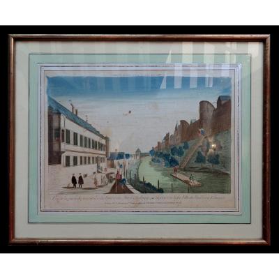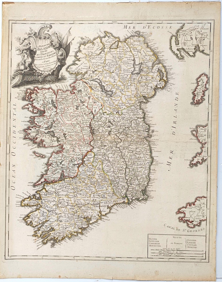


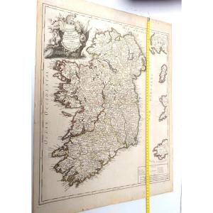


Large Map, 1745: Kingdom Of Ireland By And Chez Le Rouge (paris)
Artist: Le Rouge, Cartographe Du Roy
Beautiful large map : Kingdom of Ireland divided into provinces, counties and baronies, by Le Rouge, Georges-Louis (1712-1790). Cartographer, Edition date: 1745.
Decorated on top right with engraved cartouche, flags, abundance, sea waves, birds.
It is enhanced with colors according to political and administrative divisions.
Bowl: 57 x 48.5 cm, lower right: Notes and scales: Scale(s): 20 Leagues from 20 to the degree [= 12.4 cm]
Beautiful map, laminated on strong paper, flat , unfolded, uniform light yellowing.
Total dimensions: 66cm x 50cm
This item is for immediate purchase, payable by credit card or paypal.
- eclectic – antique dealers since 1970, Siret: FR 24.430113233. Invoice and Certificate are attached to each of our shipments.
160 €
Period: 18th century
Style: Louis 15th - Transition
Condition: Good condition
Material: Paper
Length: 66cm
Width: 50cm
Reference (ID): 1339537
Availability: In stock
Print