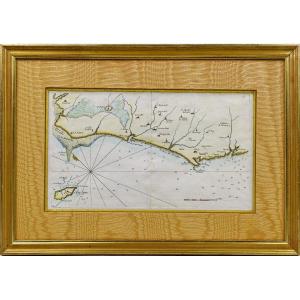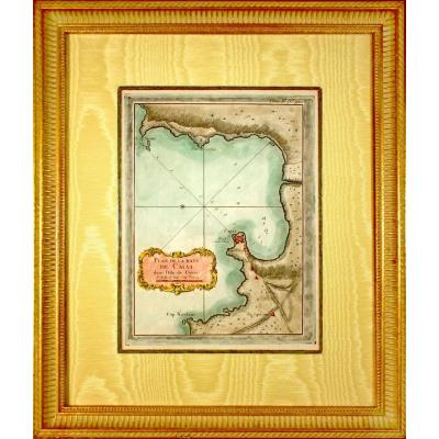


Nautical Chart Of Brest Harbor, 18th Century – Brittany - Finistère
Artist: Bellin Cartographe
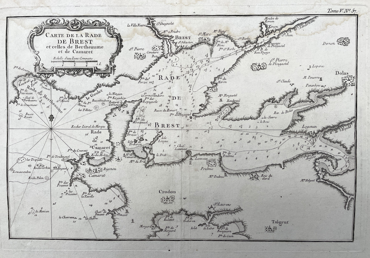
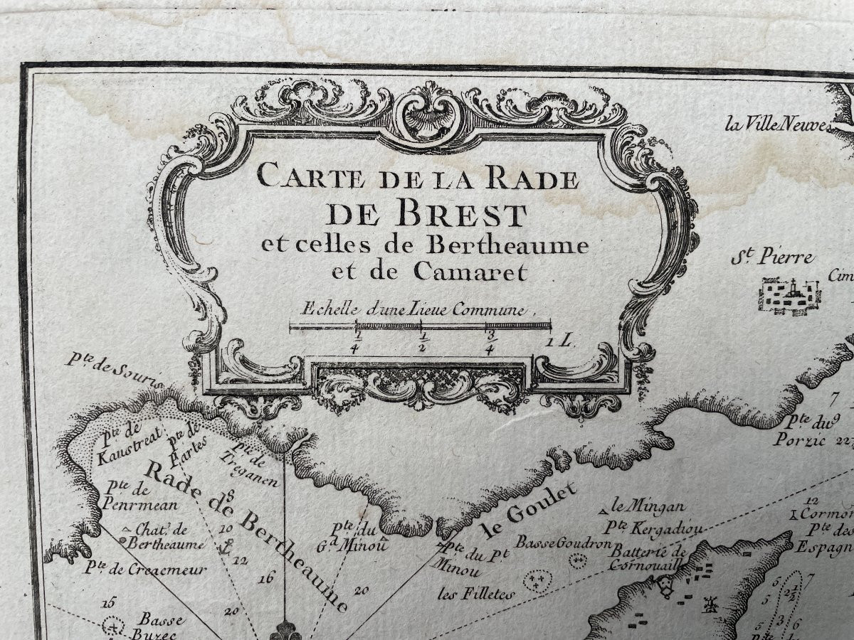
Map of the harbor of Brest and those of Bertheaume and Camaret, titled in a cartouche at the top left with the scale of the places, below, fleur-de-lis indicating the North.
Original proof made around 1760.
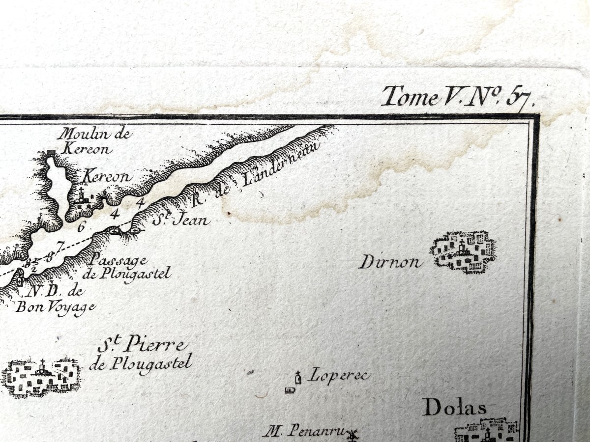
Bellin cartographer, precision at the top right volume V n°57
Very good condition. Fold in the center, some slightly marked halos on the periphery.
Sheet size: 43.7 x 33 cm. Engraving size: 34.5 x 23 cm.
Original proof made around 1760.
Bellin cartographer, precision at the top right volume V n°57
Very good condition. Fold in the center, some slightly marked halos on the periphery.
Sheet size: 43.7 x 33 cm. Engraving size: 34.5 x 23 cm.
95 €
Period: 18th century
Style: Louis 15th - Transition
Condition: Good condition
Material: Paper
Length: 43,7 cm
Height: 33 cm
Reference (ID): 1562775
Availability: In stock
Print