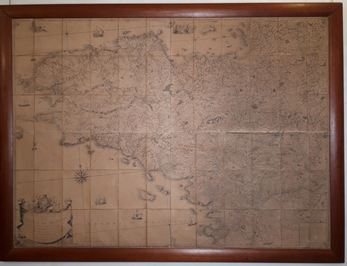
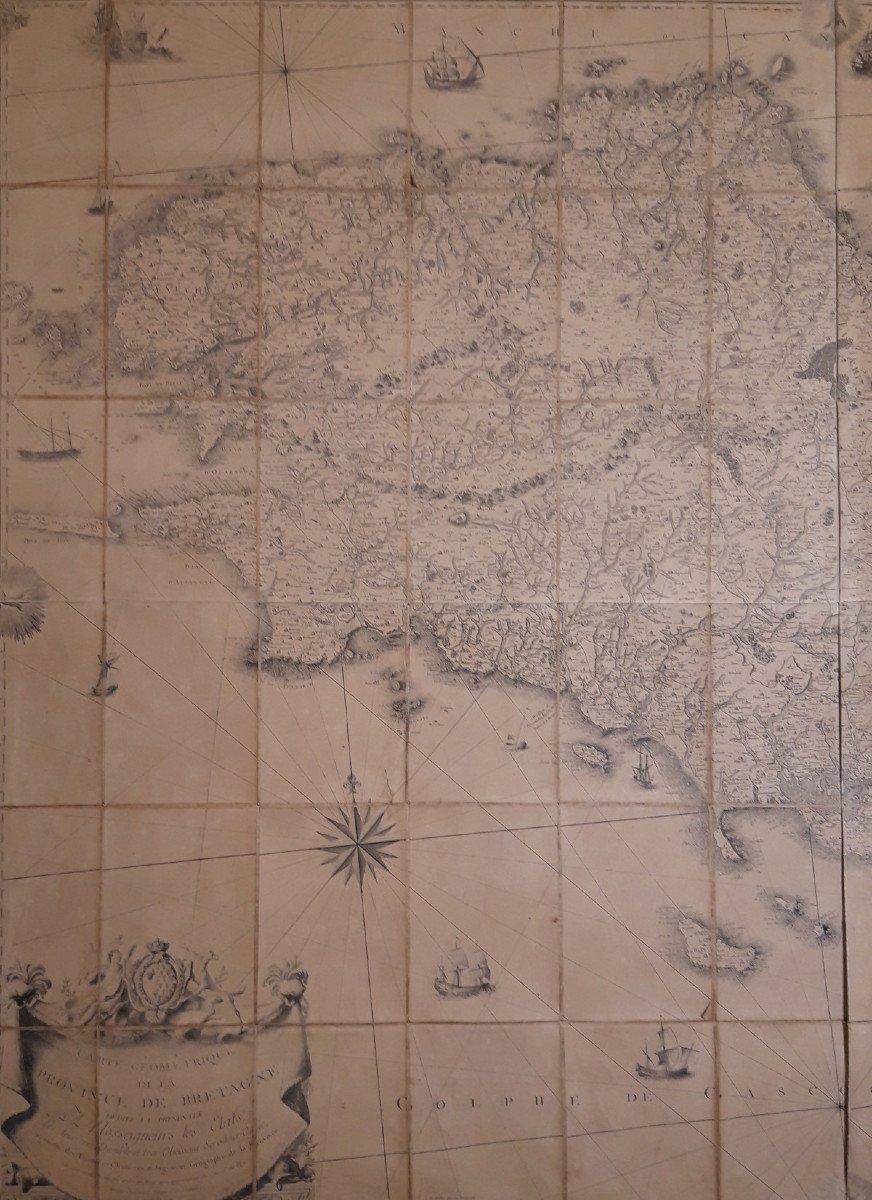

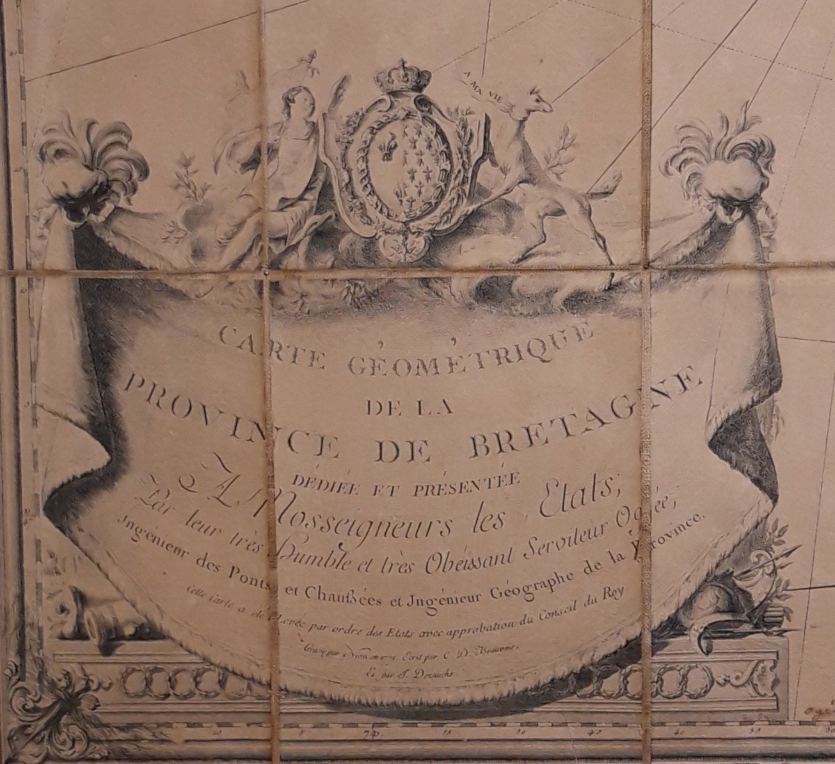
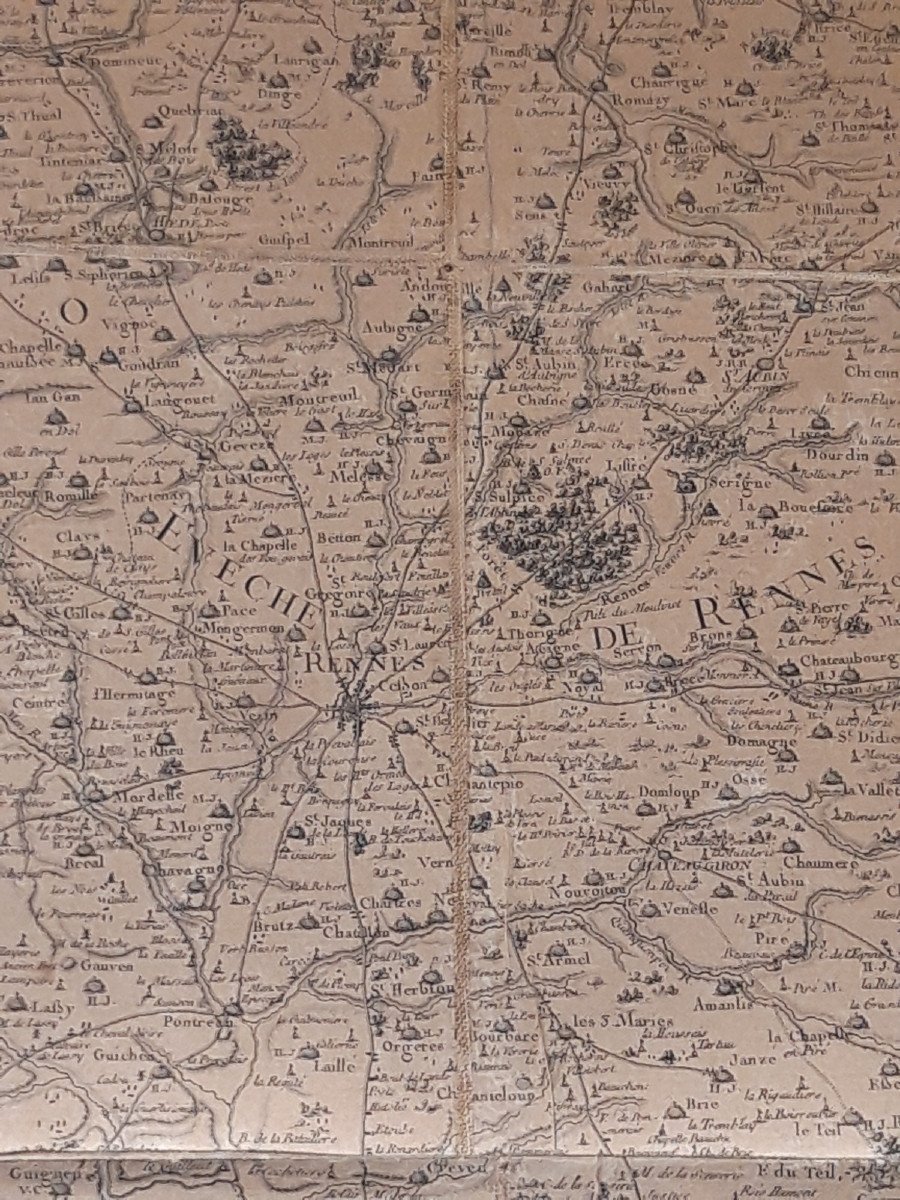
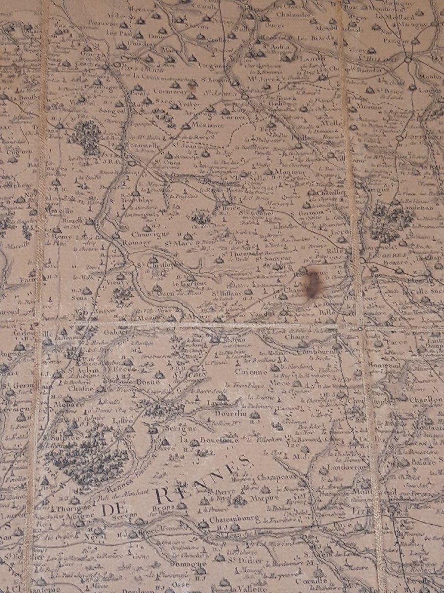
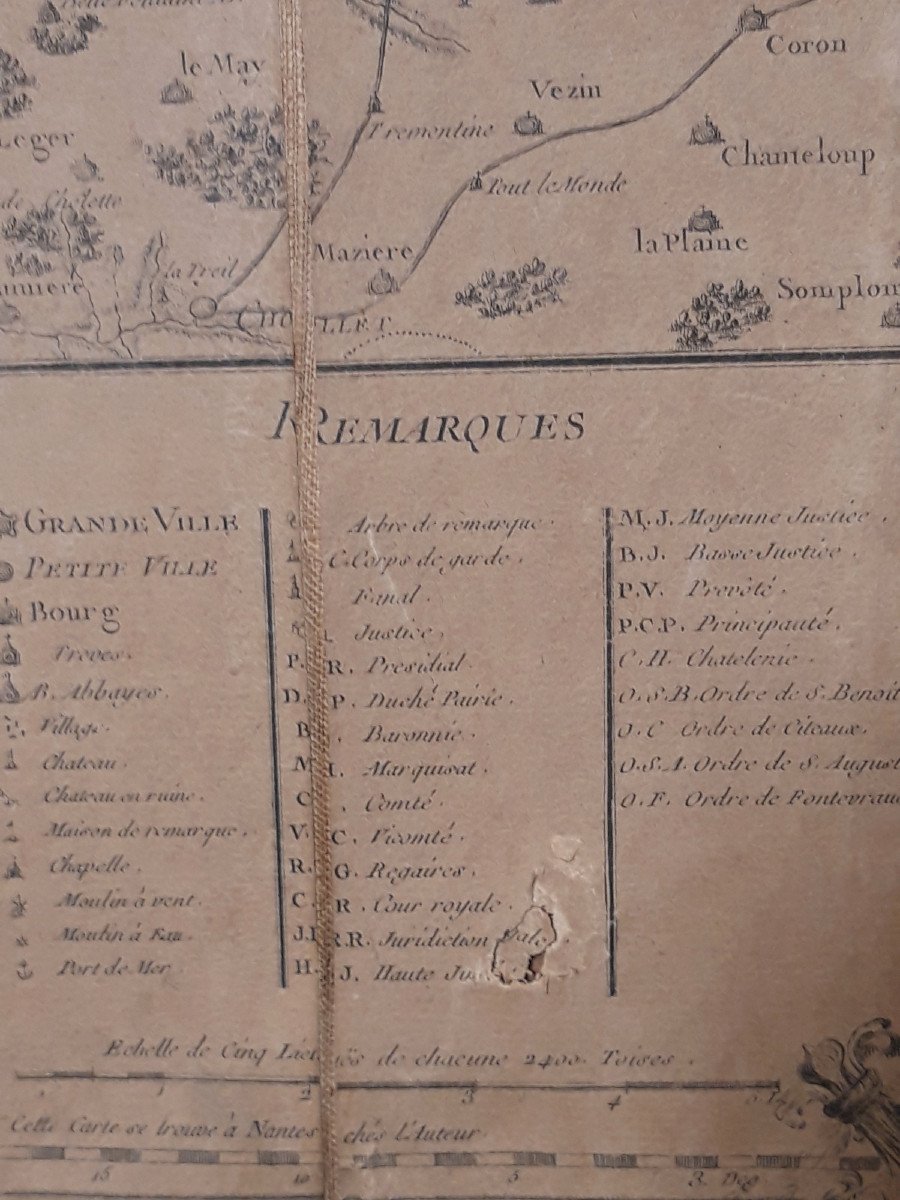


Geometric Map Of The Province Of Brittany - 1771 By Jbogée
Important map of Brittany made by the engineer geographer Jean-Baptiste Ogée (1728-1789) and engraved by Nion in 1771.
It was on a copy of this map that the Breton deputies, on February 26, 1790, delimited and approved the creation of the five new departments.
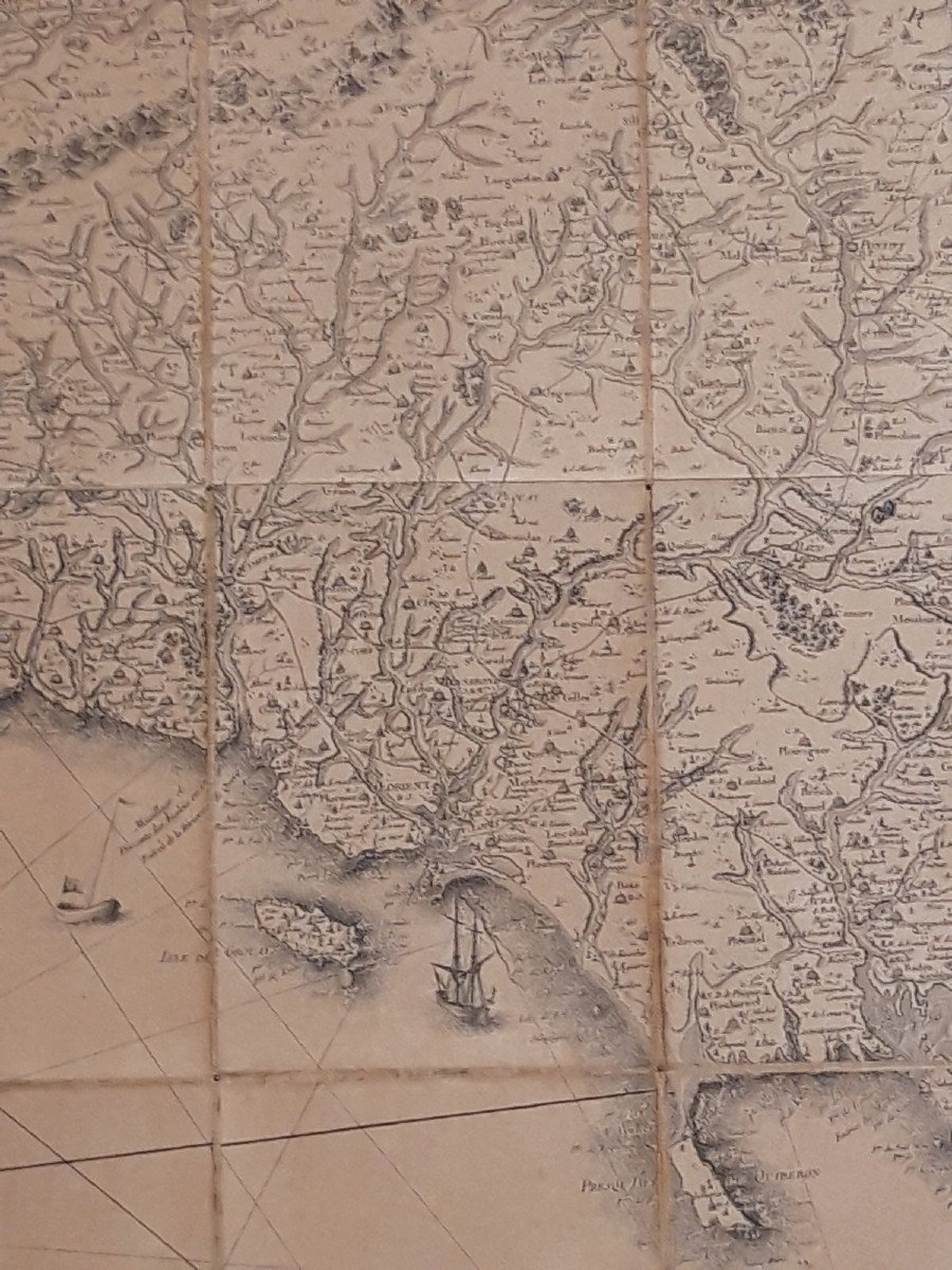
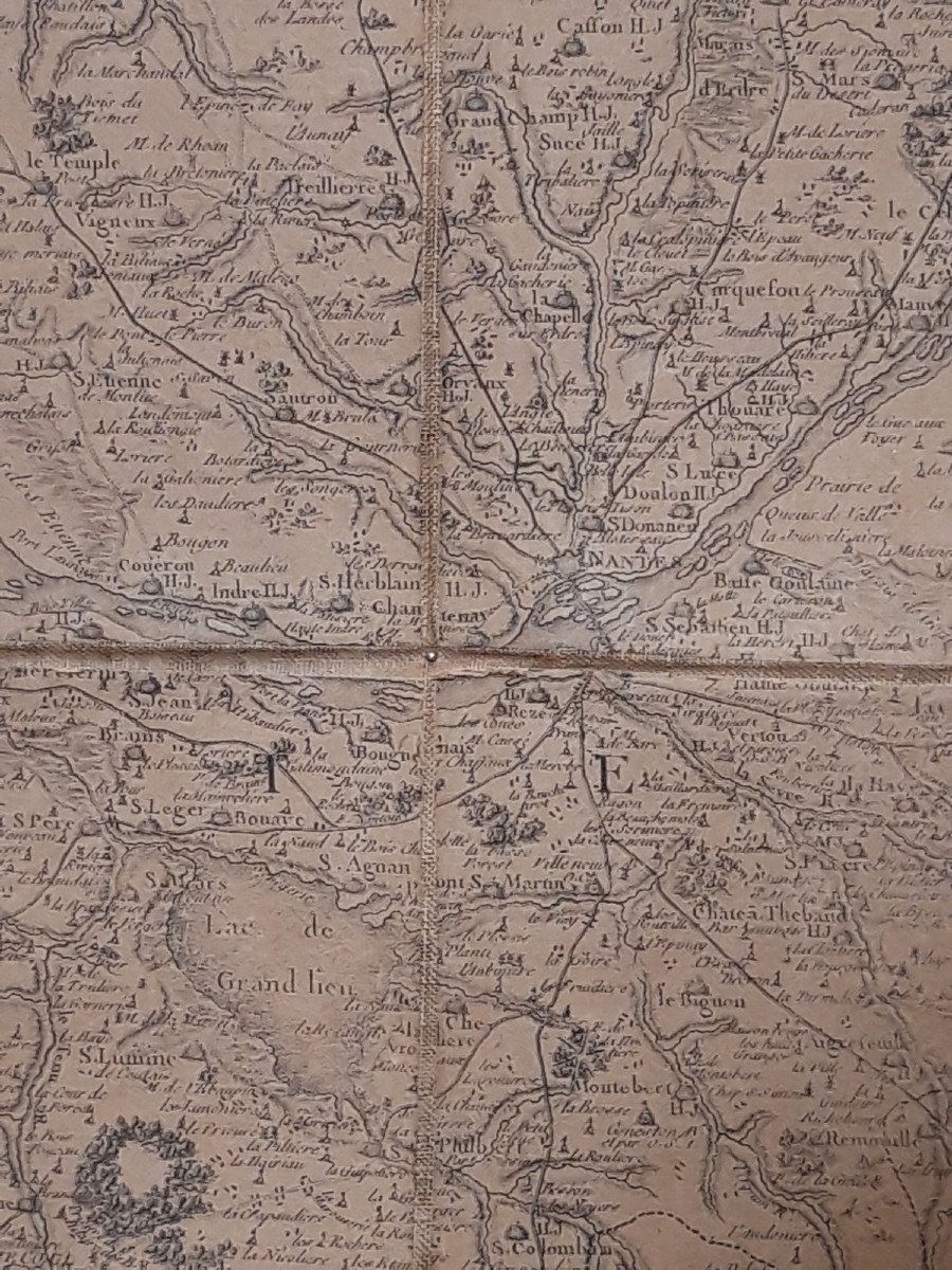
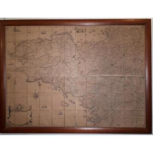
Formerly intended to be folded, this map has been cut and then interfaced in order to give it a transportable format that can be used anywhere.
Framed copy, presented in one piece, and fixed on a rigid support by small nails through the cloth and not the paper.
Good condition; one foxing (burnt?) in the upper right corner of Rennes; small tear in the remarks table (lower right corner); see photos.
France, 18th century, 1771
Dimensions at sight: 112.5 cm X 155 cm.
Framed dimensions: 126.5 cm X 169.5 cm.
Delivery worlwide possible on estimate.
It was on a copy of this map that the Breton deputies, on February 26, 1790, delimited and approved the creation of the five new departments.
Formerly intended to be folded, this map has been cut and then interfaced in order to give it a transportable format that can be used anywhere.
Framed copy, presented in one piece, and fixed on a rigid support by small nails through the cloth and not the paper.
Good condition; one foxing (burnt?) in the upper right corner of Rennes; small tear in the remarks table (lower right corner); see photos.
France, 18th century, 1771
Dimensions at sight: 112.5 cm X 155 cm.
Framed dimensions: 126.5 cm X 169.5 cm.
Delivery worlwide possible on estimate.
1 250 €
Period: 18th century
Style: Louis 15th - Transition
Condition: Good condition
Reference (ID): 1025972
Availability: In stock
Print