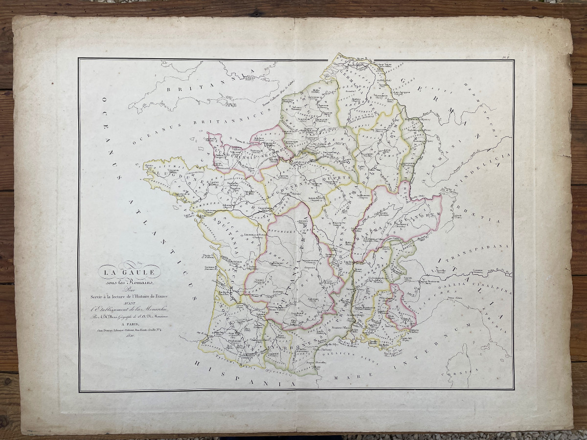

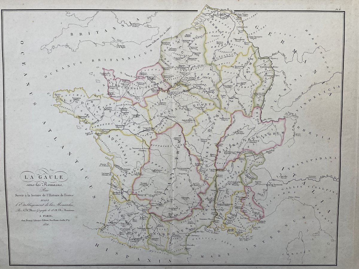


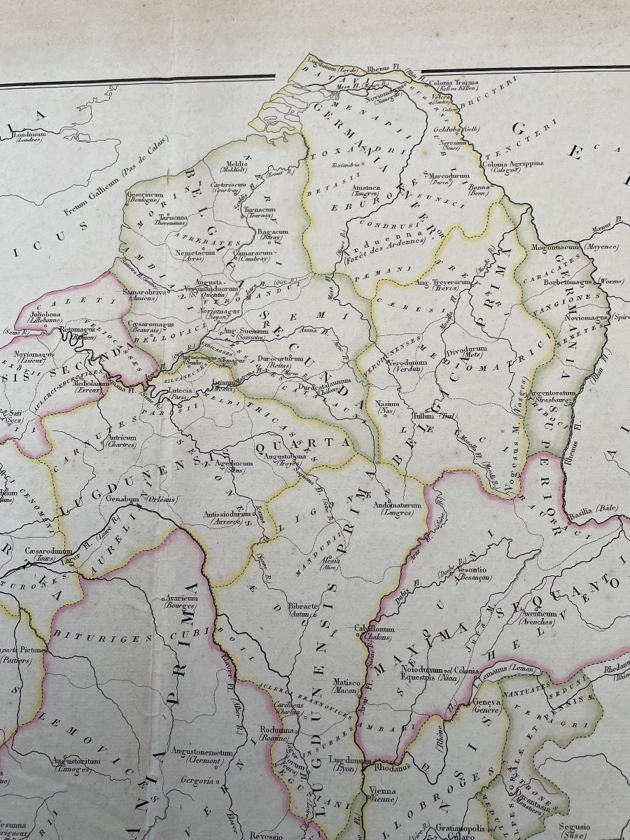
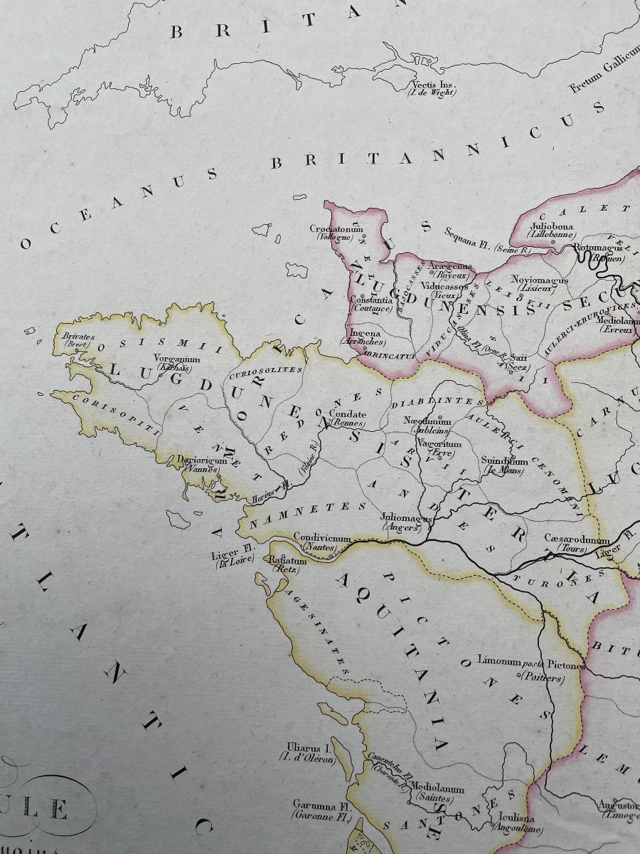


Map Of Gaul Under The Romans By Adrien-hubert Brué 1820
Artist: Adrien-hubert Brué Chez Desray à Paris
Large map of Gaul under the Romans produced in 1820 by Brué, Adrien-Hubert (1786-1832) to be used for reading the History of France before the establishment of the monarchy
Desray bookseller publisher Engraving, old borders enhanced in color
Good used condition, old fold in the center, minimal soiling in the margins
54 cm X 72 cm
Desray bookseller publisher Engraving, old borders enhanced in color
Good used condition, old fold in the center, minimal soiling in the margins
54 cm X 72 cm
125 €
Period: 19th century
Style: Rome and Antic Greece
Condition: Good condition
Material: Paper
Length: 72 cm
Width: 54 cm
Reference (ID): 1558220
Availability: In stock
Print