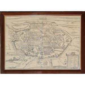
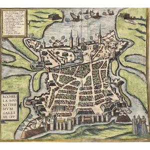
Original 16th Century Watercolor Map Of Limoges And Limousin
Artist: (boguerealdj) Bouguereau Cartographe Sous Henri Iv
Geographic map, original proof engraved under the reign of Henri IV in 1594 by (Boguerealdj) Bouguereau cartographer.
Very beautiful proof enhanced with hand-painted watercolor, bright and fresh colors in very good condition, over four hundred years old (fold in the middle, some foxing and dirt).
Sheet dimensions: 41 x 53 cm - engraving: 36 x 48 cm.
Top right, in a cartouche, city map with caption referring to the different places in the city. Bottom right, text in Latin in the cartouche at the bottom right. Bottom left, text on Limoges by Joachim Blanchon…
770 €
Period: 16th century
Style: Renaissance, Louis 13th
Condition: Good condition
Material: Paper
Length: 53 cm
Height: 41 cm
Reference (ID): 1429932
Availability: In stock
Print