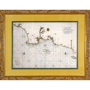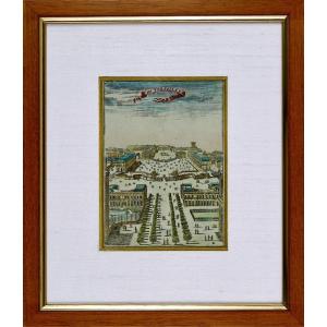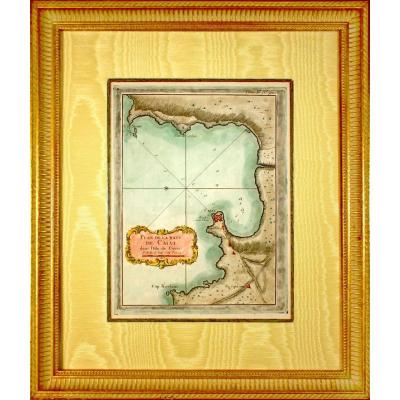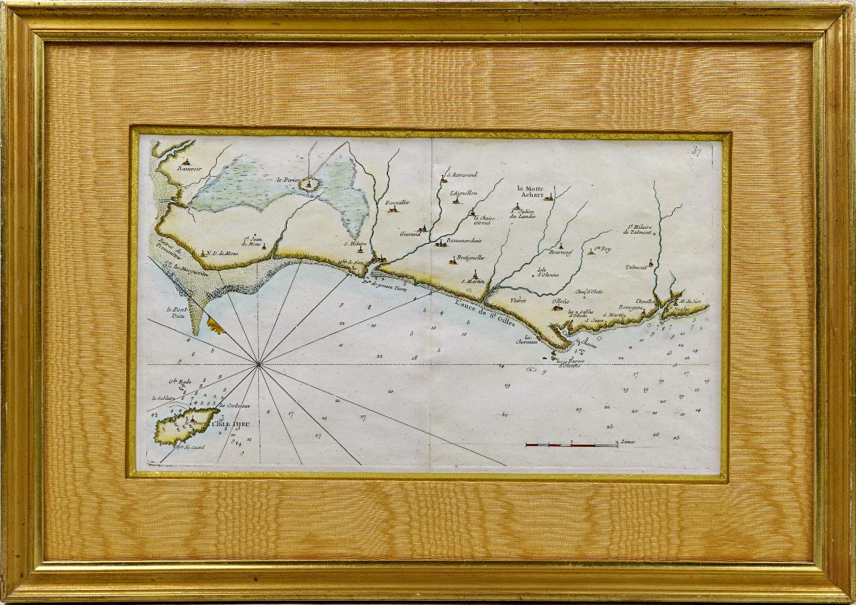

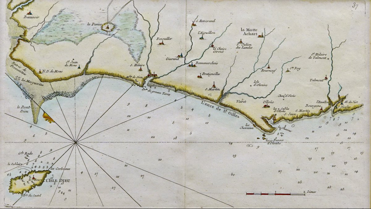
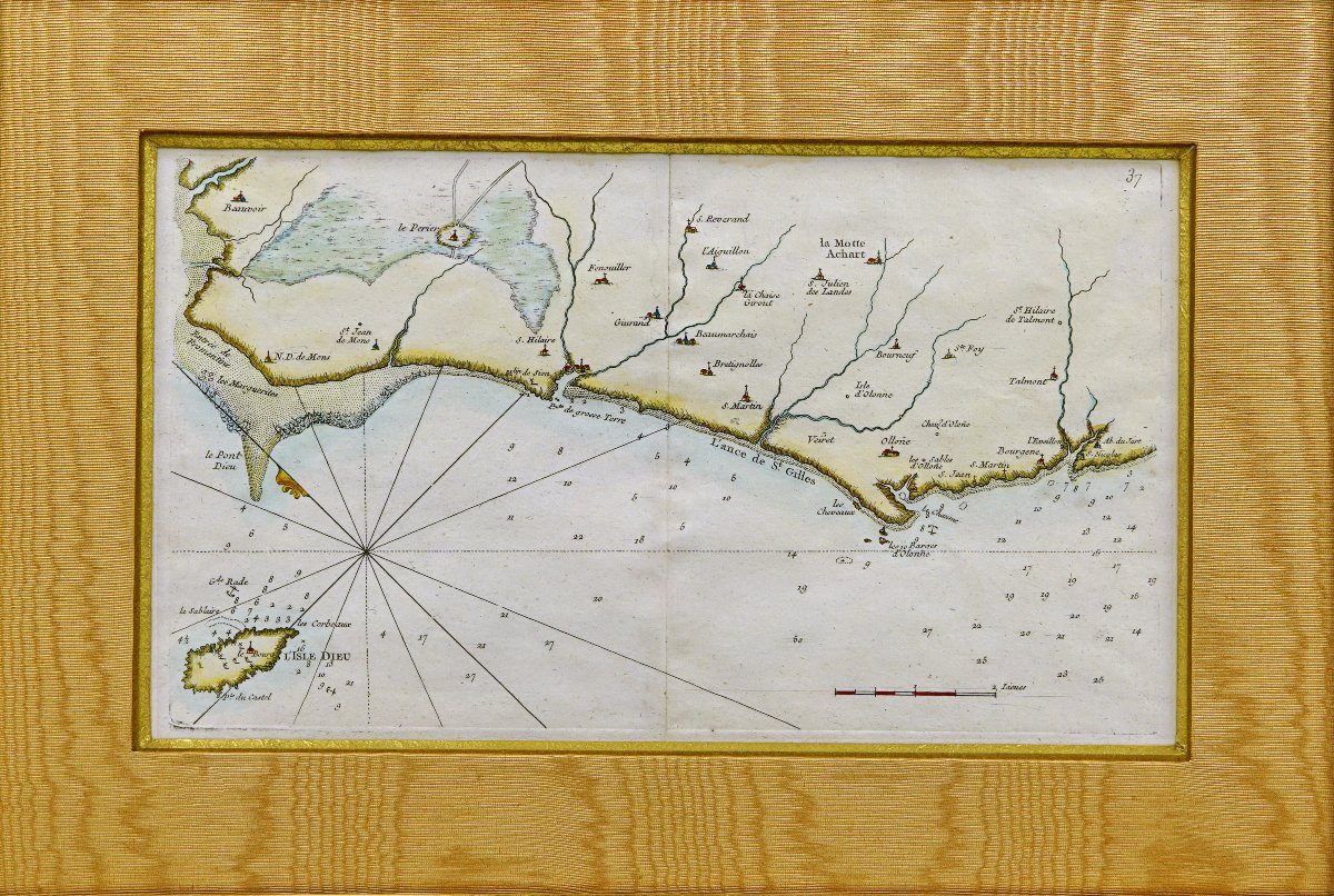
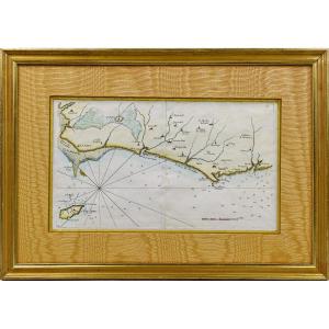


Rare Carte Marine De La Vendée - N°27 - De Beauvoir Aux Les Sables d'Olonnes - Ep. XVIIIe
PropertiesView / Product
Original proof produced in 1757 by Georges Louis Le ROUGE cartographer.
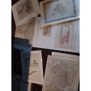
From the "Recueil des Cotes Maritimes de France" published by Desnos.
With the half fleur-de-lis indicating North, depth of water near rocks, woods, watercourses, reliefs...
Particularly detailed coastal survey, to a scale of 2 half-leagues, produced by Georges le Rouge, military engineer of fortifications and geographer to King Louis XV. He was also military engineer to the Count of Clermont, engraver, publisher and print merchant.
Beautiful hand-watercolored colors.
Dimension(s): Frame: Height: 47.5 cm - Width: 34 cm - Width. Baguette : 3 cm,
Condition(s) : PERFECT CONDITION,
Epoque : XVIIIth,
Framing : CURRENT - Old gold beveled filet - Marie-Louise in light ochre-orange moire - Wooden baguette, aged gold water gilding.
PAYMENT and SHIPPING
PAYMENTS ACCEPTED: BANK TRANSFER / PAYPAL / CB online or by CHEQUES.
PACKAGES WILL BE POSTED WITHIN 4 DAYS.
GROUP EDITION POSSIBLE IF PURCHASING SEVERAL OBJECTS.
Period: 18th century
Style: Louis 15th - Transition
Condition: Perfect condition
Material: Paper
Length: 47.5 cm
Height: 34 cm
Reference (ID): 1735932
Availability: In stock