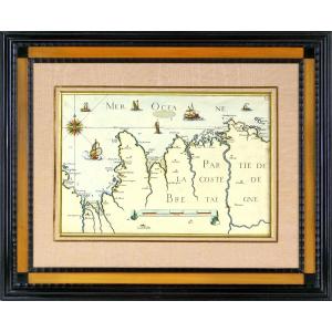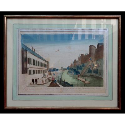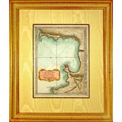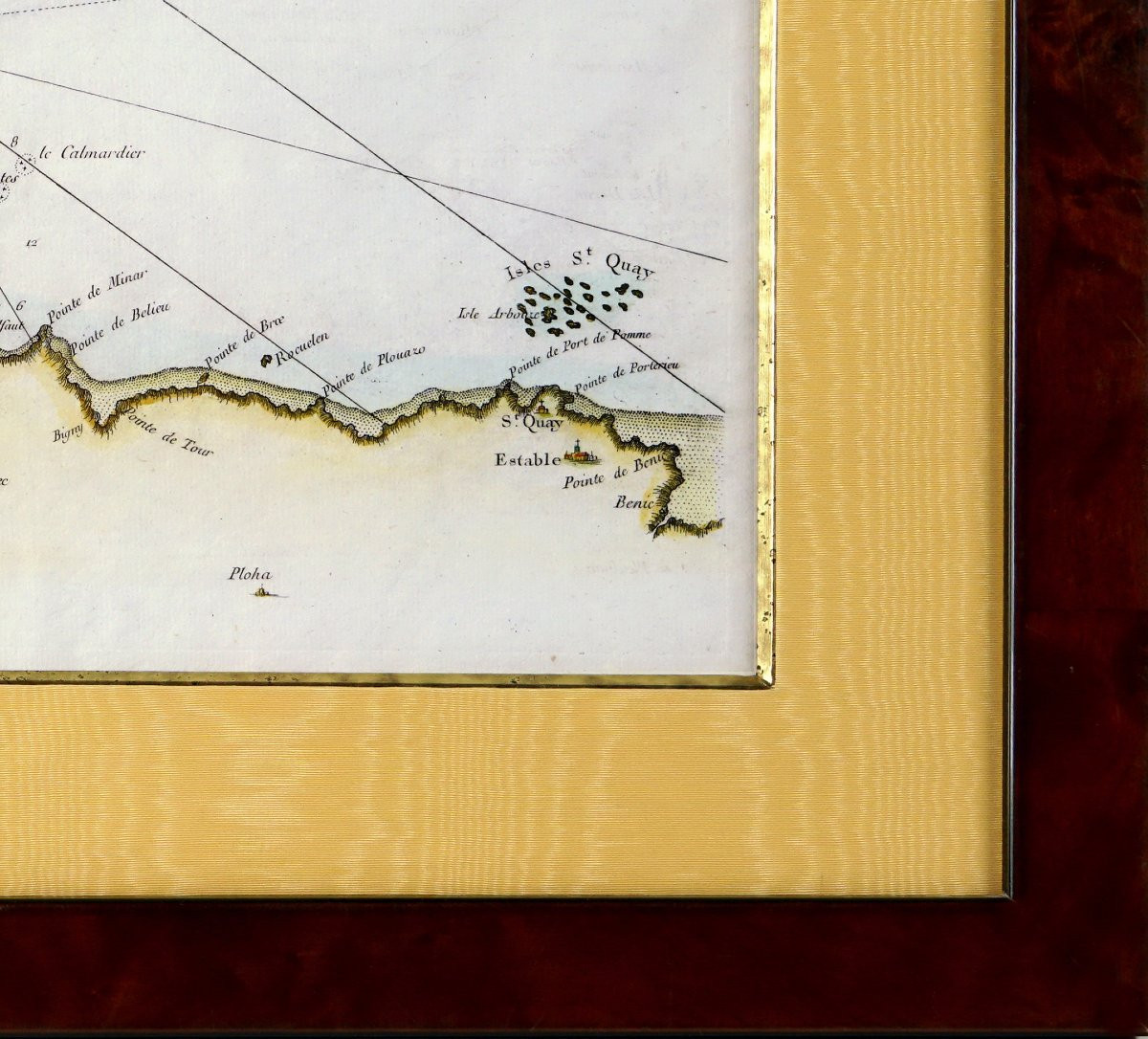

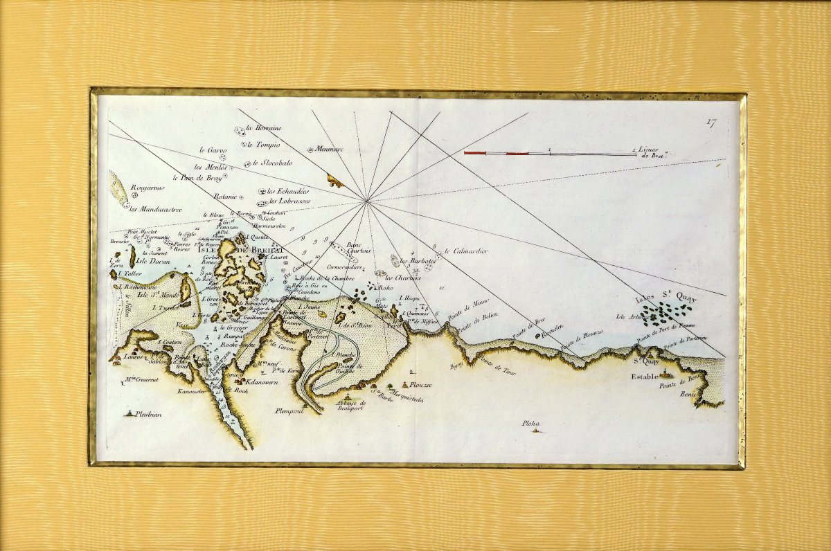
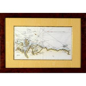


Coastal Map Of Brittany - Pleubian - Isle De Bréhat - Paimpol - Plouzec - Saint-quay-portrieux
Artist: Georges-louis Le Rouge
RARE COASTAL MAP OF BRITTANY - No. 17 - PLEUBIAN - ISLE DE BREHAT - PAIMPOL - PLOUZEC - SAINT QUAY PORTRIEUX - 18th Century. Original print made in 1757 by Georges Louis Le Rouge, cartographer. Taken from the "Recueil des Cotes Maritimes de France" published by Desnos. With the half fleur-de-lis indicating North, the water depth near rocks, woods, waterways, landforms... A particularly detailed coastal survey, at a scale of 2 half-leagues, carried out by Georges Le Rouge, military engineer of fortifications and geographer to King Louis XV. He was also military engineer to the Count of Clermont, engraver, publisher, and print dealer. Beautiful hand-colored watercolors. Dimensions: Framed: Length 49 cm - Height 36 cm - Width Frame: 3 cm, Condition: PERFECT CONDITION, Period: 18th century, Frame: CURRENT - Beveled fillet in antique gold - Light ochre-orange moiré mat - Wooden frame, aged gold water gilding, PAYMENT and SHIPPING: PAYMENTS ACCEPTED: BANK TRANSFER / PAYPAL / BANK TRANSFER / CREDIT CARD online or by CHECK (Payment plan available). PACKAGES WILL BE MAILED WITHIN 4 DAYS. COMBINED SHIPPING IS AVAILABLE FOR MULTIPLE PURCHASES.
440 €
Period: 18th century
Style: Louis 15th - Transition
Condition: Perfect condition
Material: Paper
Length: 49 cm
Height: 36 cm
Reference (ID): 1720341
Availability: In stock
Print