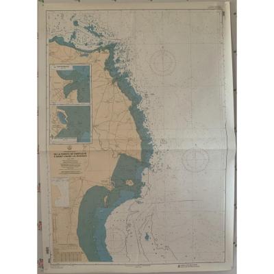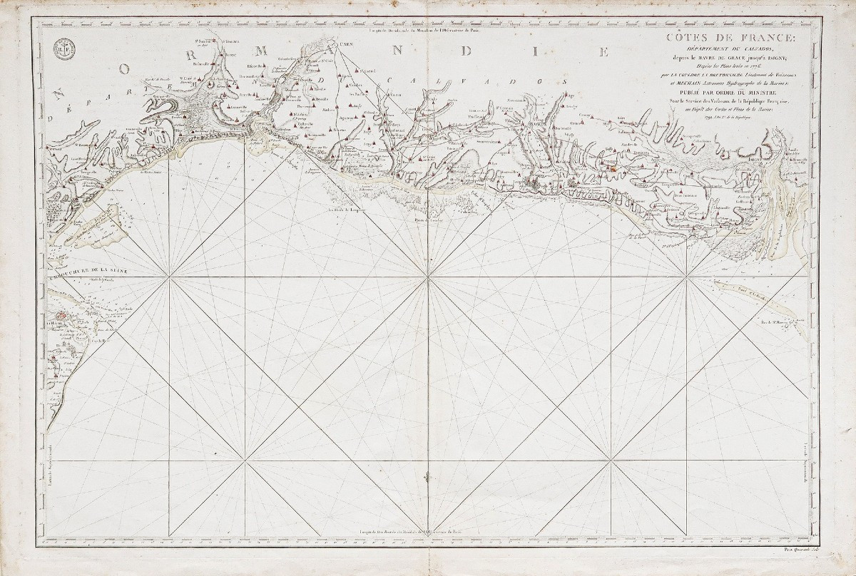
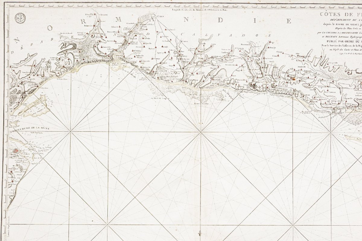
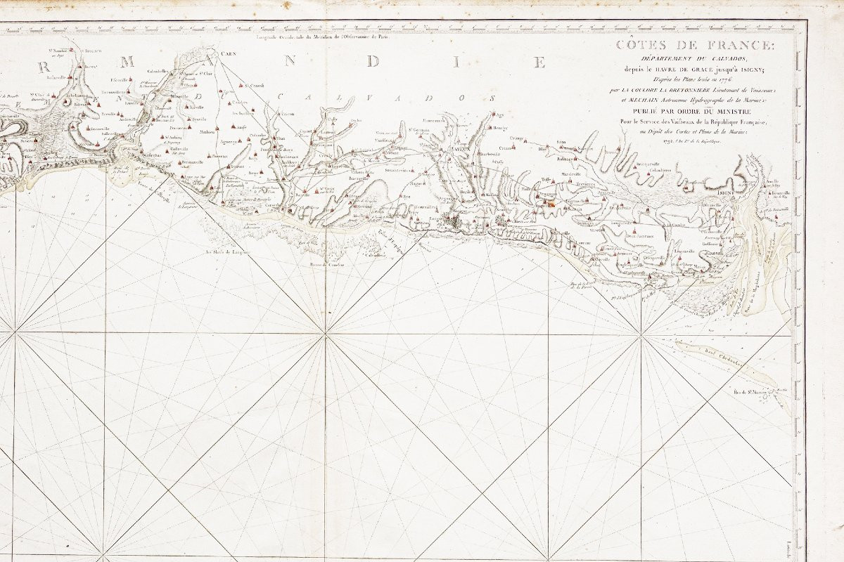

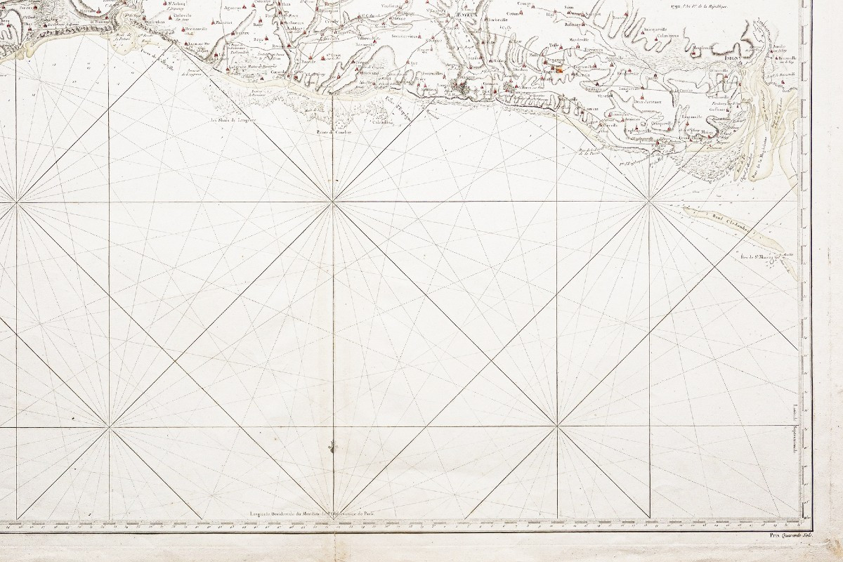
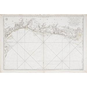


Antique Nautical Chart Of Normandy
Epreuve originale réalisée en 1792. Mechain hydrographe.
Renfort du pli central dans la marge inférieure. Rousseurs éparses.
Coloris aquarelle.
Bon état.
Format feuille : 95,5 x 64 cm.
Format gravure : 90 x 61 cm.
Original antique map of 1792.
Echelle des lieux. Relevés maritimes des côtes normandes du Havre à Isigny levé en 1776 et publié pour des dépôts des cartes 1792.
Vous pouvez consulter l’ensemble des cartes, livres et gravures disponibles sur votre région en cliquant sur le lien de notre site internet spécialisé en archives anciennes géographiques :
https://cartes-livres-anciens.com/categorie-produit/cartes-geographiques-anciennes-original-antique-maps/france/normandie/
Règlement sécurisé par carte bancaire sur notre site internet en cliquant sur le lien ci-dessous :
https://cartes-livres-anciens.com/produit/cartes-geographiques-anciennes-original-antique-maps/france/normandie/carte-marine-ancienne-de-normandie-2/
Toutes nos cartes et gravures sont accompagnées d’un certificat d’authenticité.
Original proof made in 1792. Mechain hydrographe.
Reinforcement of central fold in lower margin. Scattered foxing.
Watercolor.
Good condition.
Sheet size: 95.5 x 64 cm.
Engraving size: 90 x 61 cm.
Original antique map of 1792.
Location scale. Relevés maritimes des côtes normandes du Havre à Isigny levé en 1776 et publié pour des dépôts des cartes 1792.
You can view all of themaps, books and engravings available for your region by clicking on thelink to our website specializing in old geographicalarchives:
https://cartes-livres-anciens.com/categorie-produit/cartes-geographiques-anciennes-original-antique-maps/france/normandie/
Secure payment by credit cardon our website by clicking on the link below:
https://cartes-livres-anciens.com/produit/cartes-geographiques-anciennes-original-antique-maps/france/normandie/carte-marine-ancienne-de-normandie-2/
All our maps and prints are accompanied by a credit card.cards and engravings are accompanied by a certificate of authenticity.
600 €
Period: 18th century
Style: Other Style
Condition: Good condition
Material: Paper
Reference (ID): 1762597
Availability: In stock
Print