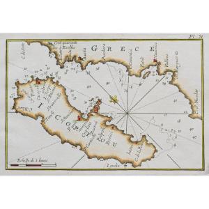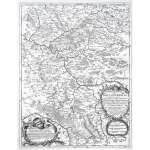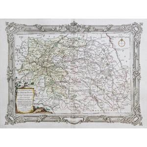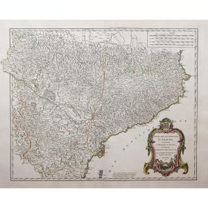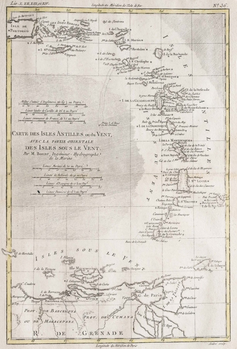
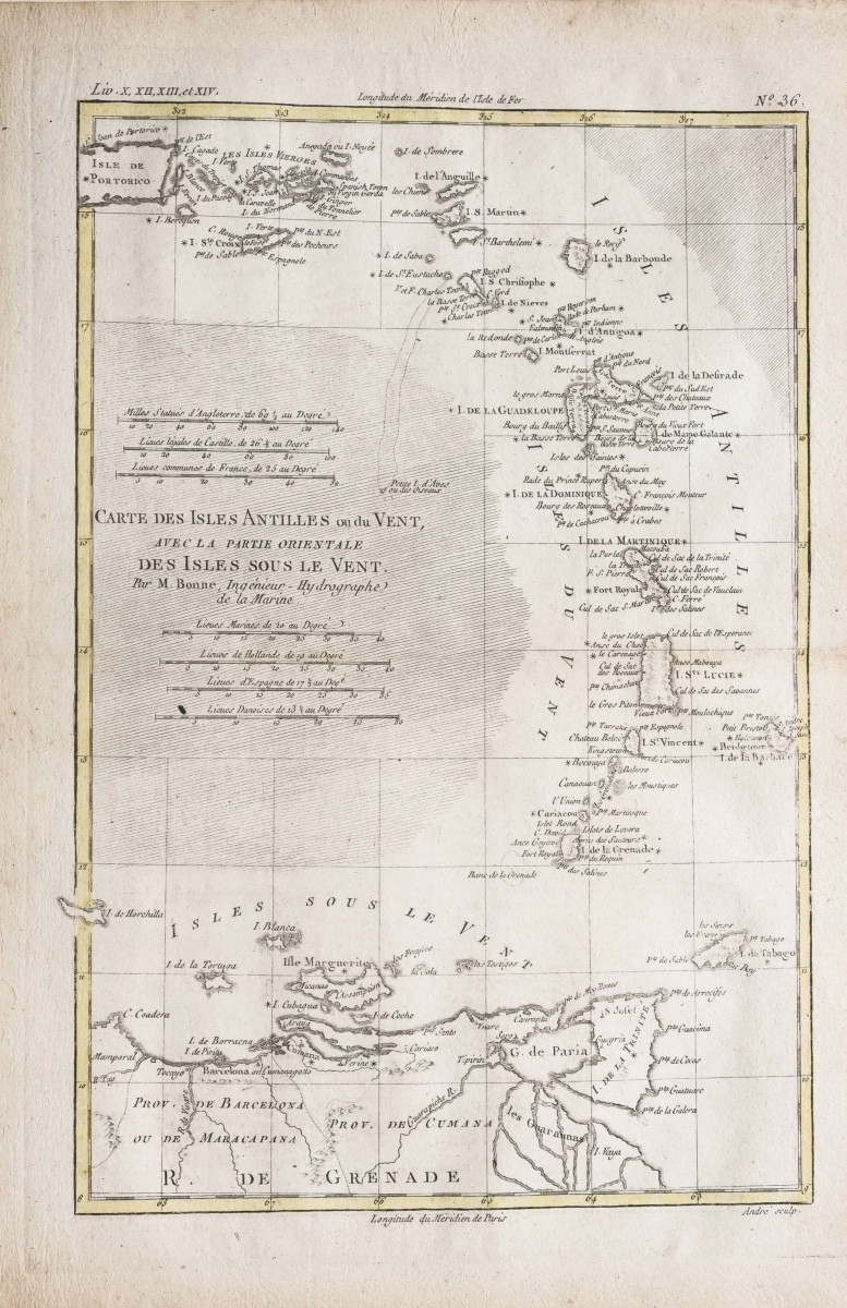

Old Geographical Map Of The Antilles – Leeward Islands
Coloris aquarelle.
Très bon état.
format feuille : 38,5 x 25, 5 cm.
Format gravure : 35x 24cm.
Original antique map around 1785.
Longitude du méridien de paris, échelle des lieux.
Vous pouvez consulter l’ensemble des cartes et gravures disponibles sur votre région en cliquant sur le lien de notre site internet spécialisé en archives anciennes géographiques :
https://cartes-livres-anciens.com/categorie-produit/cartes-geographiques-anciennes-original-antique-maps/ameriques/caraibes/
Règlement sécurisé par carte bancaire sur notre site internet en cliquant sur le lien :
https://cartes-livres-anciens.com/produit/cartes-geographiques-anciennes-original-antique-maps/ameriques/caraibes/carte-geographique-ancienne-antilles-iles-sous-le-vent/
Toutes nos cartes et gravures sont accompagnées d’un certificat d’authenticité.
Rigobert Bonne(1727-1795) est un ingénieur hydrographe et cartographe français du 18ème siècle.
Né dans les Ardennes à Raucourt en 1727, il succède en 1775 à Giovanni Rizzi-Zannoni comme cartographe du Roi de France au Service Hydrographique de la Marine (le Dépôt des cartes et plans de la Marine est créé sur ordre du Roi Louis XV en 1720).
Vers 1780, il définit précisément la projection qui portera alors son nom : la Projection de Bonne.
Il meurt à Paris en 1795, son fils Charles-Marie Rigobert dit le Chevalier Bonne (25 juin 1771 – 23 novembre 1839), poursuivra son œuvre.
Original proof made around 1785. Rigobert Bonne, hydrographic engineer of the navy. Watercolor colors. Very good condition. Sheet format: 38.5 x 25.5 cm. Engraving format: 35 x 24 cm. Original antique map around 1785. Longitude of the Paris meridian, scale of places. You can consult all the maps and engravings available in your region by clicking on the link to our website specializing in old geographical archives: https://cartes-livres-anciens.com/categorie-produit/cartes-geographiques-anciennes-original-antique-maps/ameriques/caraibes/ Secure payment by credit card on our website by clicking on the link :https://cartes-livres-anciens.com/produit/cartes-geographiques-anciennes-original-antique-maps/ameriques/caraibes/carte-geographique-ancienne-antilles-iles-sous-le-vent/ All our maps and engravings are accompanied by a certificate of authenticity. Rigobert Bonne (1727-1795) was a French hydrographic engineer and cartographer of the 18th century. Born in the Ardennes in Raucourt in 1727, he succeeded Giovanni Rizzi-Zannoni in 1775 as cartographer to the King of France at the Hydrographic Service of the Navy (the Depot of Maps and Plans of the Navy was created by order of King Louis XV in 1720). Around 1780, he precisely defined the projection that would then bear his name: the Bonne Projection. He died in Paris in 1795, his son Charles-Marie Rigobert known as the Chevalier Bonne (June 25 1771 – November 23, 1839), will continue his work.
Period: 18th century
Style: Other Style
Condition: Excellent condition
Reference (ID): 1623318
Availability: In stock