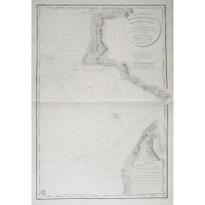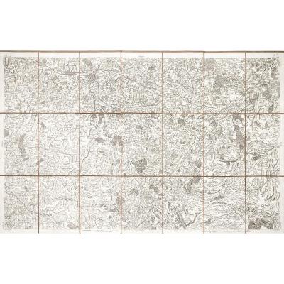
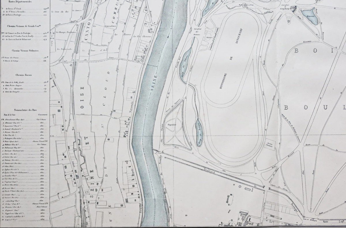
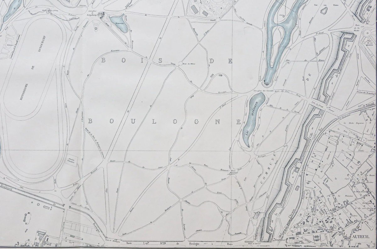
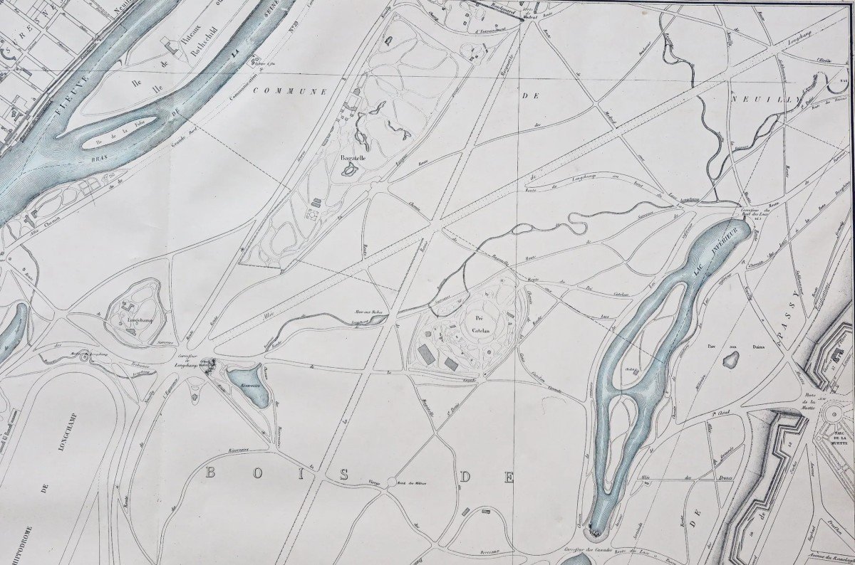
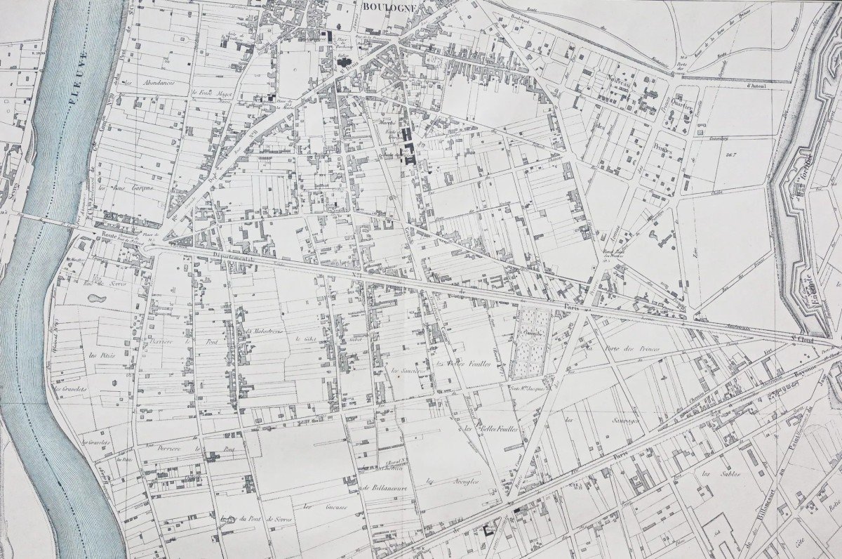


Old Plans Of Boulogne Billancourt
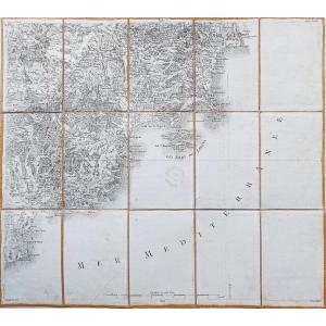
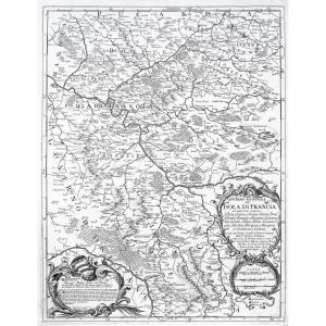
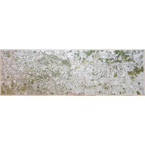
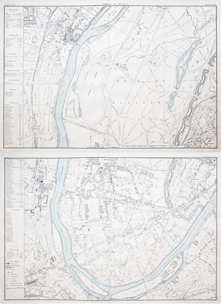
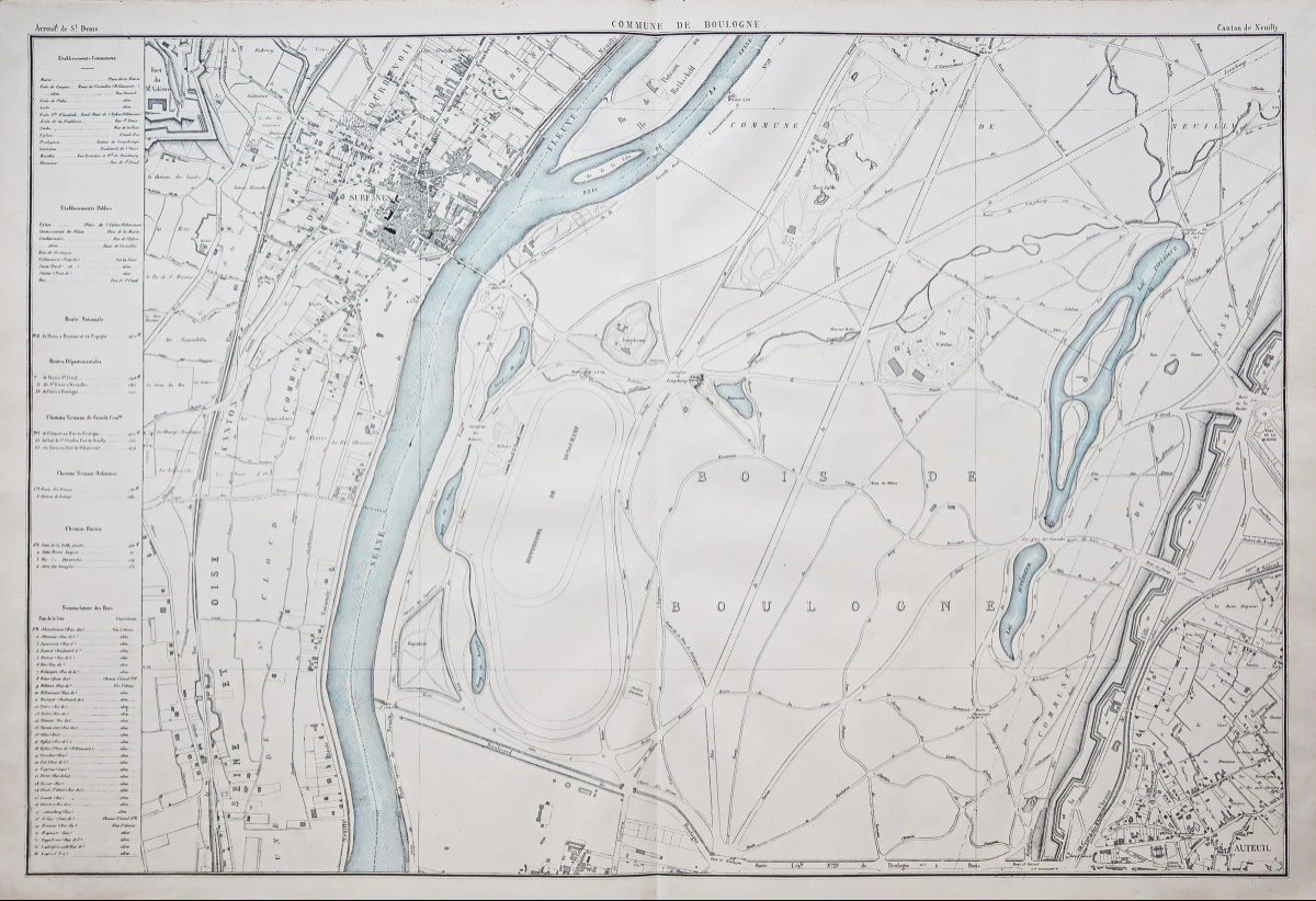
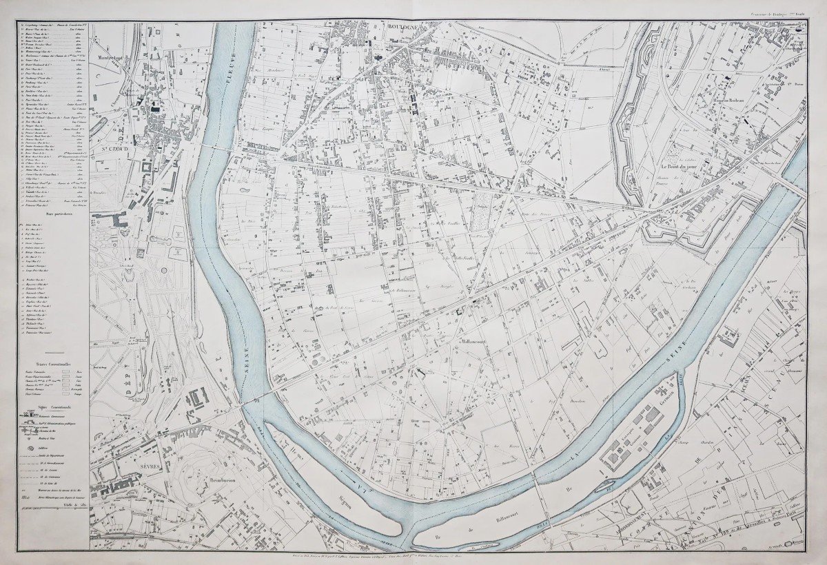
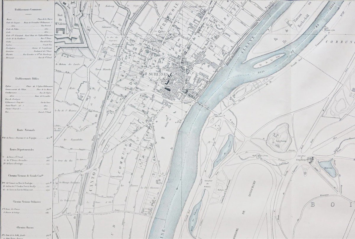
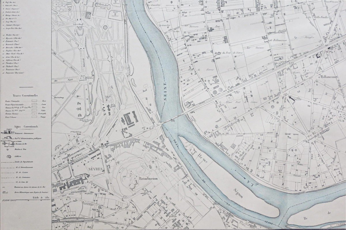
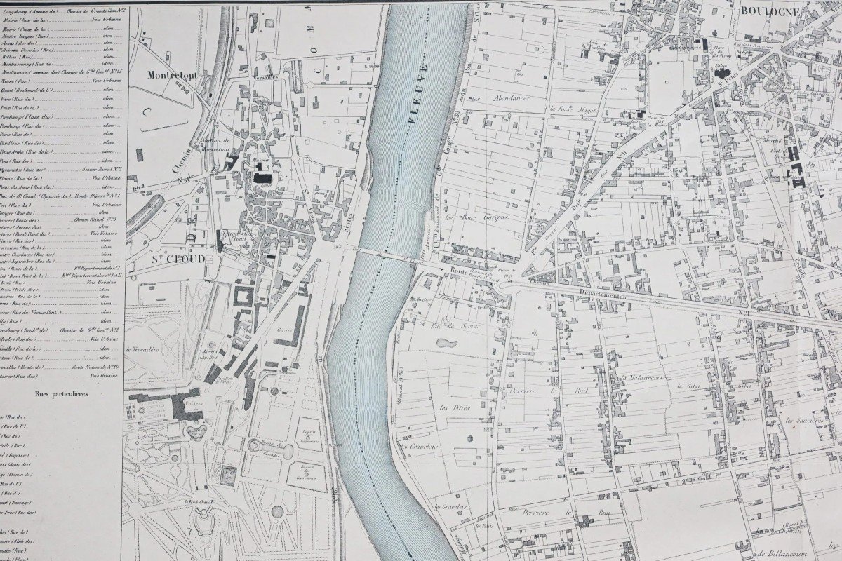
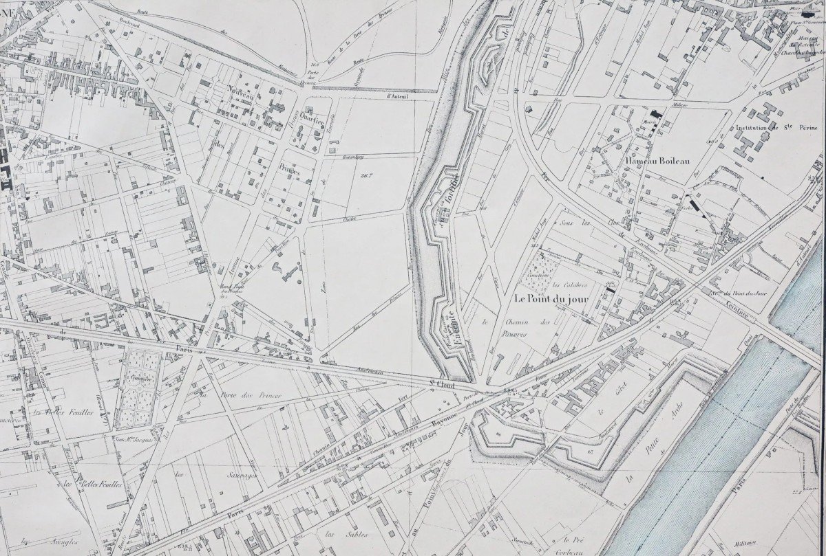
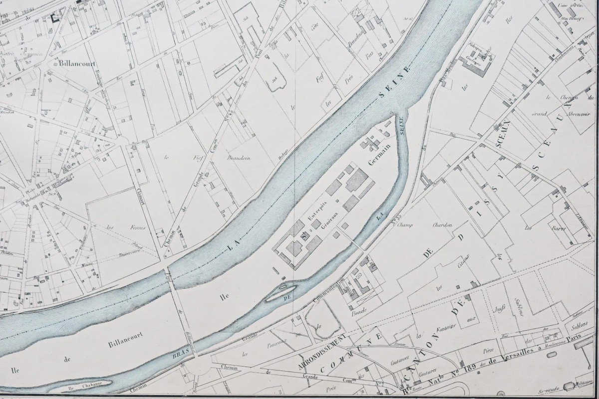
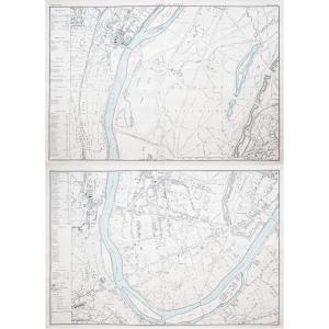
Suresnes – Saint Cloud.
Canton de Neuilly.
2 grandes cartes originales réalisées en 1874. Lefèvre géographe.
Coloris aquarelle dans la Seine.
Très bon état.
Format feuille : 95 x 64,5 cm.
Original antique map around 1900.
Ces deux cartes se joignent parfaitement avec possibilité d’un encadrement unique.
Large bandeau explicatif avec nomenclatures des principales rues.
Cartes communales du Département de la Seine (révision).
Dressée en 1854, révisée en 1870 par Lefèvre.
Peu courant.
Vous pouvez consulter l’ensemble des cartes, livres et gravures disponibles sur votre région en cliquant sur le lien de notre site internet spécialisé en archives anciennes géographiques :
https://cartes-livres-anciens.com/categorie-produit/cartes-geographiques-anciennes-original-antique-maps/france/ile-de-france-91-92/
Règlement sécurisé par carte bancaire sur notre site internet en cliquant sur le lien ci-dessous :
https://cartes-livres-anciens.com/produit/cartes-geographiques-anciennes-original-antique-maps/france/ile-de-france-91-92/plans-anciens-de-boulogne-billancourt/
Toutes nos cartes et gravures sont accompagnées d’un certificat d’authenticité.
Suresnes-Saint Cloud. Canton of Neuilly. 2 large original maps produced in 1874. Lefèvre geographer. Watercolor colors in the Seine. Very good state. Sheet size: 95 x 64.5 cm. Original antique map around 1900. These two maps join perfectly with the possibility of a unique frame. Large explanatory banner with nomenclatures of the main streets. Communal maps of the Department of the Seine (revision). Drawn up in 1854, revised in 1870 by Lefèvre. Uncommon. You can consult all the maps, books and engravings available in your region by clicking on the link of our website specializing in ancient geographical archives: https://cartes-livres-anciens.com/categorie-produit/cartes-geographiques -anciens-original-antique-maps/france/ile-de-france-91-92/ Secure payment by credit card on our website by clicking on the link below: https://cartes-livres-anciens.com /product/cartes-geographiques-anciennes-original-antique-maps/france/ile-de-france-91-92/ancient-maps-of-boulogne-billancourt/ All our maps and engravings are accompanied by a certificate of authenticity.
750 €
Period: 19th century
Style: Other Style
Condition: Excellent condition
Material: Paper
Reference (ID): 1022555
Availability: In stock
Print