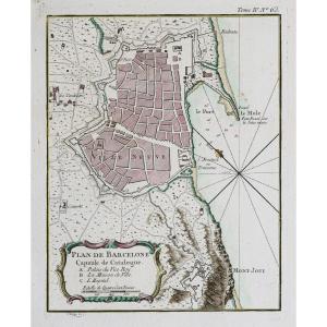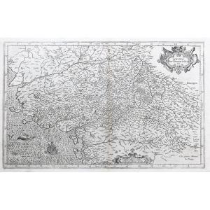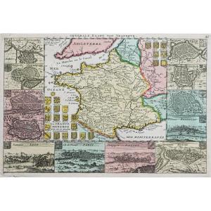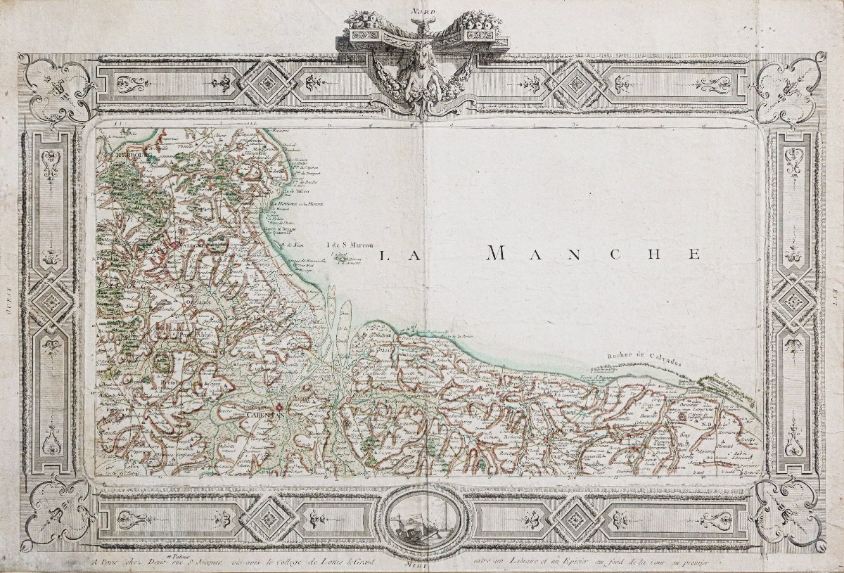

Old Map Of The Calvados Region
Epreuve originale réalisée vers 1780. Denis et Patour éditeur.
Fines traces de plis dans l’encadrement.
Beaux coloris anciens.
Bon état.
Format feuille : 68 x 46 cm.
Original antique map of 1780.
Grande carte peu courante de la géographie de Desnos, bandeau décoratif encadrant la carte, réalisée à Paris chez Denis et Patour, rue St Jacques vis avis du collège Louis le Grand, entre un libraire et un épicier au fond de la cour au premier.
Vous pouvez consulter l’ensemble des cartes, livres et gravures disponibles sur votre région en cliquant sur le lien de notre site internet spécialisé en archives anciennes géographiques :
https://cartes-livres-anciens.com/categorie-produit/cartes-geographiques-anciennes-original-antique-maps/france/normandie/
Règlement sécurisé par carte bancaire sur notre site internet en cliquant sur le lien ci-dessous :
https://cartes-livres-anciens.com/produit/cartes-geographiques-anciennes-original-antique-maps/france/normandie/carte-ancienne-de-la-region-du-calvados/
Toutes nos cartes et gravures sont accompagnées d’un certificat d’authenticité.
Desnosa été un fabricant important d’instruments de cartographie et de globes. Il occupa auprès du roi de Danemark, Christian VII, le poste convoité de royal globe maker. Il recevait pour cela une allocation annuelle de 500 livres. En retour il envoyait chaque année au roi, des cartes, des livres et des atlas. Il fut libraire et éditeur et produit une collection de cartes importante. Il fut souvent associé aux géographes Zannoni et Louis brion de la Tour (1756-1823).
Sa grande production de cartes publiées lui a valu parfois, parmi ses détracteurs jaloux de sa notoriété, une mauvaise réputation parmi les autres cartographes, qui l’ont considéré sans scrupules et sans discernement de ce qui devait être publiable ou non.
Original proof made around 1780. Denis et Patour publisher. Fine traces of folds in the frame. Beautiful old colors. Good condition. Sheet size: 68 x 46 cm. Original antique map of 1780. Large, unusual map of Desnos' geography, decorative band framing the map, made in Paris at Denis et Patour, rue St Jacques opposite the Louis le Grand college, between a bookseller and a grocer at the back of the courtyard on the first floor. You can consult all the maps, books and engravings available in your region by clicking on the link to our website specializing in old geographical archives: https://cartes-livres-anciens.com/categorie-produit/cartes-geographiques-anciennes-original-antique-maps/france/normandie/ Secure payment by credit card on our website by clicking on the link below: https://cartes-livres-anciens.com/produit/cartes-geographiques-anciennes-original-antique-maps/france/normandie/carte-ancienne-de-la-region-du-calvados/ All our maps and engravings are accompanied by a certificate of authenticity. Desnos was an important manufacturer of cartographic instruments and globes. He held the coveted position of royal globe maker for the King of Denmark, Christian VII. For this, he received an annual allowance of 500 pounds. In return, he sent the king maps, books, and atlases each year. He was a bookseller and publisher and produced a significant collection of maps. He was often associated with the geographers Zannoni and Louis Brion de la Tour (1756-1823). His large production of published maps sometimes earned him, among his detractors jealous of his notoriety, a bad reputation among other cartographers, who considered him unscrupulous and without discernment of what should be publishable or not.
225 €
Period: 18th century
Style: Other Style
Condition: Good condition
Material: Paper
Reference (ID): 1580872
Availability: In stock
Print