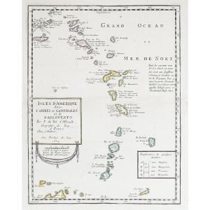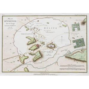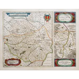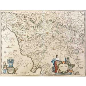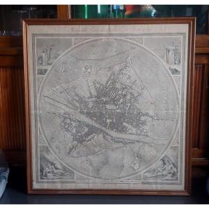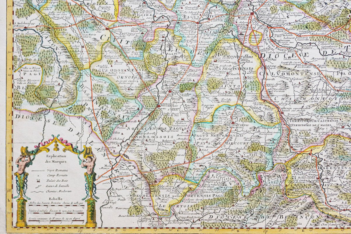


Geographical Map Of The Diocese Of Toul
Epreuve originale réalisée en 1720. Guillaume de Lisle cartographe.
Beaux coloris anciens.
2 petites déchirures sur 1cm dans les marges supérieures et inférieures du pli central restaurées anciennement.
Très bon état.
Format feuille : 62,5 x 53 cm.
Format gravure : 61 x 50 cm.
Original antique map of 1720
Vous pouvez consulter l’ensemble des cartes, livres et gravures disponibles sur votre région en cliquant sur le lien de notre site internet spécialisé en archives anciennes géographiques :
https://cartes-livres-anciens.com/categorie-produit/cartes-geographiques-anciennes-original-antique-maps/france/alsace-lorraine/
Règlement sécurisé par carte bancaire sur notre site internet en cliquant sur le lien ci-dessous :
https://cartes-livres-anciens.com/produit/cartes-geographiques-anciennes-original-antique-maps/france/alsace-lorraine/carte-geographique-du-diocese-de-toul-2/
Toutes nos cartes et gravures sont accompagnées d’un certificat d’authenticité.
Original print made in 1720. Guillaume de Lisle, cartographer. Beautiful original colors. Two small tears, 1 cm each, in the upper and lower margins of the central fold, restored previously. Very good condition. Sheet size: 62.5 x 53 cm. Image size: 61 x 50 cm. Original antique map of 1720. You can view all the maps, books, and engravings available for your region by clicking on the link to our website specializing in antique geographical archives: https://cartes-livres-anciens.com/categorie-produit/cartes-geographiques-anciennes-original-antique-maps/france/alsace-lorraine/ Secure payment by credit card on our website by clicking on the link below: https://cartes-livres-anciens.com/produit/cartes-geographiques-anciennes-original-antique-maps/france/alsace-lorraine/carte-geographique-du-diocese-de-toul-2/ All our maps and engravings come with a certificate of authenticity. Guillaume Delisle (1675–1726), son of Claude Delisle, was a student of Jean-Dominique Cassini. A student astronomer at the Academy of Sciences in 1702, he became a member in 1718; he taught geography to the young King Louis XV and was appointed First Geographer to the King. He produced more than 100 maps, which he published himself.
Beaux coloris anciens.
2 petites déchirures sur 1cm dans les marges supérieures et inférieures du pli central restaurées anciennement.
Très bon état.
Format feuille : 62,5 x 53 cm.
Format gravure : 61 x 50 cm.
Original antique map of 1720
Vous pouvez consulter l’ensemble des cartes, livres et gravures disponibles sur votre région en cliquant sur le lien de notre site internet spécialisé en archives anciennes géographiques :
https://cartes-livres-anciens.com/categorie-produit/cartes-geographiques-anciennes-original-antique-maps/france/alsace-lorraine/
Règlement sécurisé par carte bancaire sur notre site internet en cliquant sur le lien ci-dessous :
https://cartes-livres-anciens.com/produit/cartes-geographiques-anciennes-original-antique-maps/france/alsace-lorraine/carte-geographique-du-diocese-de-toul-2/
Toutes nos cartes et gravures sont accompagnées d’un certificat d’authenticité.
Guillaume DELISLE (1675 – 1726)
Fils de Claude Delisle, Guillaume Delisle fut l’élève de Jean Dominique Cassini.
Elève astronome à l’Académie des Sciences en 1702, il en devint membre en 1718 ; enseigna la géographie au jeune Roi Louis XV et fut nommé premier géographe du Roi. Il produira plus de 100 cartes qu’il édita lui-même
Original print made in 1720. Guillaume de Lisle, cartographer. Beautiful original colors. Two small tears, 1 cm each, in the upper and lower margins of the central fold, restored previously. Very good condition. Sheet size: 62.5 x 53 cm. Image size: 61 x 50 cm. Original antique map of 1720. You can view all the maps, books, and engravings available for your region by clicking on the link to our website specializing in antique geographical archives: https://cartes-livres-anciens.com/categorie-produit/cartes-geographiques-anciennes-original-antique-maps/france/alsace-lorraine/ Secure payment by credit card on our website by clicking on the link below: https://cartes-livres-anciens.com/produit/cartes-geographiques-anciennes-original-antique-maps/france/alsace-lorraine/carte-geographique-du-diocese-de-toul-2/ All our maps and engravings come with a certificate of authenticity. Guillaume Delisle (1675–1726), son of Claude Delisle, was a student of Jean-Dominique Cassini. A student astronomer at the Academy of Sciences in 1702, he became a member in 1718; he taught geography to the young King Louis XV and was appointed First Geographer to the King. He produced more than 100 maps, which he published himself.
400 €
Period: 18th century
Style: Other Style
Condition: Excellent condition
Material: Paper
Reference (ID): 1695281
Availability: In stock
Print