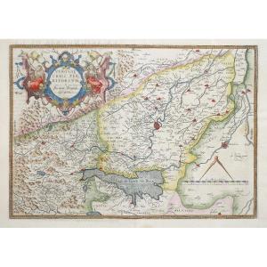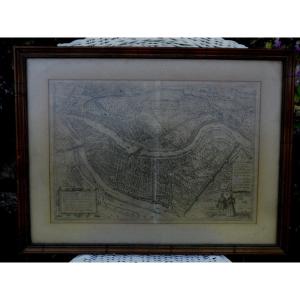


Old Map – District Of Fontainebleau
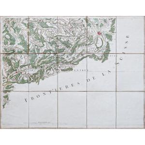
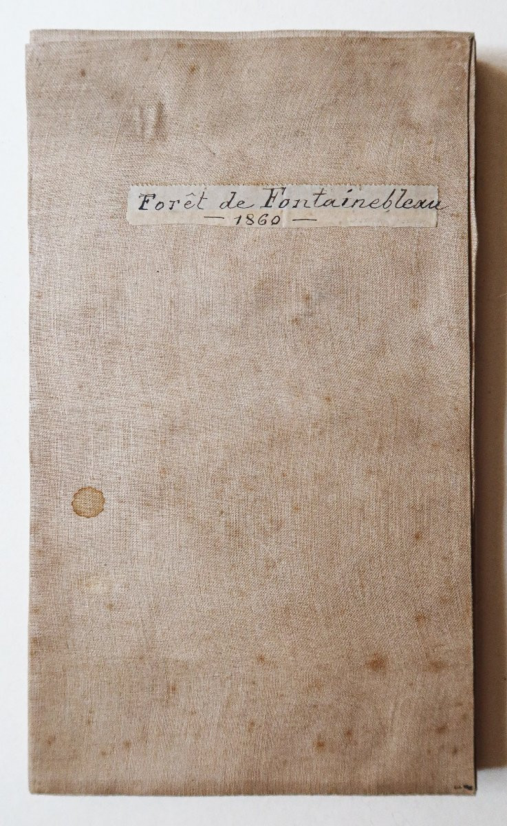
Grand plan original réalisé en 1860.
Entoilé d’époque et monté en 32 sections.
Rousseurs claires éparses.
Bon état.
Format feuille : 111,5 x 94 cm.
Format repliée : 24 x 14 cm.
Original antique map of 1860.
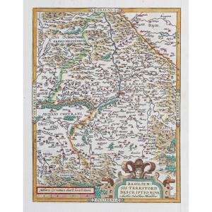
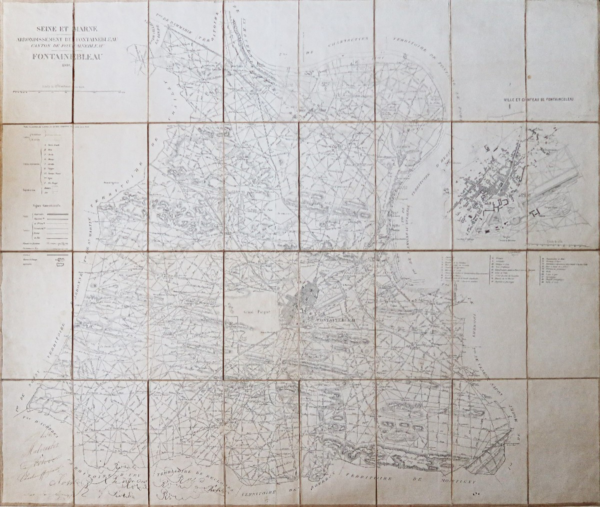
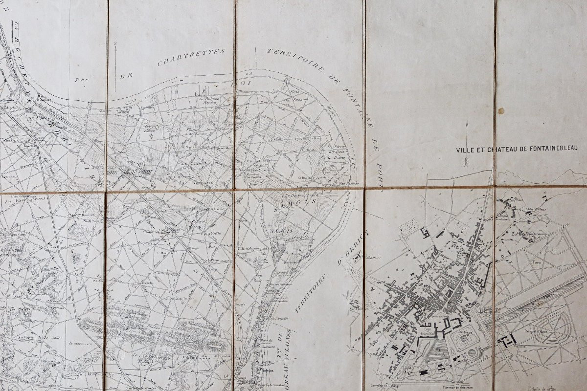
Belle représentation de Fontainebleau et ses alentours. Plan de la ville et du château dans la partie droite, avec légende de 1 à 29 situant les principaux lieux et édifices.
Dédicace ?… manuscrite dans la partie inférieure de la carte.
Vous pouvez consulter l’ensemble des cartes, livres et gravures disponibles sur votre région en cliquant sur le lien de notre site internet spécialisé en archives anciennes géographiques :
https://cartes-livres-anciens.com/categorie-produit/cartes-geographiques-anciennes-original-antique-maps/france/ile-de-france-77-seine-et-marne/
Règlement sécurisé par carte bancaire sur notre site internet en cliquant sur le lien ci-dessous : https://cartes-livres-anciens.com/produit/cartes-geographiques-anciennes-original-antique-maps/france/ile-de-france-77-seine-et-marne/carte-ancienne-arrondissement-de-fontainebleau/
Toutes nos cartes et gravures sont accompagnées d’un certificat d’authenticité.
Large original map made in 1860. Period canvas mounted and mounted in 32 sections. Scattered light foxing. Good condition. Sheet size: 111.5 x 94 cm. Folded size: 24 x 14 cm. Original antique map of 1860. Beautiful representation of Fontainebleau and its surroundings. Map of the town and the castle on the right side, with legend from 1 to 29 locating the main places and buildings. Dedication? ... handwritten in the lower part of the map. You can consult all the maps, books and engravings available in your region by clicking on the link to our website specializing in old geographical archives: https://cartes-livres-anciens.com/categorie-produit/cartes-geographiques-anciennes-original-antique-maps/france/ile-de-france-77-seine-et-marne/ Secure payment by credit card on our website by clicking on the link below: https://cartes-livres-anciens.com/produit/cartes-geographiques-anciennes-original-antique-maps/france/ile-de-france-77-seine-et-marne/carte-ancienne-arrondissement-de-fontainebleau/ All our maps and engravings are accompanied by a certificate of authenticity.
Entoilé d’époque et monté en 32 sections.
Rousseurs claires éparses.
Bon état.
Format feuille : 111,5 x 94 cm.
Format repliée : 24 x 14 cm.
Original antique map of 1860.
Belle représentation de Fontainebleau et ses alentours. Plan de la ville et du château dans la partie droite, avec légende de 1 à 29 situant les principaux lieux et édifices.
Dédicace ?… manuscrite dans la partie inférieure de la carte.
Vous pouvez consulter l’ensemble des cartes, livres et gravures disponibles sur votre région en cliquant sur le lien de notre site internet spécialisé en archives anciennes géographiques :
https://cartes-livres-anciens.com/categorie-produit/cartes-geographiques-anciennes-original-antique-maps/france/ile-de-france-77-seine-et-marne/
Règlement sécurisé par carte bancaire sur notre site internet en cliquant sur le lien ci-dessous : https://cartes-livres-anciens.com/produit/cartes-geographiques-anciennes-original-antique-maps/france/ile-de-france-77-seine-et-marne/carte-ancienne-arrondissement-de-fontainebleau/
Toutes nos cartes et gravures sont accompagnées d’un certificat d’authenticité.
Large original map made in 1860. Period canvas mounted and mounted in 32 sections. Scattered light foxing. Good condition. Sheet size: 111.5 x 94 cm. Folded size: 24 x 14 cm. Original antique map of 1860. Beautiful representation of Fontainebleau and its surroundings. Map of the town and the castle on the right side, with legend from 1 to 29 locating the main places and buildings. Dedication? ... handwritten in the lower part of the map. You can consult all the maps, books and engravings available in your region by clicking on the link to our website specializing in old geographical archives: https://cartes-livres-anciens.com/categorie-produit/cartes-geographiques-anciennes-original-antique-maps/france/ile-de-france-77-seine-et-marne/ Secure payment by credit card on our website by clicking on the link below: https://cartes-livres-anciens.com/produit/cartes-geographiques-anciennes-original-antique-maps/france/ile-de-france-77-seine-et-marne/carte-ancienne-arrondissement-de-fontainebleau/ All our maps and engravings are accompanied by a certificate of authenticity.
400 €
Period: 19th century
Style: Other Style
Condition: Good condition
Material: Paper
Reference (ID): 1569781
Availability: In stock
Print