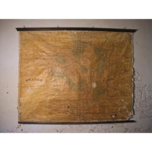
Old Planisphere – World Map
Grande épreuve originale réalisée en 1908. Publiée par la Compagnie Scarborough.
Carte recto verso gravée sur papier parcheminé.
Très belle impression en couleurs.
Emboitage d’époque.
traces de plis d'origine qui disparaissent après pressage pour encadrement
Format feuille : 103,5 x 101 cm.
Format repliée : 26,5 x 13 cm.
Original antique map of 1908.
Grande et belle carte imprimée sur 2 faces : l’une détaille l’hémisphère occidental avec les Amériques, et l’autre illustre l’Europe, l’Afrique, l’Asie et l’Australie.
Une attention particulière a été portée au réseau ferroviaire et maritime mondial.
Encarts avec légendes situant les consulats britanniques et américains, les villes et des statistiques concernant les populations.
Vous pouvez consulter l’ensembledes cartes, livres et gravures disponibles sur votre région en cliquant sur lelien de notre site internet spécialisé en archives anciennesgéographiques : https://cartes-livres-anciens.com/categorie-produit/cartes-geographiques-anciennes-original-antique-maps/monde-cartes-marines/mappemonde/
Règlement sécurisé par cartebancaire sur notre site internet en cliquant sur le lien ci-dessous : https://cartes-livres-anciens.com/produit/cartes-geographiques-anciennes-original-antique-maps/monde-cartes-marines/mappemonde/planisphere-ancien-carte-du-monde/
Toutesnos cartes et gravures sont accompagnées d’un certificat d’authenticité.
Large original proof made in 1908. Published by the Scarborough Company. Double-sided map engraved on parchment paper. Very nice color printing. Period slipcase. Traces of original folds which disappear after pressing for framing. Sheet size: 103.5 x 101 cm. Folded size: 26.5 x 13 cm. Original antique map of 1908. Large and beautiful map printed on 2 sides: one details the Western Hemisphere with the Americas, and the other illustrates Europe, Africa, Asia and Australia. Particular attention has been paid to the global rail and maritime network. Inserts with legends locating British and American consulates, cities and population statistics. You can consult all the maps, books and engravings available in your region by clicking on the link to our website specializing in old geographical archives: https://cartes-livres-anciens.com/product-category/old-geographic-maps-original-antique-maps/world-marine-maps/worldmap/ Secure payment by credit card on our website by clicking on the link below: https://cartes-livres-anciens.com/product/old-geographic-maps-original-antique-maps/world-marine-maps/worldmap/planisphere-ancien-carte-du-monde/ All our maps and engravings are accompanied by a certificate of authenticity.
500 €
Period: 20th century
Style: Other Style
Condition: Excellent condition
Material: Paper
Reference (ID): 1568141
Availability: In stock
Print