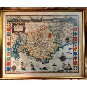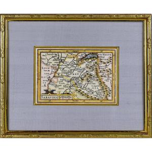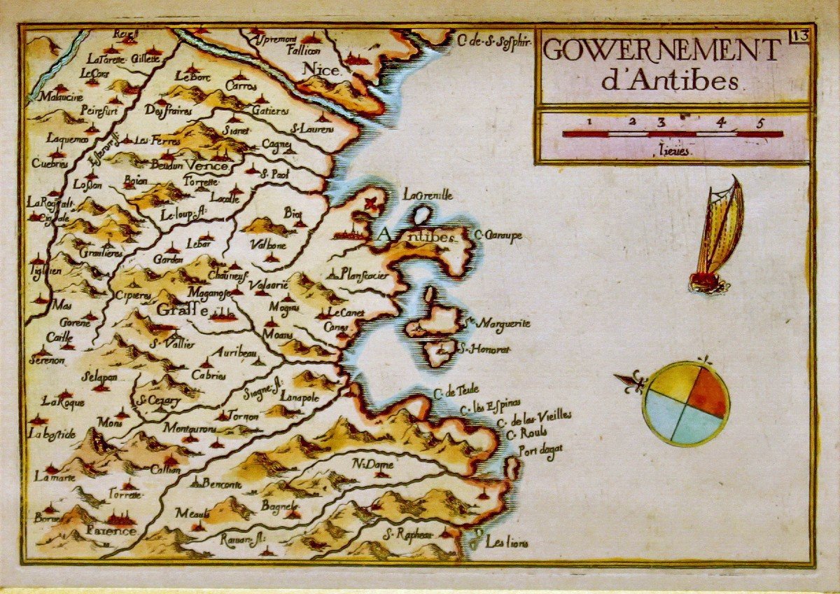


Rare Engraving Map Of The Government Of Antibes - Ep. 17th Century (circa 1635)
Artist: Nicolas Tassin
Representing the map of the GOVERNMENT OF ANTIBES, GRASSE, VALBONNE, NICE, etc... Beautiful original engraving, on steel with a burin and laid paper, by Nicolas TASSIN Hand watercolored Dimension(s): Length. 29.6 cm – High. 25 cm - Width. Baguette: 1.6 cm, Condition(s): PERFECT CONDITION, Period: 1st HALF of the 17th century (Circa 1635), Framing: CURRENT - Gold bevel - Marie-Louise in ecru wild silk - Gold fillet in aged gold - Baguette in wood, in aged water gilding. PAYMENT and TRANSPORT PAYMENTS ACCEPTED via PAYPAL / LYDIA / CB by VAD (distance selling) or by CHECK PACKAGES WILL BE POSTED WITHIN 3 DAYS. COMBINED SHIPPING POSSIBLE IF MULTIPLE ITEMS PURCHASED.
280 €
Period: 17th century
Style: Renaissance, Louis 13th
Condition: Perfect condition
Material: Paper
Length: 29.6 cm
Height: 25 cm
Reference (ID): 1353283
Availability: In stock
Print