18th Century Framed Map Of New Testament Regions, Jerusalem, Holy Land, Greece, Orient
18th Century Framed Map Of New Testament Regions, Jerusalem, Holy Land, Greece, Orient -photo-2
18th Century Framed Map Of New Testament Regions, Jerusalem, Holy Land, Greece, Orient -photo-3
18th Century Framed Map Of New Testament Regions, Jerusalem, Holy Land, Greece, Orient -photo-4
18th Century Framed Map Of New Testament Regions, Jerusalem, Holy Land, Greece, Orient -photo-1
18th Century Framed Map Of New Testament Regions, Jerusalem, Holy Land, Greece, Orient -photo-2
18th Century Framed Map Of New Testament Regions, Jerusalem, Holy Land, Greece, Orient -photo-3
18th Century Framed Map Of New Testament Regions, Jerusalem, Holy Land, Greece, Orient -photo-4

18th Century Framed Map Of New Testament Regions, Jerusalem, Holy Land, Greece, Orient

Artist: Rigobert Bonne 1727-1794
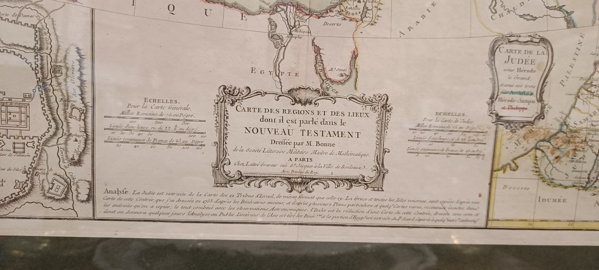
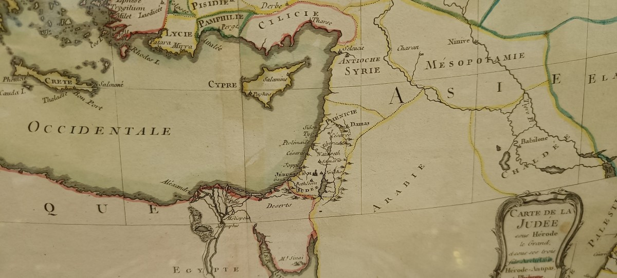
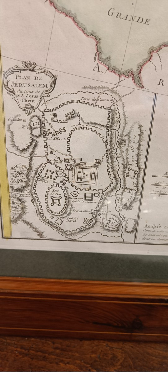
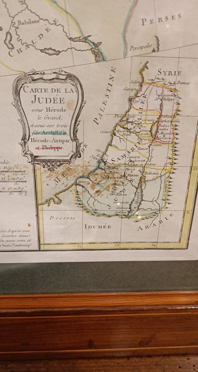
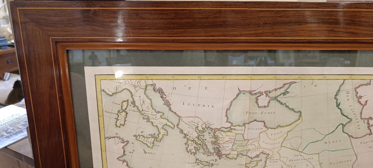
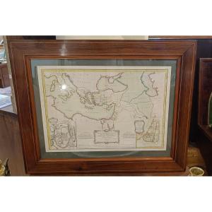
18th century watercolor map by Rigobert Bonne titled "Map of the Regions and Places spoken of in the New Testament" representing the entire Mediterranean basin at the time of the Gospels. Representation of the plan of the city of Jerusalem at the time of Jesus Christ and of Judea under Herod the Great. Beautiful rosewood frame and lemonwood fillets 64cm x 51 cm
450 €

Period: 18th century

Style: Other Style

Condition: Excellent condition

Reference (ID): 1616085

Availability: In stock

Print

88A avenue Joseph Pineau
Noirmoutier en l'île 85330, France

06 13 50 19 76

Follow the dealer

CONTACT

SIGN UP TO OUR NEWSLETTER

facebook
instagram

KRON Frédéric Antiquités
18th Century Framed Map Of New Testament Regions, Jerusalem, Holy Land, Greece, Orient
1616085-main-68c831211e86b.jpg

06 13 50 19 76


*We will send you a confirmation email from info@proantic.com .
Please check your messages, including the spam folder.