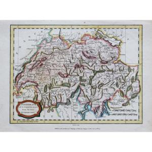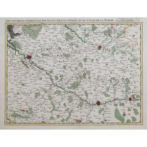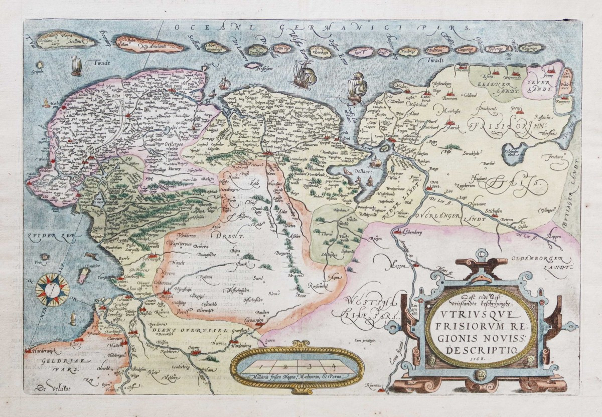
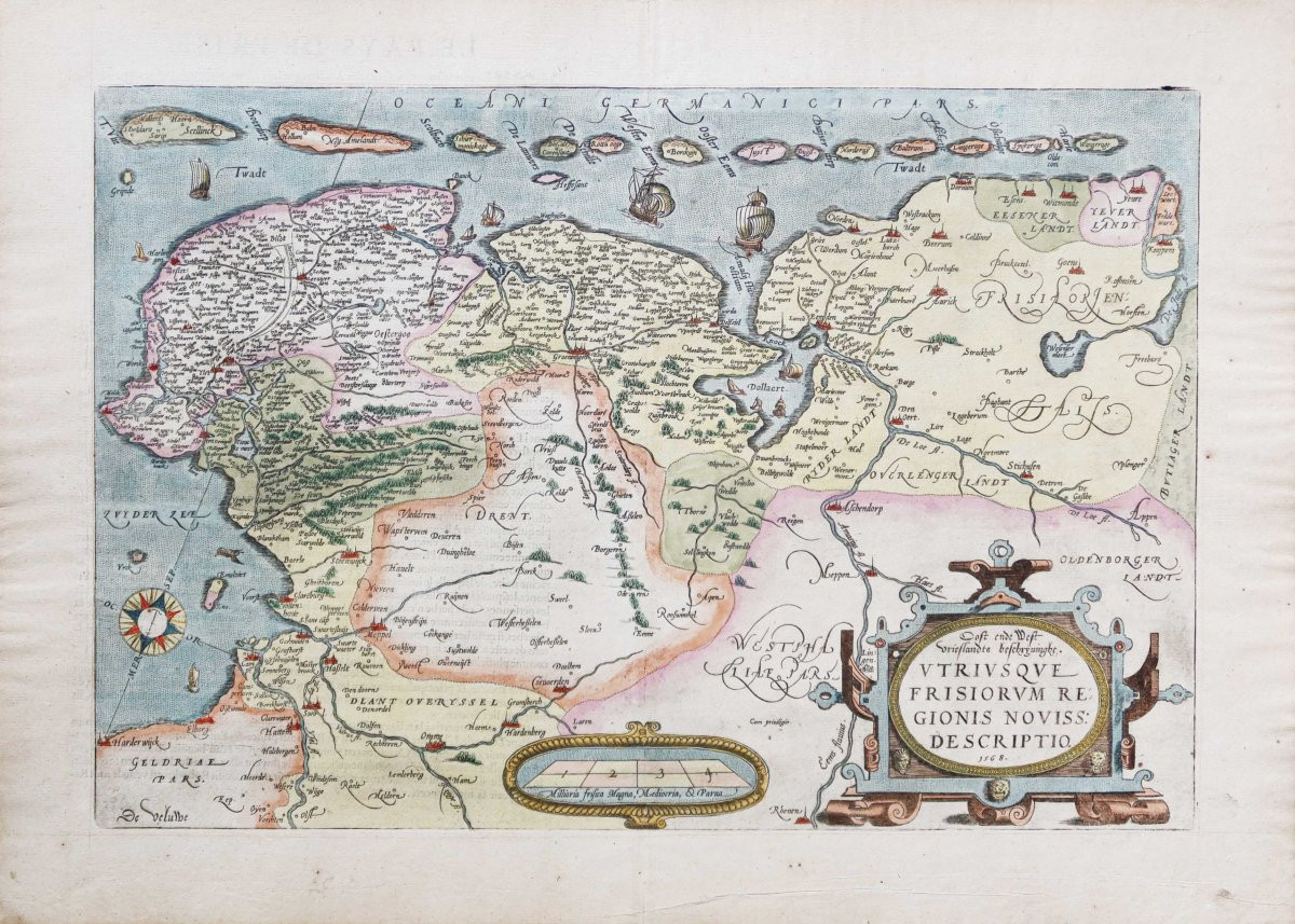


Old Geographic Map – Holland
Artist: Jacob Van Deventer
Epreuve originale réalisée en 1581. Abraham Ortelius éditeur.
Texte explicatif en vieux français au verso.
Beaux coloris aquarelle.
Très bon état.
Format feuille : 60,5 x 43,5 cm.
Format gravure : 51,5 x 35 cm.
Original antique map of 1581.
D’après une carte réalisée en 1568 de jacob van Deventer (1500 - 1575)
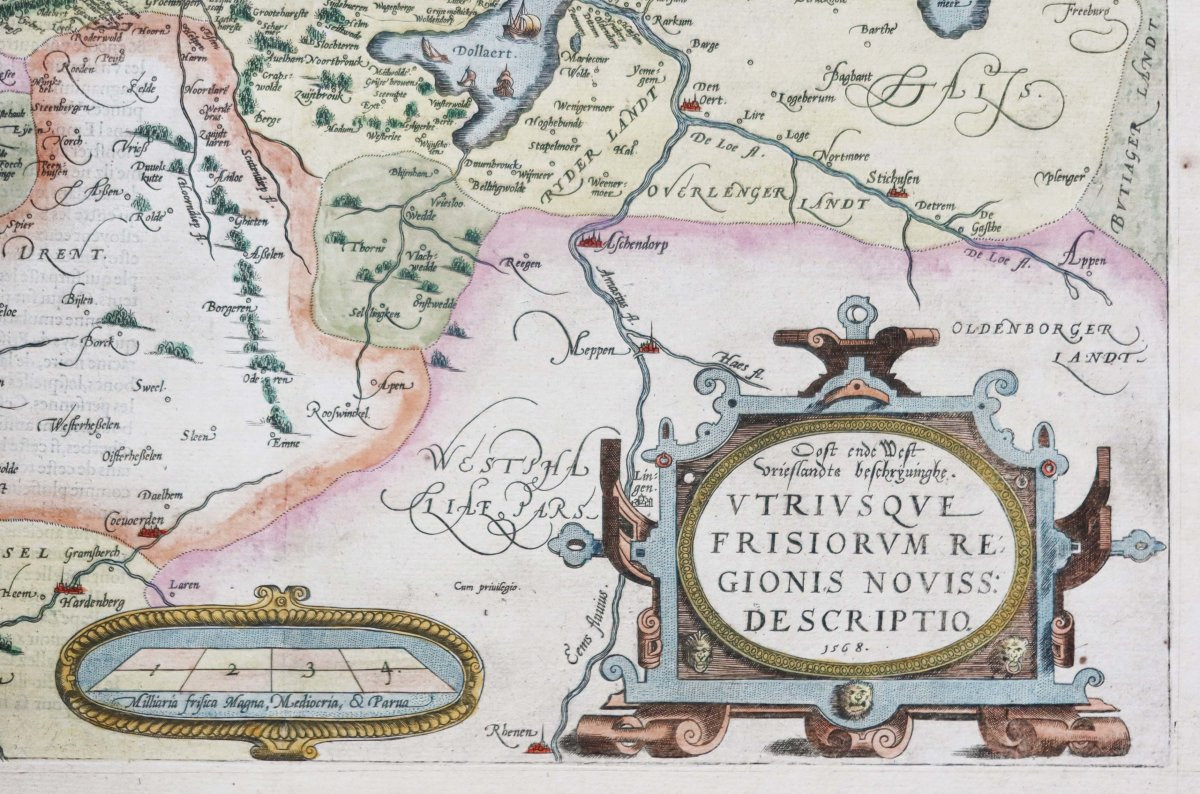
Large cartouche de titre décoratif, échelle des mesures et boussole. Particulièrement décorative.
Vous pouvez consulter l’ensemble des cartes, livres et gravures disponibles sur votre région en cliquant sur le lien de notre site internet spécialisé en archives anciennes géographiques : https://cartes-livres-anciens.com/categorie-produit/cartes-geographiques-anciennes-original-antique-maps/europe/paysbas-belgique-luxembourg/
Règlement sécurisé par carte bancaire sur notre site internet en cliquant sur le lien ci-dessous : https://cartes-livres-anciens.com/produit/cartes-geographiques-anciennes-original-antique-maps/europe/paysbas-belgique-luxembourg/carte-geographique-ancienne-hollande/
Toutes nos cartes et gravures sont accompagnées d’un certificat d’authenticité.
Abraham Ortell (Ortel, Ortels, Ortelius), né le 14 avril 1527 et mort le 28 juin 1598, fut reconnu avec Gérard Mercator comme le « père de notre géographie moderne ».
Dès 1547, il est inscrit à la guilde de Saint-Luc en qualité d’enlumineur de cartes. C’est en 1554, à Francfort, qu’il fit la connaissance de Gerardus Mercator. Celui-ci venait de publier sa carte de l’Europe, carte qui avait été un véritable événement dans le monde scientifique du temps. Les rapports commerciaux établis entre les deux hommes se transformèrent vite en amitié. Mercator, mathématicien, eut tôt fait de communiquer son enthousiasme à son jeune émule.
Pour Ortelius, la voie qu’il s’était tracée, s’élargissait vers de nouvelles ambitions : l’enlumineur de cartes allait désormais s’attacher à les tracer, à les composer et à les réunir.
Ortelius n’eut pas seulement le mérite de populariser l’étude de la géographie, il suscita de nouvelles recherches et, grâce à lui, de nombreuses cartes furent levées et publiées.
Original proof made in 1581. Abraham Ortelius publisher. Explanatory text in old French on the back. Beautiful watercolor colors. Very good condition. Sheet size: 60.5 x 43.5 cm. Engraving size: 51.5 x 35 cm. Original antique map of 1581. Based on a map made in 1568 by Jacob van Deventer (1500 - 1575) Large decorative title cartouche, measurement scale and compass. Particularly decorative. You can consult all the maps, books and engravings available on your region by clicking on the link of our website specialized in old geographical archives: https://cartes-livres-anciens.com/categorie-produit/cartes-geographiques-anciennes-original-antique-maps/europe/paysbas-belgique-luxembourg/ Secure payment by credit card on our website by clicking on the link below: https://cartes-livres-anciens.com/produit/cartes-geographiques-anciennes-original-antique-maps/europe/paysbas-belgique-luxembourg/carte-geographique-ancienne-hollande/ All our maps and engravings are accompanied by a certificate of authenticity. Abraham Ortell (Ortel, Ortels, Ortelius), born on April 14, 1527 and died on June 28, 1598, was recognized with Gerard Mercator as the "father of our modern geography". From In 1547, he was registered with the Guild of Saint Luke as a map illuminator. In 1554, in Frankfurt, he met Gerardus Mercator. The latter had just published his map of Europe, a map that had been a real event in the scientific world of the time. The business relationship established between the two men quickly turned into friendship. Mercator, a mathematician, was quick to communicate his enthusiasm to his young emulator. For Ortelius, the path he had chosen for himself broadened towards new ambitions: the map illuminator would henceforth focus on tracing, composing and bringing them together. Ortelius not only had the merit of popularizing the study of geography, he sparked new research and, thanks to him, numerous maps were drawn and published.
600 €
Period: 16th century
Style: Other Style
Condition: Excellent condition
Material: Paper
Reference (ID): 1543949
Availability: In stock
Print