

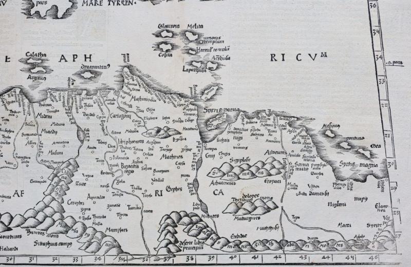
Old Geographic Map Of North Africa
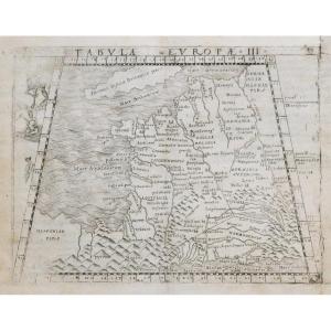
Epreuve originale réalisée en 1541. Laurent Fries cartographe.
Belle épreuve bien contrastée.
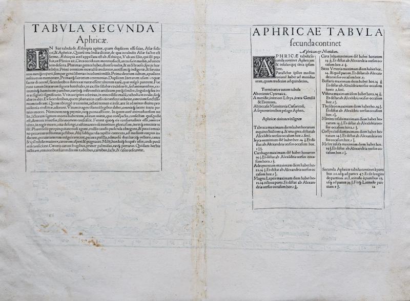
Texte explicatif en latin au verso.
Très bon état.
Format feuille: 52,5 x 38 cm.
Format gravure: 45,5 x 28,5 cm.
Original antique map of 1541.
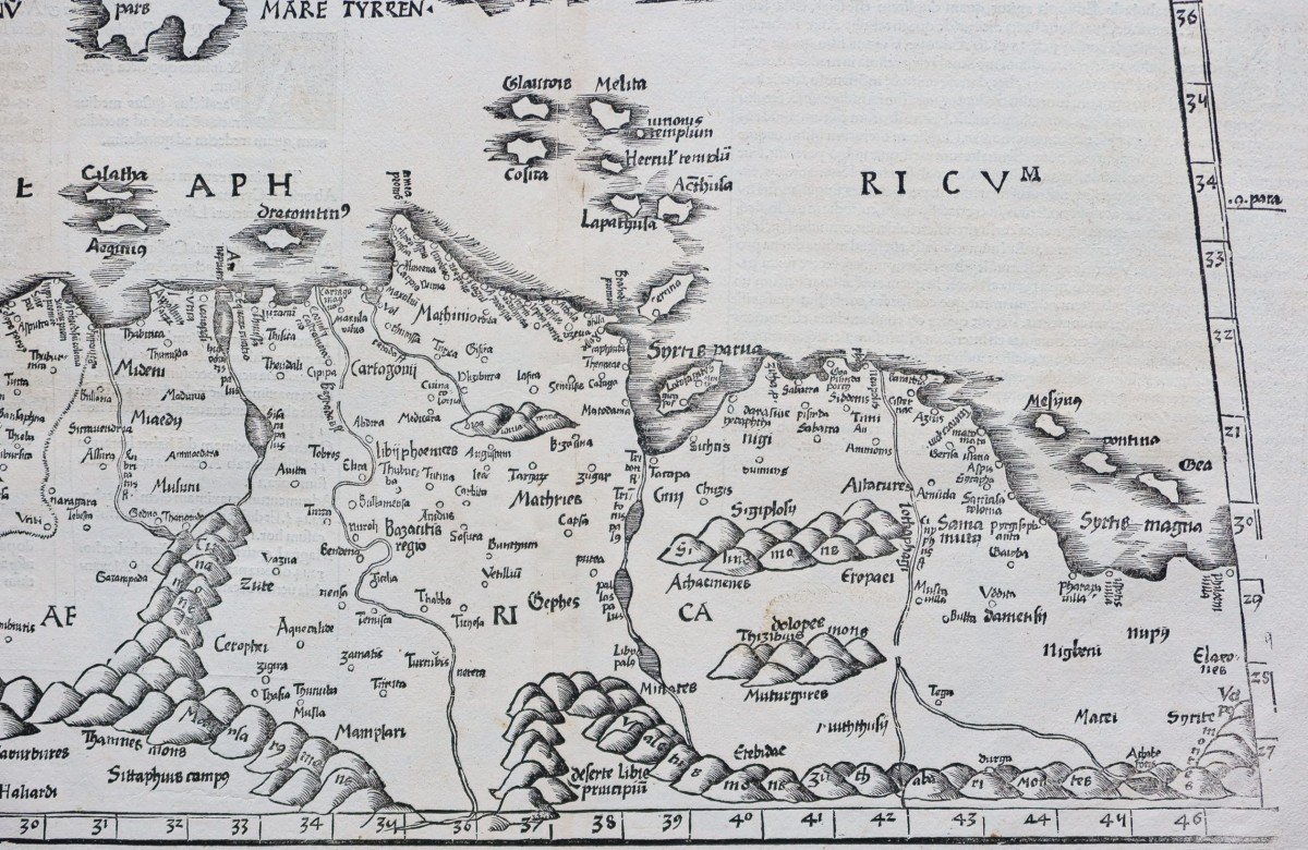
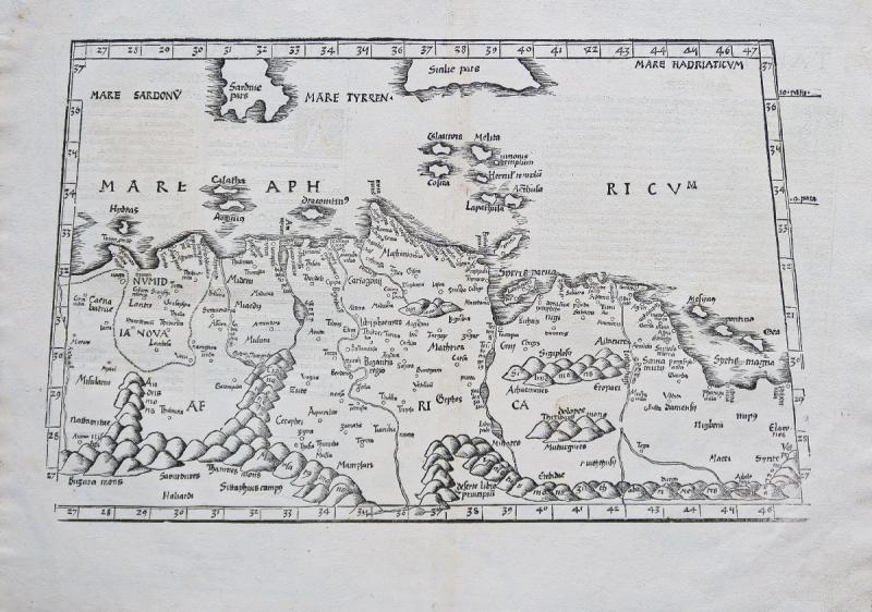
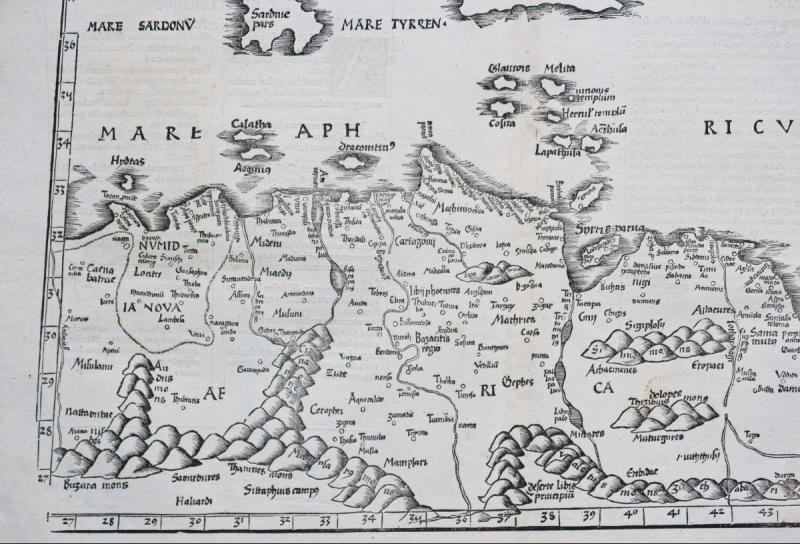
Rare impression de 1541. Cette carte ptolémaïque gravée sur bois est centrée sur les régions de l’Afrique du Nord (Algérie, Tunisie et Libye). La carte représente également plusieurs îles de la Méditerranée. Elle fournit d’excellents détails topographiques sur les anciens noms de lieux, les rivières, les lacs, les baies, les reliefs et les îles.
Vous pouvez consulter l’ensemble des cartes, livres et gravures disponibles sur votre région en cliquant sur le lien de notre site internet spécialisé en archives anciennes géographiques :
https://cartes-livres-anciens.com/categorie-produit/cartes-geographiques-anciennes-original-antique-maps/afrique/afrique-du-nord/
Règlement sécurisé par carte bancaire sur notre site interneten cliquant sur le lien ci-dessous :
https://cartes-livres-anciens.com/produit/cartes-geographiques-anciennes-original-antique-maps/afrique/afrique-du-nord/carte-geographique-ancienne-de-lafrique-du-nord-2/
Toutes nos cartes et gravures sont accompagnées d’un certificat d’authenticité.
Original proof made in 1541. Laurent Fries cartographer. Beautiful proof well contrasted. Explanatory text in Latin on the back. Very good state. Sheet size: 52.5 x 38 cm. Engraving format: 45.5 x 28.5 cm. Original antique map of 1541. Rare print from 1541. This woodcut Ptolemaic map is centered on the regions of North Africa (Algeria, Tunisia and Libya). The map also represents several islands in the Mediterranean. It provides excellent topographic detail on ancient place names, rivers, lakes, bays, landforms and islands. You can consult all the maps, books and engravings available in your region by clicking on the link of our website specializing in ancient geographic archives: https://cartes-livres-anciens.com/categorie-produit/cartes-geographique -anciennes-original-antique-maps / afrique / afrique-du-nord / Secure payment by credit card on our website by clicking on the link below: https://cartes-livres-anciens.com/produit/cartes -geographical-ancient-original-antique-maps / africa / africa-du-nord / carte-geographique-ancien-de-lafrique-du-nord-2 / All our maps and engravings are accompanied by a certificate of authenticity.
Belle épreuve bien contrastée.
Texte explicatif en latin au verso.
Très bon état.
Format feuille: 52,5 x 38 cm.
Format gravure: 45,5 x 28,5 cm.
Original antique map of 1541.
Rare impression de 1541. Cette carte ptolémaïque gravée sur bois est centrée sur les régions de l’Afrique du Nord (Algérie, Tunisie et Libye). La carte représente également plusieurs îles de la Méditerranée. Elle fournit d’excellents détails topographiques sur les anciens noms de lieux, les rivières, les lacs, les baies, les reliefs et les îles.
Vous pouvez consulter l’ensemble des cartes, livres et gravures disponibles sur votre région en cliquant sur le lien de notre site internet spécialisé en archives anciennes géographiques :
https://cartes-livres-anciens.com/categorie-produit/cartes-geographiques-anciennes-original-antique-maps/afrique/afrique-du-nord/
Règlement sécurisé par carte bancaire sur notre site interneten cliquant sur le lien ci-dessous :
https://cartes-livres-anciens.com/produit/cartes-geographiques-anciennes-original-antique-maps/afrique/afrique-du-nord/carte-geographique-ancienne-de-lafrique-du-nord-2/
Toutes nos cartes et gravures sont accompagnées d’un certificat d’authenticité.
Original proof made in 1541. Laurent Fries cartographer. Beautiful proof well contrasted. Explanatory text in Latin on the back. Very good state. Sheet size: 52.5 x 38 cm. Engraving format: 45.5 x 28.5 cm. Original antique map of 1541. Rare print from 1541. This woodcut Ptolemaic map is centered on the regions of North Africa (Algeria, Tunisia and Libya). The map also represents several islands in the Mediterranean. It provides excellent topographic detail on ancient place names, rivers, lakes, bays, landforms and islands. You can consult all the maps, books and engravings available in your region by clicking on the link of our website specializing in ancient geographic archives: https://cartes-livres-anciens.com/categorie-produit/cartes-geographique -anciennes-original-antique-maps / afrique / afrique-du-nord / Secure payment by credit card on our website by clicking on the link below: https://cartes-livres-anciens.com/produit/cartes -geographical-ancient-original-antique-maps / africa / africa-du-nord / carte-geographique-ancien-de-lafrique-du-nord-2 / All our maps and engravings are accompanied by a certificate of authenticity.
750 €
Period: 16th century
Style: Other Style
Condition: Excellent condition
Material: Paper
Reference (ID): 805985
Availability: In stock
Print