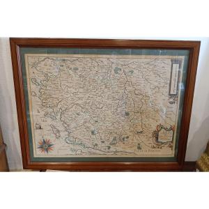
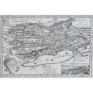
Antique Map Under Glass, Duchy Of Brittany, 1632, By Joannes Janssonius
This antique map was framed in the 1960s. You will notice creases, marks, and yellowing. However, the map remains presentable, though not perfect. Our photos allow you to appreciate the quality of the artwork. For condition details, please examine the photos carefully. Feel free to zoom in. The photos are an integral part of the description. Dimensions: - Frame: Height: 55 cm Width: 66.3 cm Thickness: 1 cm - Image: Height: 47.2 cm Width: 57.5 cm A5236
200 €
Period: 17th century
Style: Other Style
Condition: Condition of use
Width: 66,3 cm
Height: 55 cm
Depth: 1 cm
Reference (ID): 1651404
Availability: In stock
Print