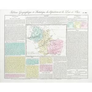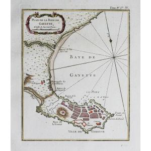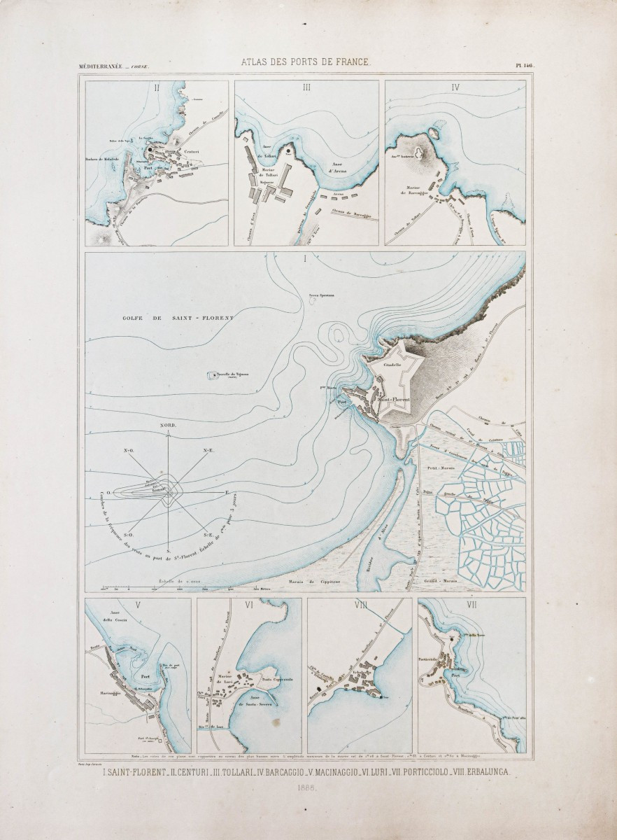
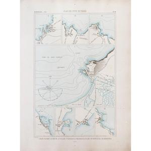
Marine Chart – Saint-florent – Centuri – Luri
Carte gravée en 1888.
Belle impression en couleurs.
Très bon état.
Format feuille : 67 x 49 cm.
Original antique chart of 1888.
Rare collection illustrant les ports de France.
Institution qui modèle le littoral français (1667 – 2000), dans la tradition des Neptune français.
Vous pouvez consulter l’ensemble des cartes, livres et gravures disponibles sur votre région en cliquant sur le lien de notre site internet spécialisé en archives anciennes géographiques :
https://cartes-livres-anciens.com/categorie-produit/cartes-geographiques-anciennes-original-antique-maps/france/corse/
Règlement sécurisé par carte bancaire sur notre site internet en cliquant sur le lien ci-dessous :
https://cartes-livres-anciens.com/produit/cartes-geographiques-anciennes-original-antique-maps/france/corse/carte-marine-saint-florent-centuri-luri/
Toutes nos cartes et gravures sont accompagnées d’un certificat d’authenticité.
Engraved map from 1888. Beautiful color print. Very good condition. Sheet size: 67 x 49 cm. Original antique chart from 1888. Rare collection illustrating the ports of France. Institution that shaped the French coastline (1667–2000), in the tradition of the French Neptunes. You can view all the maps, books, and engravings available for your region by clicking on the link to our website specializing in antique geographical archives: https://cartes-livres-anciens.com/categorie-produit/cartes-geographiques-anciennes-original-antique-maps/france/corse/ Secure payment by credit card on our website by clicking on the link below: https://cartes-livres-anciens.com/produit/cartes-geographiques-anciennes-original-antique-maps/france/corse/carte-marine-saint-florent-centuri-luri/ All our maps and engravings are accompanied of a certificate of authenticity.
250 €
Period: 19th century
Style: Other Style
Condition: Excellent condition
Material: Paper
Reference (ID): 1727238
Availability: In stock
Print