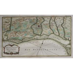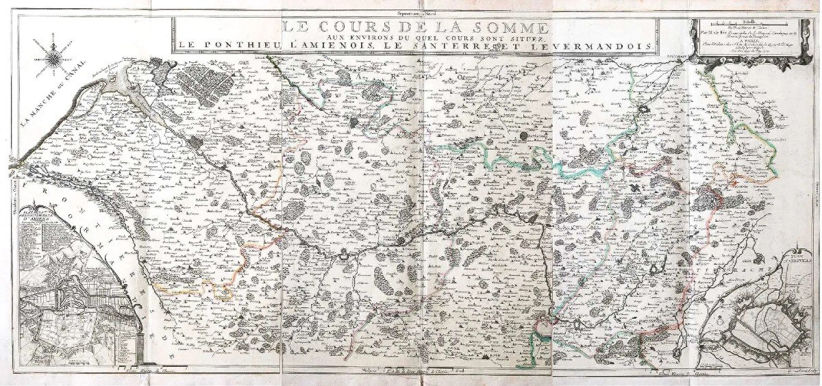

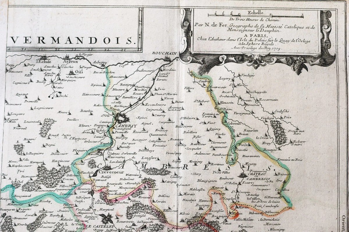
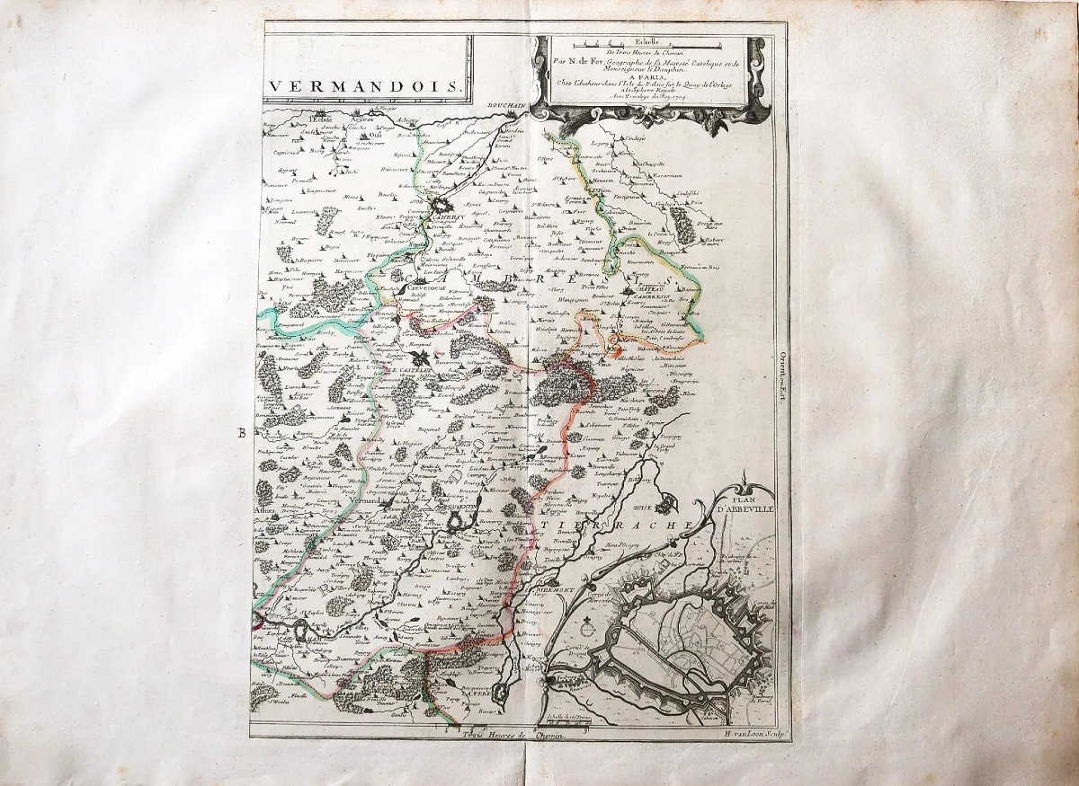

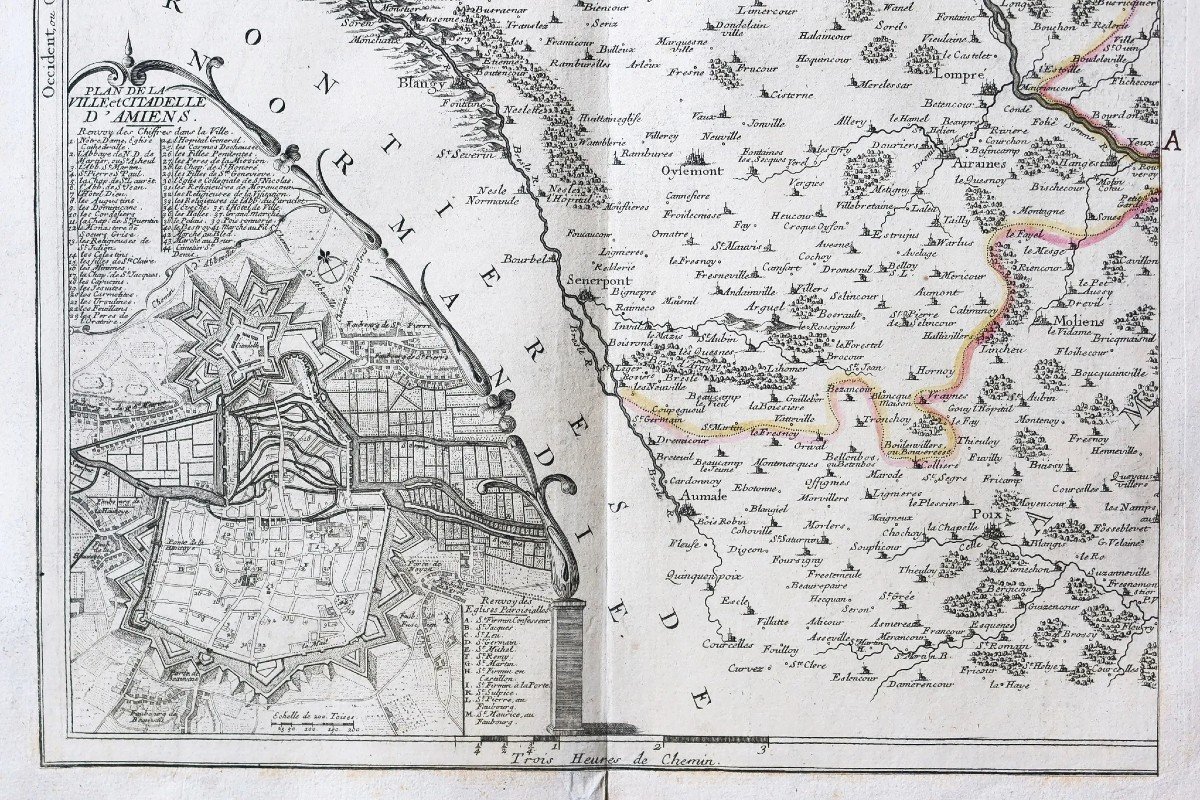
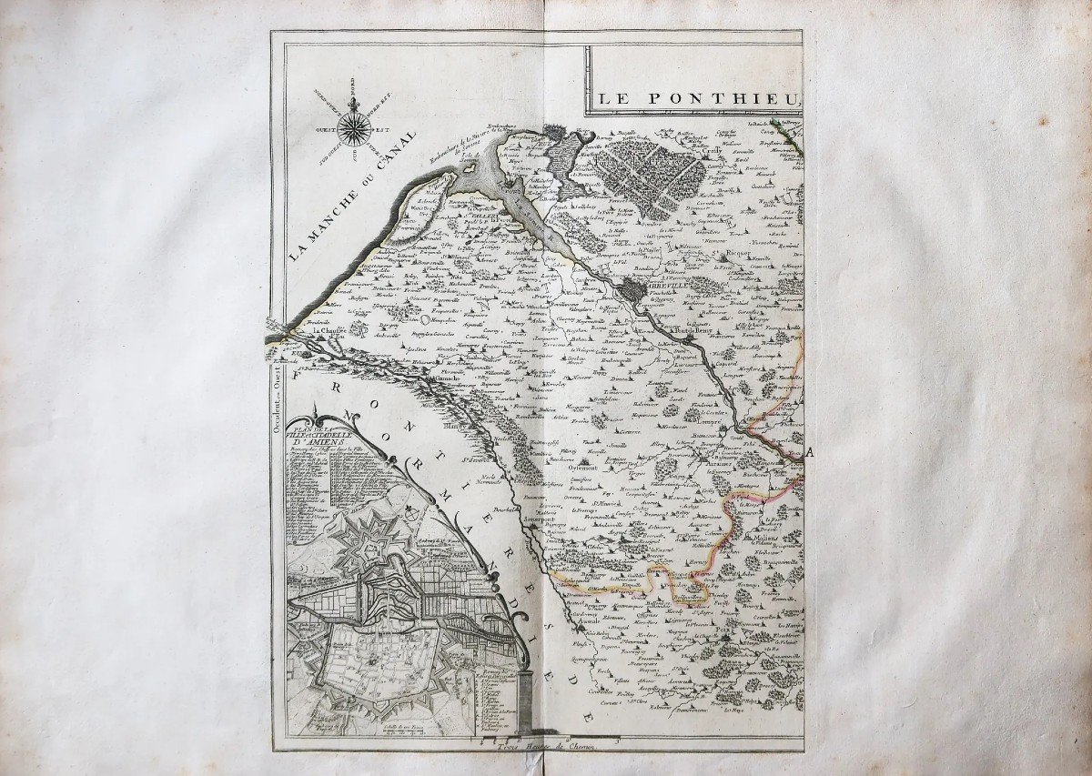

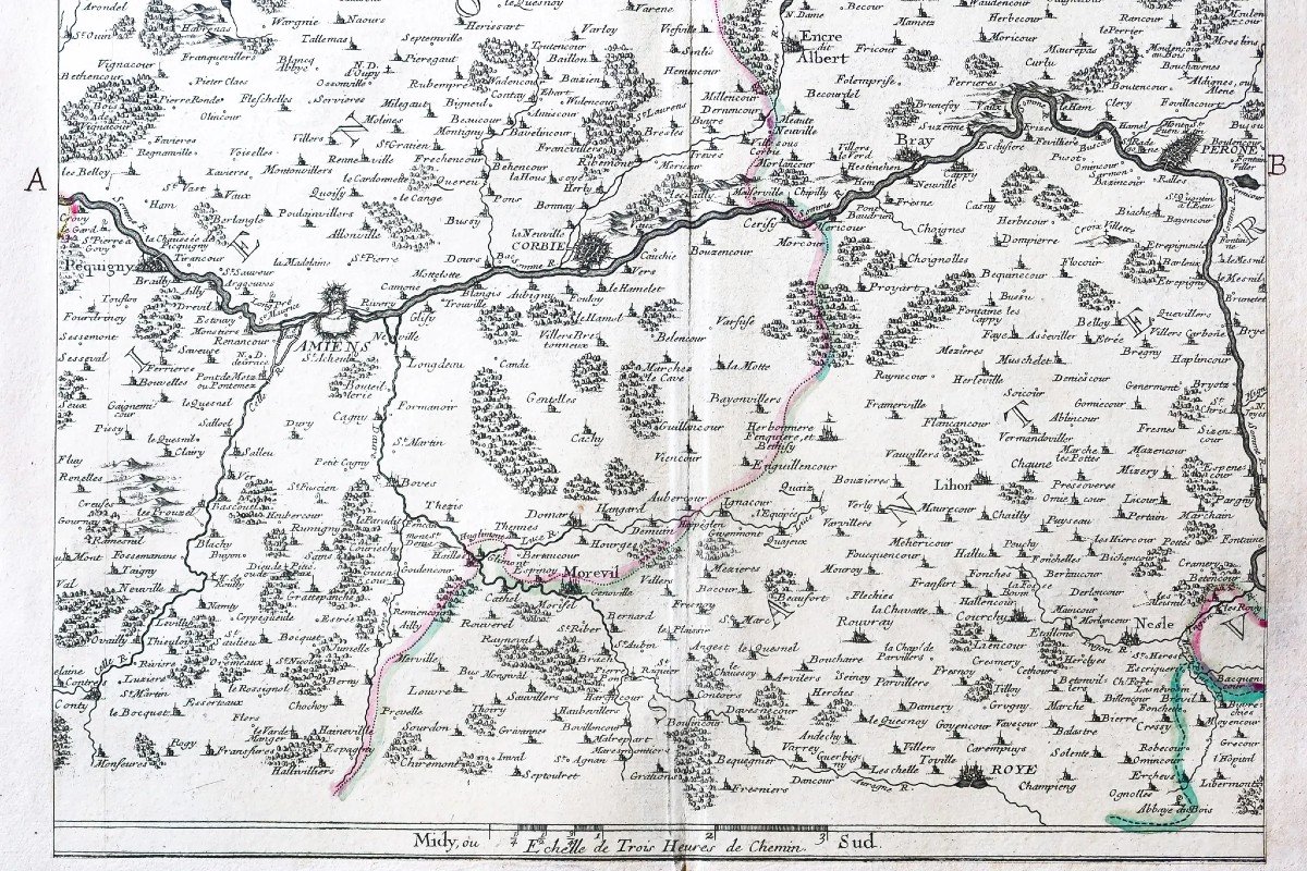
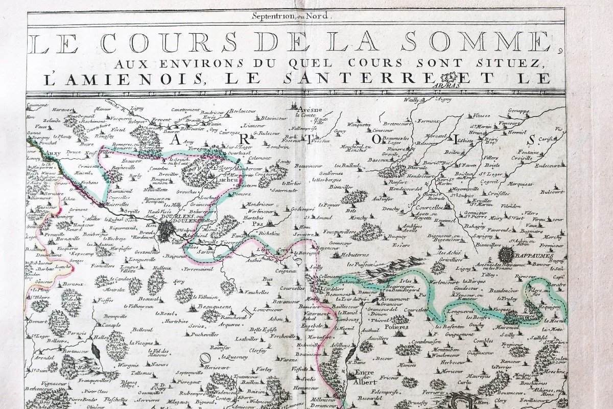
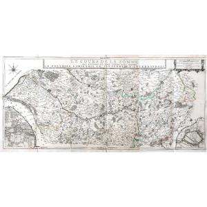


Map Of Picardy – Somme River
Artist: Nicolas De Fer
The course of the Somme around which are located the Ponthieu, the Amiénois, the Santerre and the Vermandois. Very large original proof made in 1709. Nicolas de Fer cartographer. Cards in 3 copper-cut sheets and formerly mounted on large paper. Colored boundaries of the time. Very good state. Single sheet format: 78 x 55.5 cm. Unit engraving format: 37 x 51 cm. Format assembled engravings: 112.5 x 55.5 cm. Original antique map of 1709. Rare representation of the Somme river. Particularly decorative map decorated with an inset representing the city and citadel of Amiens with references from 1 to 44 and from A to M locating the main places and monuments. Compass, second insert representing the plan of Abbeville and scale of the places. Assembly possible on request. You can consult all the maps and engravings available in your region by clicking on the link of our website specializing in ancient geographical archives: https://cartes-livres-anciens.com/categorie-produit/cartes-geographiques-anciennes -original-antique-maps/france/picardie-oise/ Secure payment by credit card on our website by clicking on the link: https://cartes-livres-anciens.com/produit/cartes-geographiques-anciennes-original- antique-maps/france/picardie-oise/carte-de-la-picardie-riviere-de-la-somme/ Nicolas de Fer, engraver-geographer born in 1646, died in Paris on October 15, 1720, executed more than 600 maps or plans, including France political, administrative, ecclesiastical, hydrographic, orographic, etc., as well as various bordering countries. His maps are distinguished by their ornamental side and the picturesqueness of their historiated frames. He had the title of geographer to the king. All our maps and engravings are accompanied by a certificate of authenticity.
2 000 €
Period: 18th century
Style: Other Style
Condition: Excellent condition
Material: Paper
Reference (ID): 945902
Availability: In stock
Print