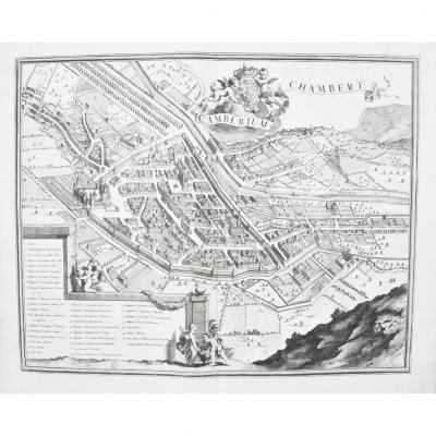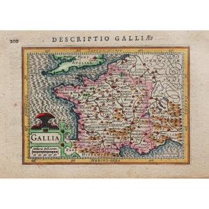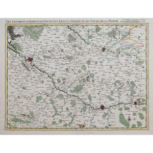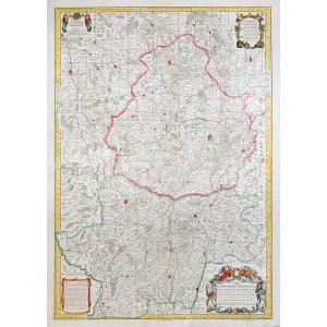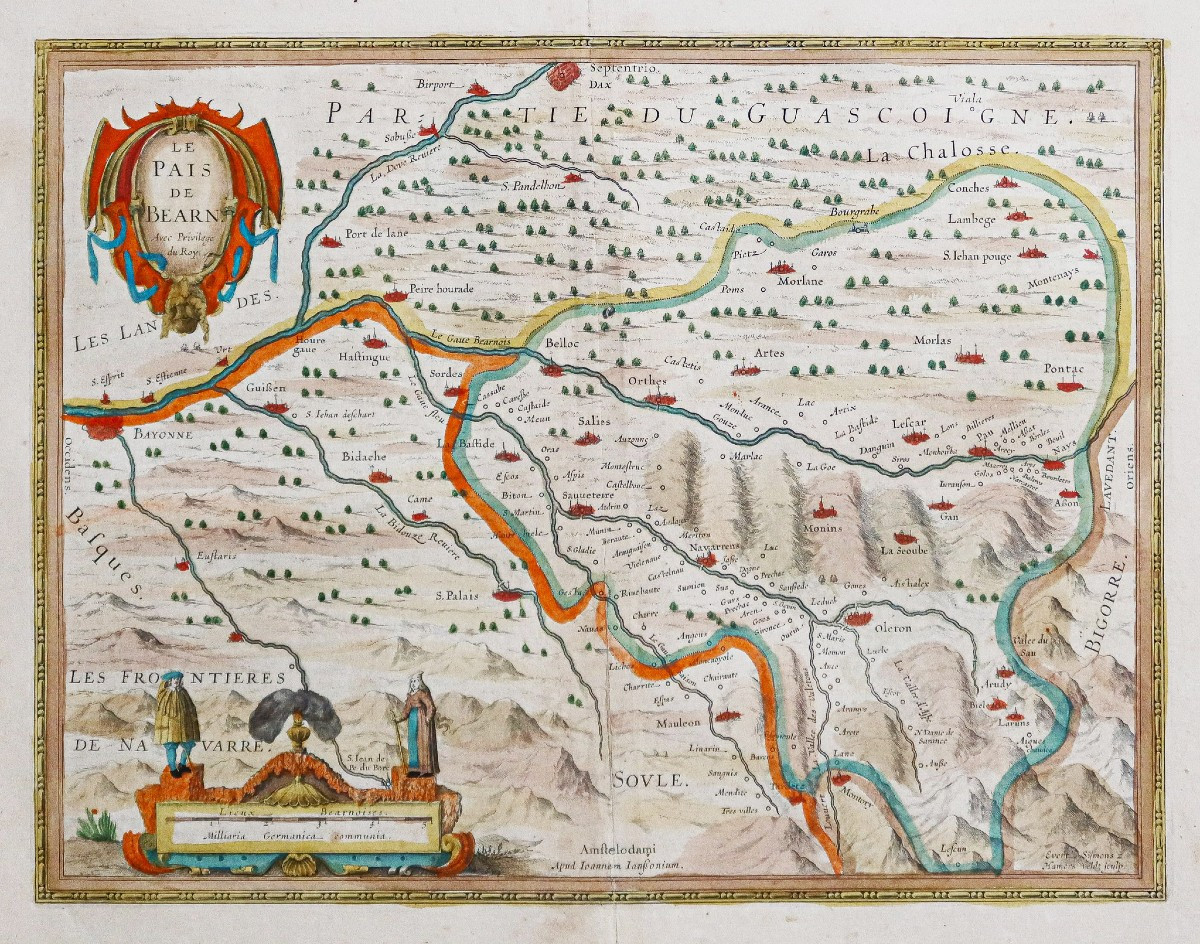


Old Geographical Map Of The Pays De Béarn
Fines rousseurs dans la marge supérieure loin de la carte.
Très beaux coloris anciens
Texte explicatif au verso en vieux français.
Très bon état.
Format feuille : 59 x 51 cm.
Format gravure : 50,5 x 39 cm.
Original antique map around 1630.
Belle carte en parfait coloris anciens. Cartouche de titre a vec privilèges.
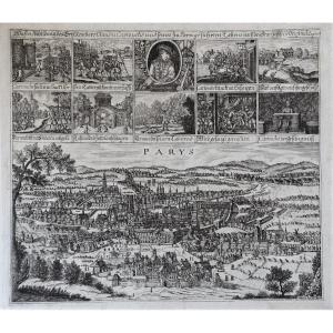
Habitants de la région en habits traditionnels surmontant l’échelle des lieux.
Large texte historique an dos de la principauté de Béarn.
Vous pouvez consulter l’ensemble des cartes, livres et gravures disponibles sur votre région en cliquant sur le lien de notre site internet spécialisé en archives anciennes géographiques : https://cartes-livres-anciens.com/categorie-produit/cartes-geographiques-anciennes-original-antique-maps/france/aquitaine-guyenne-gascogne-perigord/
Règlement sécurisé par carte bancaire sur notre site internet en cliquant sur le lien ci-dessous : https://cartes-livres-anciens.com/produit/cartes-geographiques-anciennes-original-antique-maps/france/aquitaine-guyenne-gascogne-perigord/carte-geographique-ancienne-du-pays-de-bearn-2/
Toutes nos cartes et gravures sont accompagnées d’un certificat d’authenticité.
Johannes Janssonius, plus connu sous le nom de Jan Jansson, est né à Arnhem, où son père était libraire et éditeur (Jan Janszoon the Elder).
En 1612, il épousa la fille du cartographe et éditeur Jodocus Hondius, puis s’installa à Amsterdam en tant qu’éditeur de livres. En 1616, il publie ses premières cartes de France et d’Italie et produit à partir de ce moment un très grand nombre de cartes, tout à fait comparables à celles de la famille Blaeu, car très proches en quantité et en qualité.
De 1630 à 1638 environ, il s’associa à son beau-frère, Henricus Hondius, et publia de nouvelles éditions des atlas Mercator / Hondius auxquels il fut associé. À la mort de Henricus, il reprit l’entreprise, élargissant encore l’édition de cartes jusqu’à ce qu’il publie finalement un Atlas Major en 11 volumes à une échelle similaire à celle de l’Atlas Major de Blaeu.
En général, les cartes de Jansson ressemblent beaucoup à celles de Blaeu et, en fait, elles en ont souvent été copiées, mais elles ont tendance à être plus flamboyantes et, selon certains, plus décoratives.
Original proof made around 1630. Johannes Jansson cartographer. Fine foxing in the upper margin far from the map. Very beautiful old colors. Explanatory text on the back in old French. Very good condition. Sheet size: 59 x 51 cm. Engraving size: 50.5 x 39 cm. Original antique map around 1630. Beautiful map in perfect old colors. Title cartouche with privileges. Inhabitants of the region in traditional clothes surmounting the ladder of places. Large historical text on the back of the principality of Béarn. You can consult all the maps, books and engravings available on your region by clicking on the link of our website specialized in old geographical archives: https://cartes-livres-anciens.com/categorie-produit/cartes-geographiques-anciennes-original-antique-maps/france/aquitaine-guyenne-gascogne-perigord/ Secure payment by credit card on our website by clicking on the link below: https://cartes-livres-anciens.com/produit/cartes-geographiques-anciennes-original-antique-maps/france/aquitaine-guyenne-gascogne-perigord/carte-geographique-ancienne-du-pays-de-bearn-2/ All our maps and engravings are accompanied by a certificate of authenticity. Johannes Janssonius, better known as Jan Jansson, was born in Arnhem, where his father was a bookseller and publisher (Jan Janszoon the Elder). In 1612, he married the daughter of the cartographer and publisher Jodocus Hondius, and later moved to Amsterdam as a book publisher. In 1616, he published his first maps of France and Italy and from then on produced a very large number of maps, quite comparable to those of the Blaeu family, as they were very close in quantity and quality. From about 1630 to 1638, he went into partnership with his brother-in-law, Henricus Hondius, and published new editions of the Mercator / Hondius atlases with which he was associated. Upon Henricus's death, he took over the business, further expanding the map edition until he finally published an 11-volume Atlas Major on a similar scale to Blaeu's Atlas Major. In general, Jansson's maps closely resemble Blaeu's and, in fact, have often been copied, but they tend to be more flamboyant and, some say, more decorative.
Period: 17th century
Style: Other Style
Condition: Excellent condition
Material: Paper
Reference (ID): 1577760
Availability: In stock