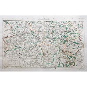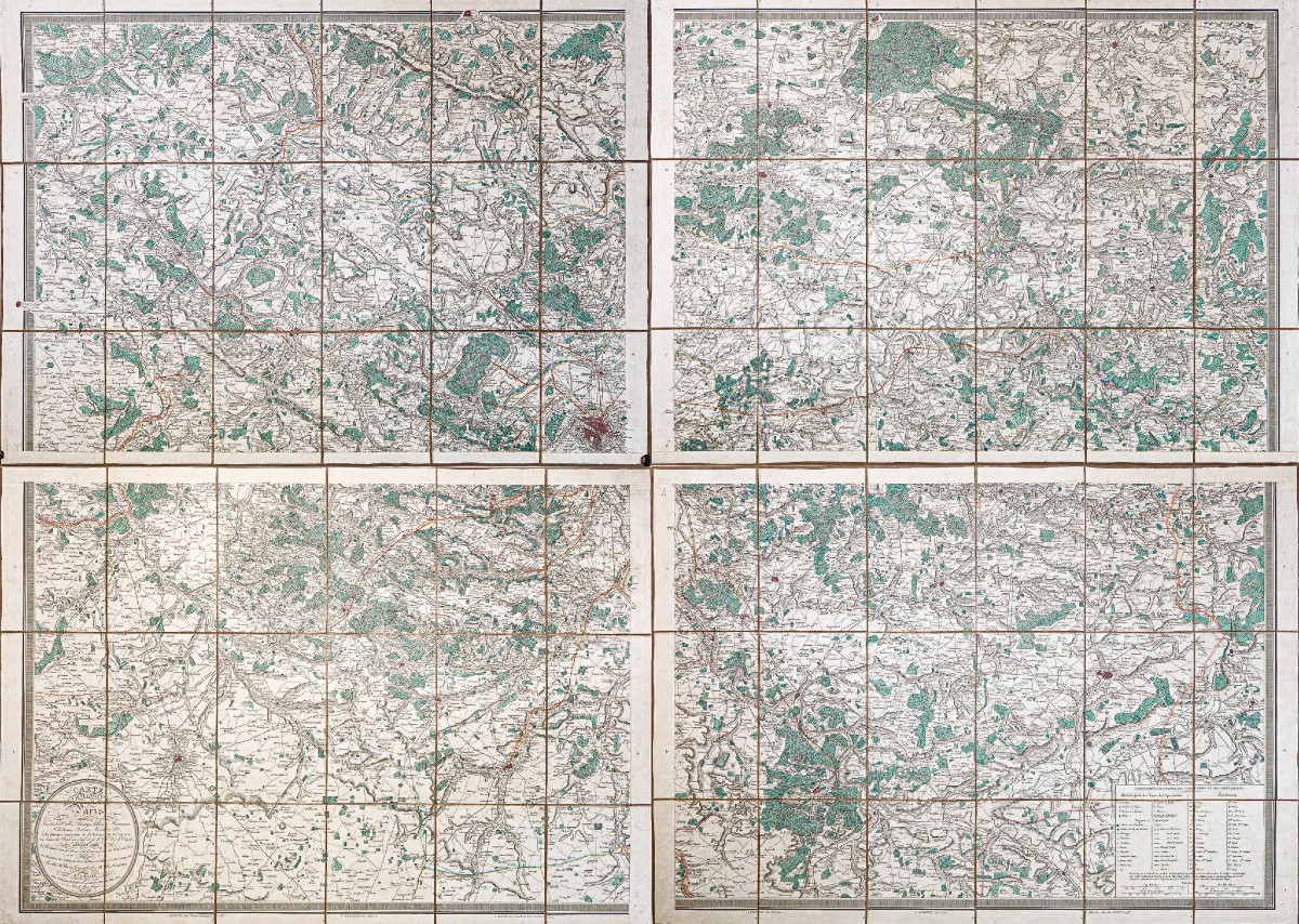
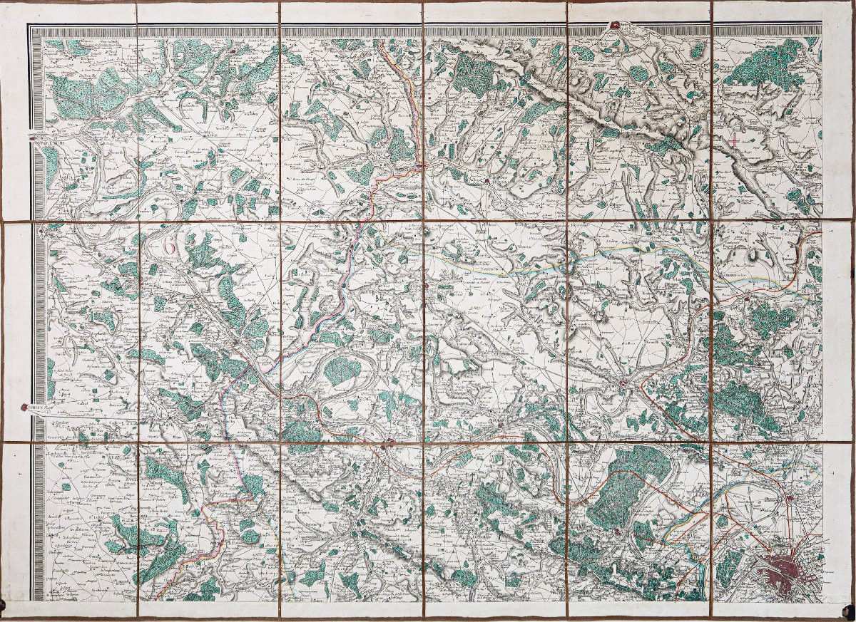
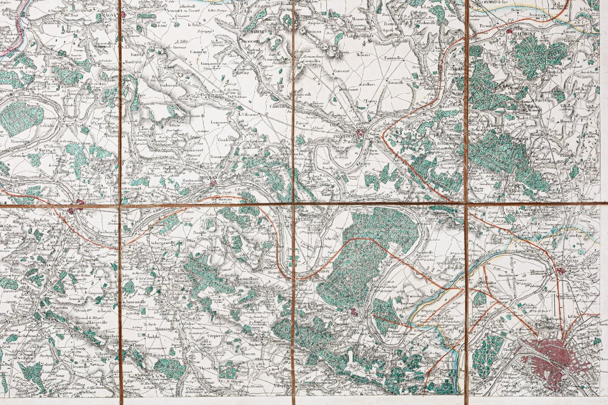


Old Maps Of Paris And Its Suburbs
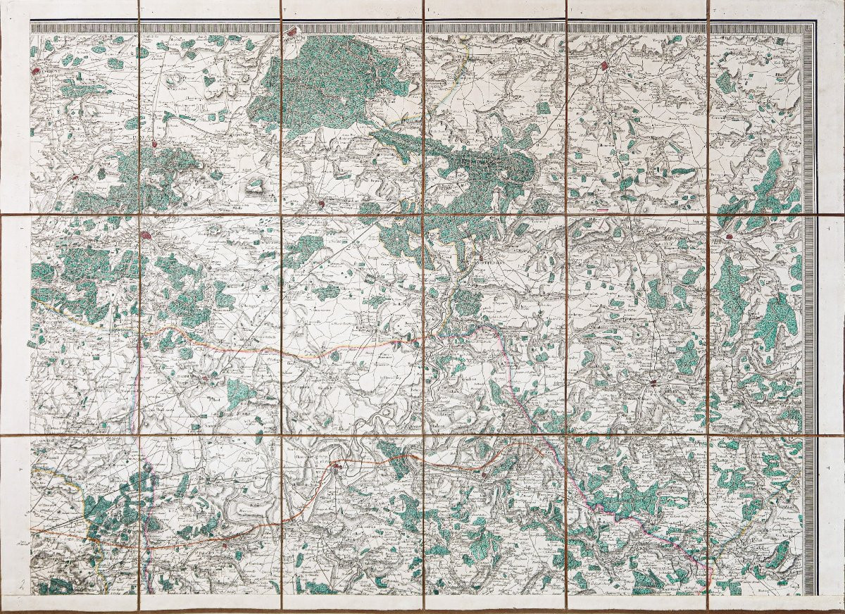
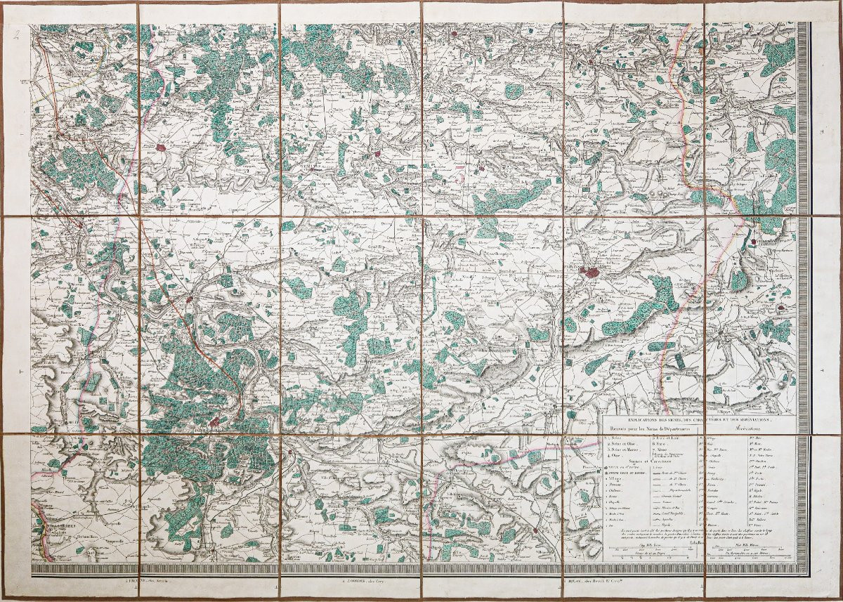
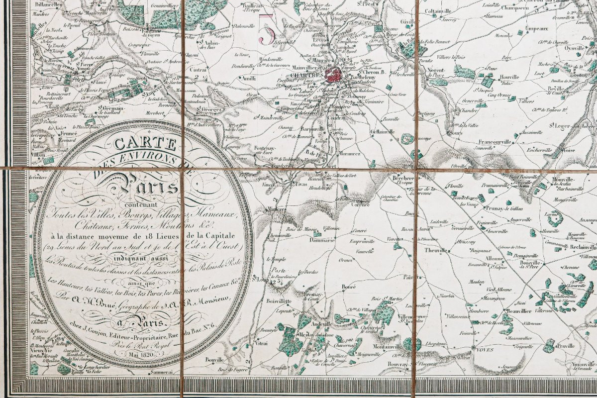
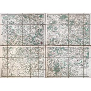
4 Plans entoilés d’époque montés en 18 sections.
Coloris aquarelle.
Emboitage avec traces de frottements, couvercle fendu.
Très bon état.
Format de chaque plan : 71 x 50,5 cm.
Format assemblé : 145 x 105 cm
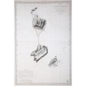
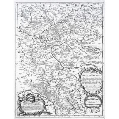
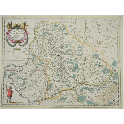
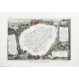
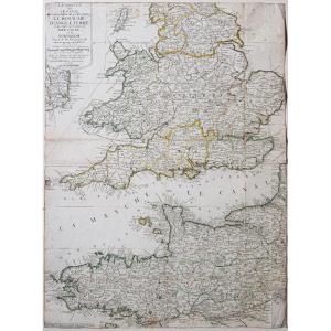
Plan de Paris et ses environs allant de Paris à Compiègne, Chartres, Beauvais, Fontainebleau…
Vous pouvez consulter l’ensemble des cartes et gravures disponibles sur votre région en cliquant sur le lien de notre site internet spécialisé en archives anciennes géographiques : https://cartes-livres-anciens.com/categorie-produit/cartes-geographiques-anciennes-original-antique-maps/france/ile-de-france-cartes-geographiques/
Règlement sécurisé par carte bancaire sur notre site internet en cliquant sur le lien : https://cartes-livres-anciens.com/produit/cartes-geographiques-anciennes-original-antique-maps/france/ile-de-france-cartes-geographiques/plan-ancien-de-paris-et-ses-environs-2/
Toutes nos cartes et gravures sont accompagnées d’un certificat d’authenticité.
4 vintage canvas-backed maps mounted in 18 sections. Watercolor colors. Slipcase with traces of rubbing, split cover. Very good condition. Format of each map: 71 x 50.5 cm. Assembled format: 145 x 105 cm Map of Paris and its surroundings going from Paris to Compiègne, Chartres, Beauvais, Fontainebleau… You can consult all the maps and engravings available in your region by clicking on the link to our website specializing in old geographical archives: https://cartes-livres-anciens.com/categorie-produit/cartes-geographiques-anciennes-original-antique-maps/france/ile-de-france-cartes-geographiques/ Secure payment by credit card on our website by clicking on the link: https://cartes-livres-anciens.com/produit/cartes-geographiques-anciennes-original-antique-maps/france/ile-de-france-cartes-geographiques/plan-ancien-de-paris-et-ses-environs-2/ All our maps and engravings are accompanied by a certificate of authenticity.
Coloris aquarelle.
Emboitage avec traces de frottements, couvercle fendu.
Très bon état.
Format de chaque plan : 71 x 50,5 cm.
Format assemblé : 145 x 105 cm
Plan de Paris et ses environs allant de Paris à Compiègne, Chartres, Beauvais, Fontainebleau…
Vous pouvez consulter l’ensemble des cartes et gravures disponibles sur votre région en cliquant sur le lien de notre site internet spécialisé en archives anciennes géographiques : https://cartes-livres-anciens.com/categorie-produit/cartes-geographiques-anciennes-original-antique-maps/france/ile-de-france-cartes-geographiques/
Règlement sécurisé par carte bancaire sur notre site internet en cliquant sur le lien : https://cartes-livres-anciens.com/produit/cartes-geographiques-anciennes-original-antique-maps/france/ile-de-france-cartes-geographiques/plan-ancien-de-paris-et-ses-environs-2/
Toutes nos cartes et gravures sont accompagnées d’un certificat d’authenticité.
4 vintage canvas-backed maps mounted in 18 sections. Watercolor colors. Slipcase with traces of rubbing, split cover. Very good condition. Format of each map: 71 x 50.5 cm. Assembled format: 145 x 105 cm Map of Paris and its surroundings going from Paris to Compiègne, Chartres, Beauvais, Fontainebleau… You can consult all the maps and engravings available in your region by clicking on the link to our website specializing in old geographical archives: https://cartes-livres-anciens.com/categorie-produit/cartes-geographiques-anciennes-original-antique-maps/france/ile-de-france-cartes-geographiques/ Secure payment by credit card on our website by clicking on the link: https://cartes-livres-anciens.com/produit/cartes-geographiques-anciennes-original-antique-maps/france/ile-de-france-cartes-geographiques/plan-ancien-de-paris-et-ses-environs-2/ All our maps and engravings are accompanied by a certificate of authenticity.
1 600 €
Period: 19th century
Style: Other Style
Condition: Excellent condition
Material: Paper
Reference (ID): 1549858
Availability: In stock
Print