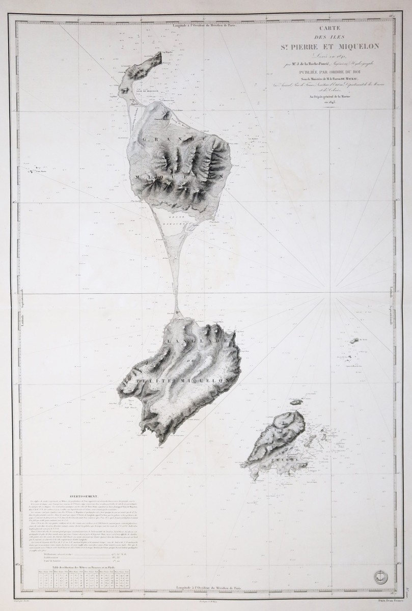

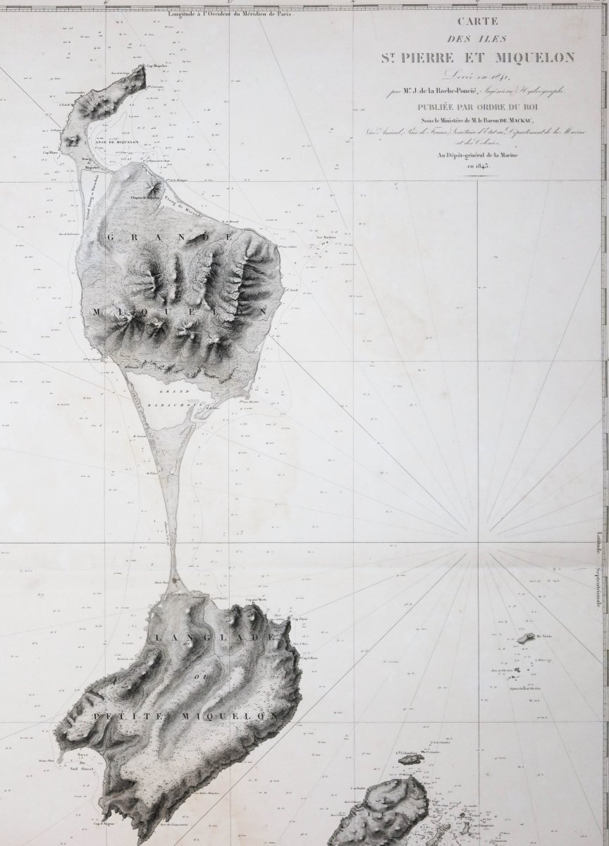
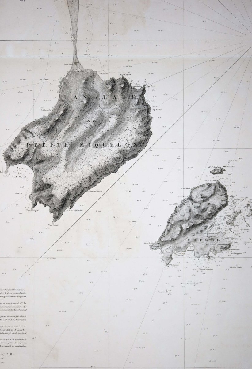
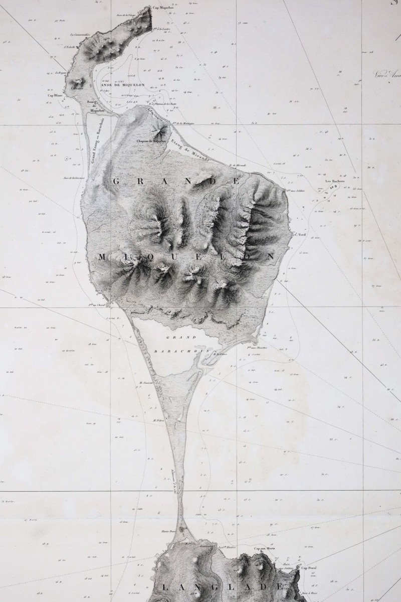
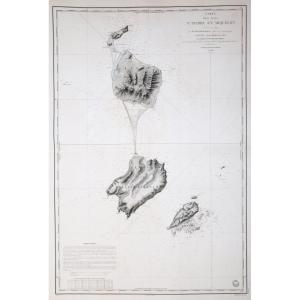


Nautical Chart Of Saint Pierre And Miquelon
Original proof engraved in 1843. De Laroche Poncié hydrographe. Reinforcement on the back of the central fold in the left side margin. Fine oxidation in the center of the proof. Very nice impression. Good condition. Sheet size: 97 x 67 cm. Engraving size: 89 x 60 cm. Original antique chart of 1843. You can consult all the maps, books and engravings available in your region by clicking on the link to our website specializing in old geographical archives: https://cartes-livres-anciens.com/categorie-produit/cartes-geographiques-anciennes-original-antique-maps/france/dom-tom/ Secure payment by credit card on our website by clicking on the link below: https://cartes-livres-anciens.com/produit/cartes-geographiques-anciennes-original-antique-maps/ameriques/canada/carte-marine-de-saint-pierre-et-miquelon/All our maps and engravings are accompanied by a certificate of authenticity. In the tradition of the French Neptunes, the last French commission at the beginning of the 19th century. The French Pilot, testimony of twenty campaigns at sea led by Beautemps-Beaupré, studies all the western and northern coasts of France from Bayonne to Dunkirk. These documents contain no less than 150 maps and plans, 279 views and 184 tables of high and low tides, forming a set of 613 separate works which are treasures for navigation. This work is still admired by the maritime world and, in the words of Frédéric Chassériau, "will remain the finest title of contemporary hydrography in the eyes of posterity."
300 €
Period: 19th century
Style: Other Style
Condition: Good condition
Material: Paper
Reference (ID): 1619745
Availability: In stock
Print