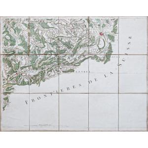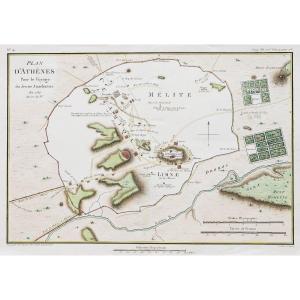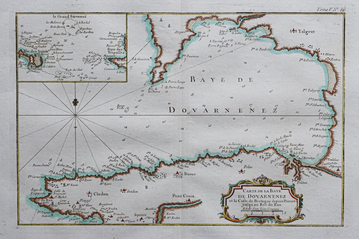
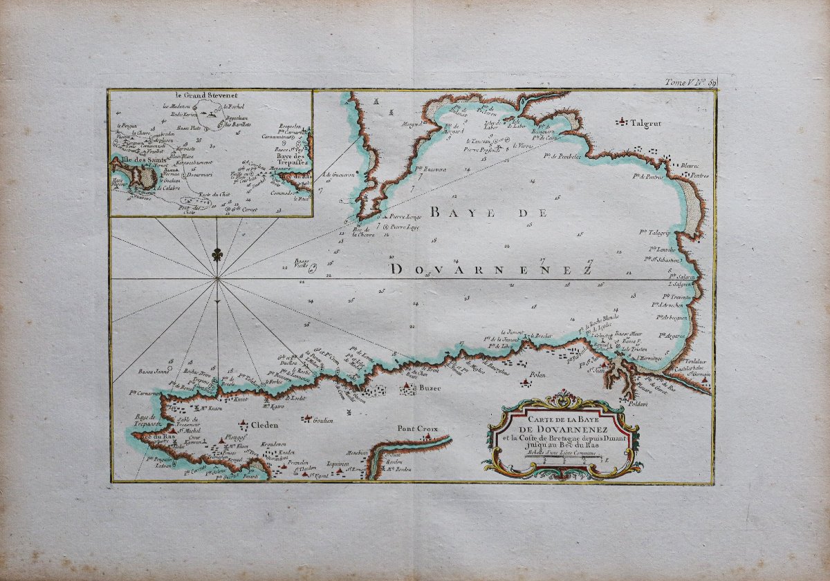

Antique Nautical Chart – Douarnenez Bay – Brittany
Original print made in 1760. Bellin, geographer.
Watercolor highlights.
Scattered light foxing.
Very good condition.
Sheet size: 47.5 x 34 cm.
Engraving size: 36 x 24 cm.
Antique original map from 1760.
Inset illustrating the Baie des Trépassés and Île-de-Sein.
Fleur-de-lis indicating north and decorative title cartouche.
You can view allthe maps, books, and engravings available for your region by clicking on thelink to our website specializing in historicalgeographic archives:
https://cartes-livres-anciens.com/product-category/antique-geographic-maps-original-antique-maps/france/brittany/
Secure payment by creditcard on our website by clicking the link below:
https://cartes-livres-anciens.com/produit/cartes-geographiques-anciennes-original-antique-maps/france/bretagne/carte-marine-ancienne-baie-de-douarnenez/
Allour maps and engravings come with a certificate of authenticity.
Jacques-Nicolas Bellin, born in Paris in 1703 and died in Versailles on March 21, 1772, was a French cartographer and hydrographer. In 1721, Bellin was appointed hydrographer of the Ministry of the Navy following the creation of the French Hydrographic Office and the Navy’s Map and Plan Repository. He was a member of the Académie de Marine and the Royal Society of London. Over the course of a 50-year career, he produced a large number of maps and atlases. His maps of Canada and the French territories in North America (New France, Acadia, Louisiana) are of considerable value.
275 €
Period: 18th century
Style: Other Style
Condition: Excellent condition
Material: Paper
Reference (ID): 1781471
Availability: In stock
Print