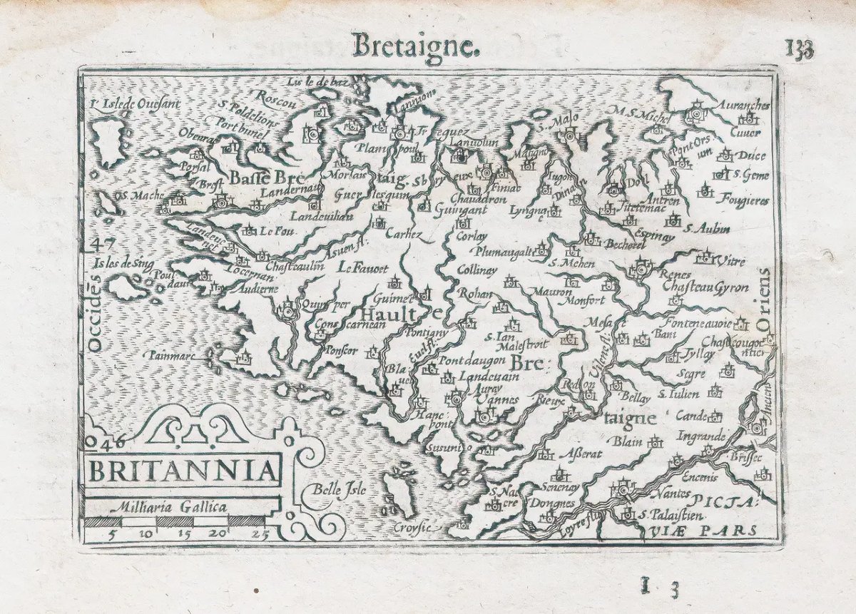
Old Map Of Brittany Britain
Artist: Ortelius
Original print made in 1598.
By Abraham Ortelius.
Light water stains in the upper margin that do not extend onto the map.
Good condition.
Explanatory text in Old French on the reverse.
Dimensions
Charming miniature map produced in the late 16th century for Ortelius’s Pocket Atlas.
You canview all the maps and engravings available for your region byclicking on the link to our website specializing inhistorical geographic archives: https://cartes-livres-anciens.com/fr/categories/bretagne
Secure paymentby credit card on our website by clicking the link: https://cartes-livres-anciens.com/fr/products/carte-ancienne-de-la-bretagne?v_id=variant_01KRX76YXRF1Z6CWCP5Z3NYRR3
Allof our maps and engravings come with a certificate of authenticity.
Abraham Ortel, better known as Ortelius, was born in Antwerp and, after studying Greek, Latin, and mathematics, settled there with his sister as a bookseller and “mapmaker.” He traveled extensively, particularly to major book fairs; his business prospered, and he forged connections with scholars in many countries.A turning point in his career came in 1564 with the publication of an eight-sheet world map, of which only one copy is known to exist: other individual maps followed, and then, at a friend’s suggestion, he compiled a collection of maps that he had engraved in a uniform size, thus creating a set of maps that was first published in 1570 under the title *Theatrum Orbis Terrarum* (Atlas of the Entire World).
By Abraham Ortelius.
Light water stains in the upper margin that do not extend onto the map.
Good condition.
Explanatory text in Old French on the reverse.
Dimensions
Sheet: 18.5 × 12 cm.
Engraving: 12.5 × 9 cm.
Charming miniature map produced in the late 16th century for Ortelius’s Pocket Atlas.
You canview all the maps and engravings available for your region byclicking on the link to our website specializing inhistorical geographic archives: https://cartes-livres-anciens.com/fr/categories/bretagne
Secure paymentby credit card on our website by clicking the link: https://cartes-livres-anciens.com/fr/products/carte-ancienne-de-la-bretagne?v_id=variant_01KRX76YXRF1Z6CWCP5Z3NYRR3
Allof our maps and engravings come with a certificate of authenticity.
Abraham Ortel, better known as Ortelius, was born in Antwerp and, after studying Greek, Latin, and mathematics, settled there with his sister as a bookseller and “mapmaker.” He traveled extensively, particularly to major book fairs; his business prospered, and he forged connections with scholars in many countries.A turning point in his career came in 1564 with the publication of an eight-sheet world map, of which only one copy is known to exist: other individual maps followed, and then, at a friend’s suggestion, he compiled a collection of maps that he had engraved in a uniform size, thus creating a set of maps that was first published in 1570 under the title *Theatrum Orbis Terrarum* (Atlas of the Entire World).
175 €
Period: 17th century
Style: Other Style
Condition: Good condition
Material: Paper
Reference (ID): 1860936
Availability: In stock
Print