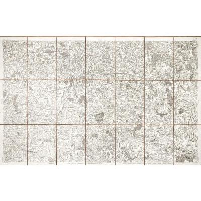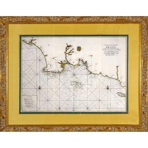


Engraving - Large Marine Chart From The Bay Of Audierne To The Island Of Groa (groix) - 18th Century
Artist: Neptune Francois
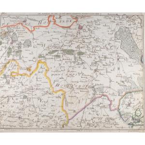
PropertiesView / Product VERY LARGE NAUTICAL CHART SPECIAL MAP OF THE COASTS OF BRITTANY FROM THE BAY OF AUDIERNE TO THE ISLE OF GROIX - Ep. 18thPropertiesView / Product Original steel engraving on laid paper, enhanced with watercolor. The route covers the southern Finistère and Morbihan coastline: Penmarc'h point, Audierne bay, Bénodet, mouth of the Odet, Concarneau, Trévignon, Glénan archipelago, Laïta river, Quimperlé, Lorient - Port-Louis harbor, as far as the Island of Groix. Reading the map: We observe a large network of lines radiating from several points (the navigation lines, called rhumbs), punctuated by two colored compass roses. The entire shoreline is well documented: depth figures (soundings), sandbanks, shoals, outcropping or submerged rocks, passes, anchorages marked by anchors, as well as landmarks on the coast. A title block and a “Remarks” block serve as a legend to understand the symbols.Dimension(s): Frame: Length 1.14 m - Height 91 cm cm - Width Baguette: 6.5 cm, Condition: PERFECT CONDITION - Original crease in the center, Period: 18th century (CIRCA 1773), Frame: CURRENT: large green wild silk net - old gold beveled net - honey yellow wild silk mat - Carved, gilded and patinated wooden baguette. Observation(s): VERY RARE NAUTICAL CHART. “NEPTUNE FRANCOIS” is the name given, from the end of the 17th century, to the large atlas of French nautical charts – “Neptune” in reference to the god of the sea, and “françois” to indicate that these are surveys and routes drawn up by the engineers/hydrographers of the kingdom of France for the service of the King’s ships. First published at the end of the 1690s, the work includes the “Cartes particuliers des côtes de France”, as well as suites (Mediterranean, seas of North…). PAYMENT and TRANSPORT: PAYMENTS ACCEPTED - BANK TRANSFER / PAYPAL (lametairie@bbox.fr) / CREDIT CARD. PARCELS WILL BE POSTED WITHIN 3 DAYS. GROUPED SHIPPING POSSIBLE IN CASE OF PURCHASE OF MULTIPLE ITEMS.
1 750 €
Period: 18th century
Style: Louis 16th, Directory
Condition: Perfect condition
Material: Paper
Length: 1.14 m
Height: 91 cm
Reference (ID): 1633303
Availability: In stock
Print