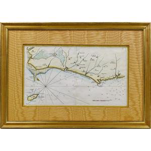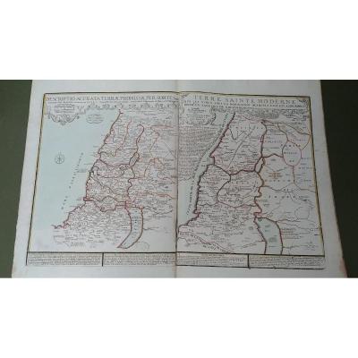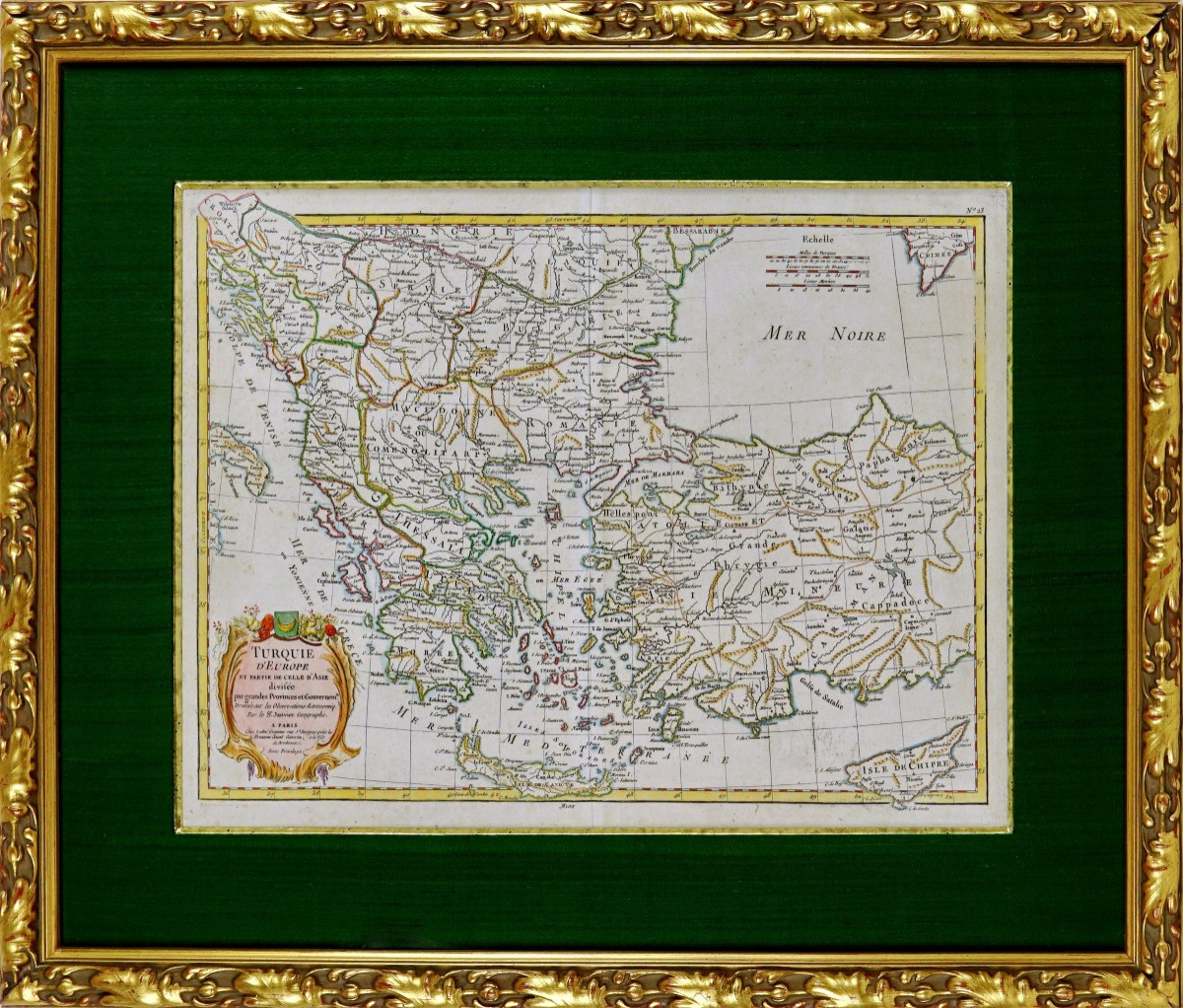


Engraving Of European Turkey And Part Of That Of Asia Divided - Ep. 18th
Engraving of EUROPEAN TURKEY and part of Asia divided by major provinces and government - 18th century
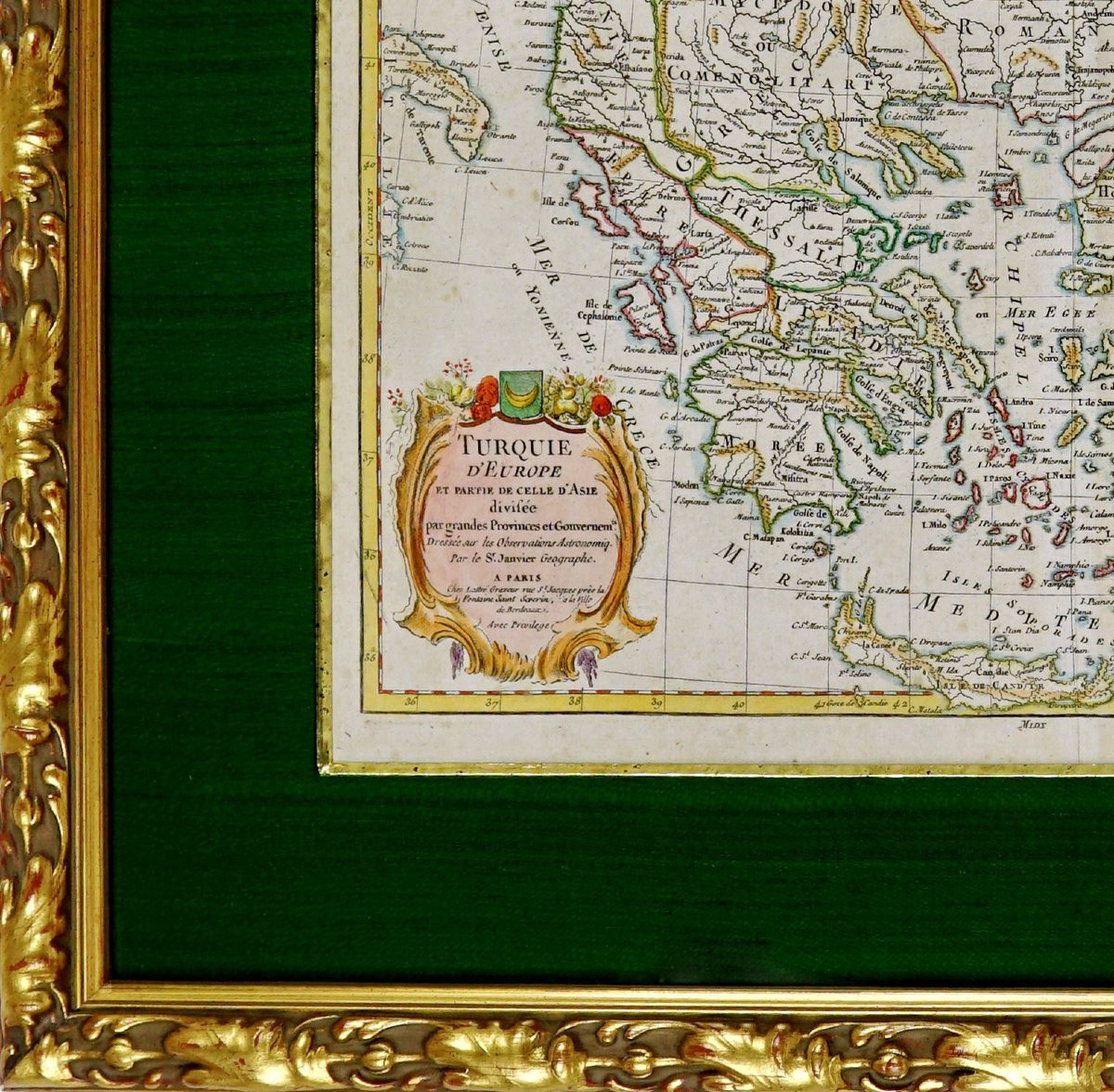
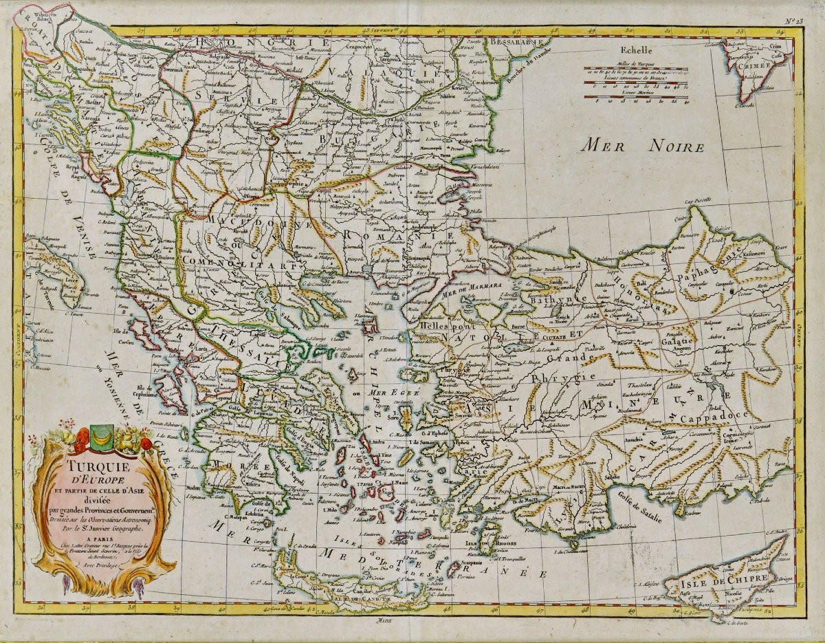
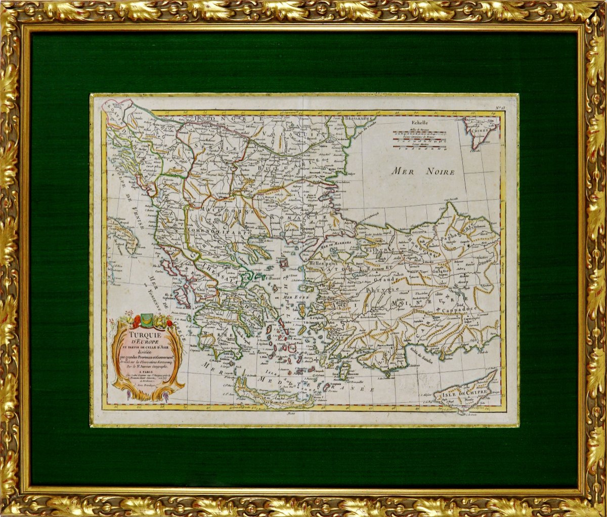
Engraving on steel, on laid paper, hand-enhanced with watercolor. Drawn by J. JANVIER and published by J. LATTRE
European Turkey (Balkans, Greece, and Cyprus) with a broad coverage of Asia Minor (Anatolia); mention of the island of Cyprus.
Beautiful polychrome rocaille cartouche in the lower left corner, titled in a rocaille frame (Louis XV style) with trophies, garlands, and draperies. Multi-unit scale in the upper right corner, longitudes referred to the French meridian (often Iron Island). Seas and straits clearly indicated: Black Sea, Hellespont, Sea of Marmara, Dardanelles, Archipelago (Aegean), Mediterranean.
This map illustrates the Ottoman Empire in the 18th century. century, when the Porte still controlled most of Balkan Europe and Anatolia. The mixture of modern (Ottoman provinces) and ancient (scholarly heritage) names is characteristic of French atlases.
Dimensions: Frame: Height 52.5 cm – Length 65.5 cm – Width of rod: 3 cm,
Condition: PERFECT CONDITION,
Period: LATE 18th century,
Frame: Current mounting: "old gold" bevel, bronze-green wild silk marigold and carved wooden rod, water-based gilding.
480 €
Period: 18th century
Style: Louis 16th, Directory
Condition: Perfect condition
Material: Paper
Length: 65.5 cm
Height: 52.5 cm
Reference (ID): 1627018
Availability: In stock
Print