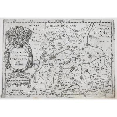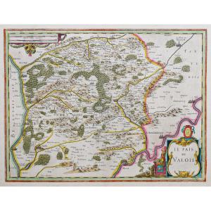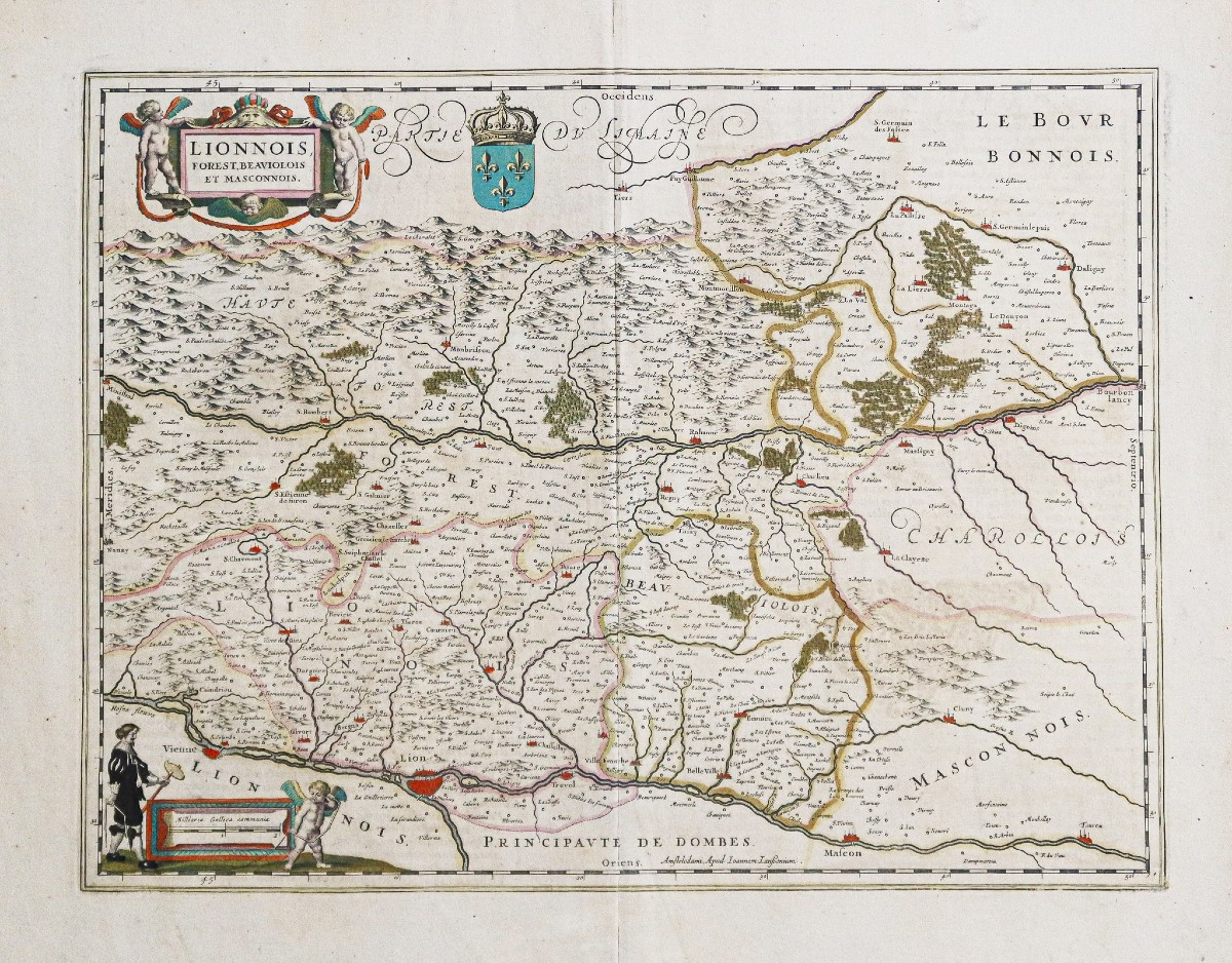

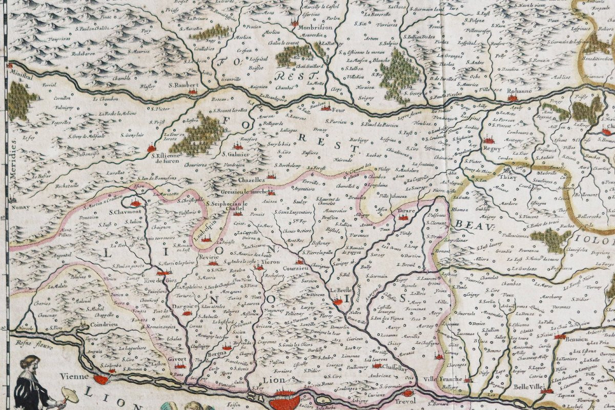
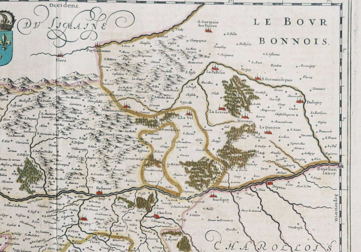
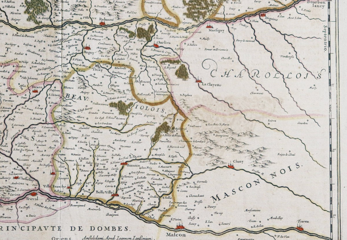
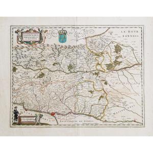


Old Map Of Lyonnais – Mâcon – Forest
Original proof made around 1650. Jansson Johanne geographer. Antique colors. Explanatory text on the back in Spanish. Very good condition. Sheet size: 60 x 49.5 cm. Engraving size: 50 x 8.5 cm. Original antique map of 1650. Beautiful impression for this map oriented towards the west, title cartouche supported by 2 cherubs, a scale of the places. You can consult all the maps, books and engravings available on your region by clicking on the link of our website specialized in old geographical archives: https://cartes-livres-anciens.com/categorie-produit/cartes-geographiques-anciennes-original-antique-maps/france/rhone-alpes/ Secure payment by credit card on our website by clicking on the link below: https://cartes-livres-anciens.com/produit/cartes-geographiques-anciennes-original-antique-maps/france/rhone-alpes/carte-ancienne-du-lyonnais-macon-forest/All our maps and engravings are accompanied by a certificate of authenticity. Johannes Janssonius, better known as Jan Jansson, was born in Arnhem, where his father was a bookseller and publisher (Jan Janszoon the Elder). In 1612, he married the daughter of the cartographer and publisher Jodocus Hondius, and then moved to Amsterdam as a book publisher. In 1616, he published his first maps of France and Italy and from then on produced a very large number of maps, quite comparable to those of the Blaeu family, being very close in quantity and quality. From about 1630 to 1638, he was in partnership with his brother-in-law, Henricus Hondius, and published new editions of the Mercator / Hondius atlases with which he was associated. Upon Henricus's death, he took over the business, further expanding the map edition until he finally published an 11-volume Atlas Major on a similar scale to Blaeu's Atlas Major. In general, Jansson's maps closely resemble Blaeu's and, in fact, have often been copied, but they tend to be more flamboyant and, some say, more decorative.
325 €
Period: 17th century
Style: Other Style
Condition: Excellent condition
Material: Paper
Reference (ID): 1612863
Availability: In stock
Print