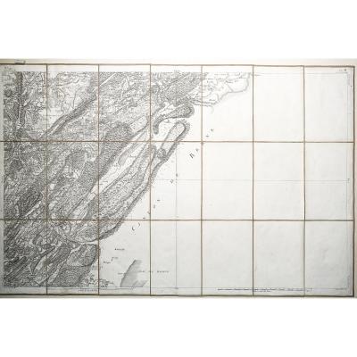


Geological Map Of The Toulon Area
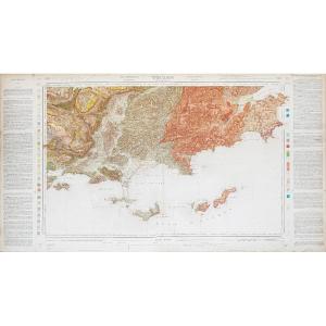
Grande épreuve originale publiée en 1887.
Carte chromolithographiée et entoilée d’époque.
Tampon à sec avec date d’édition.
Très bon état.
Format : 113,5 x 61,5 cm
Original antique map of 1887.
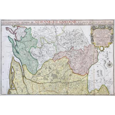
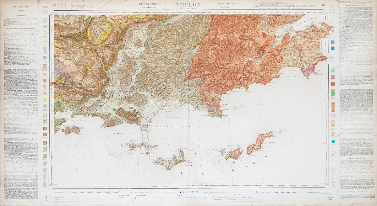
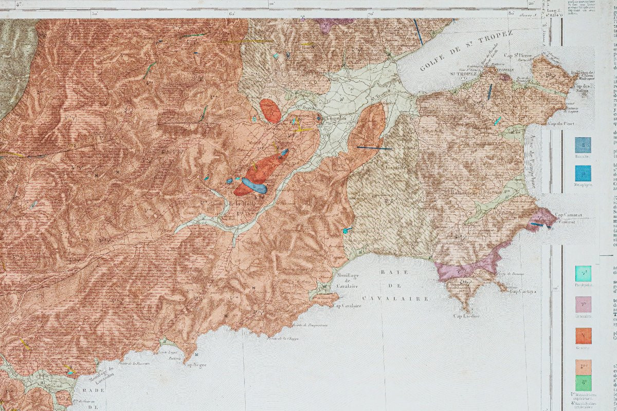
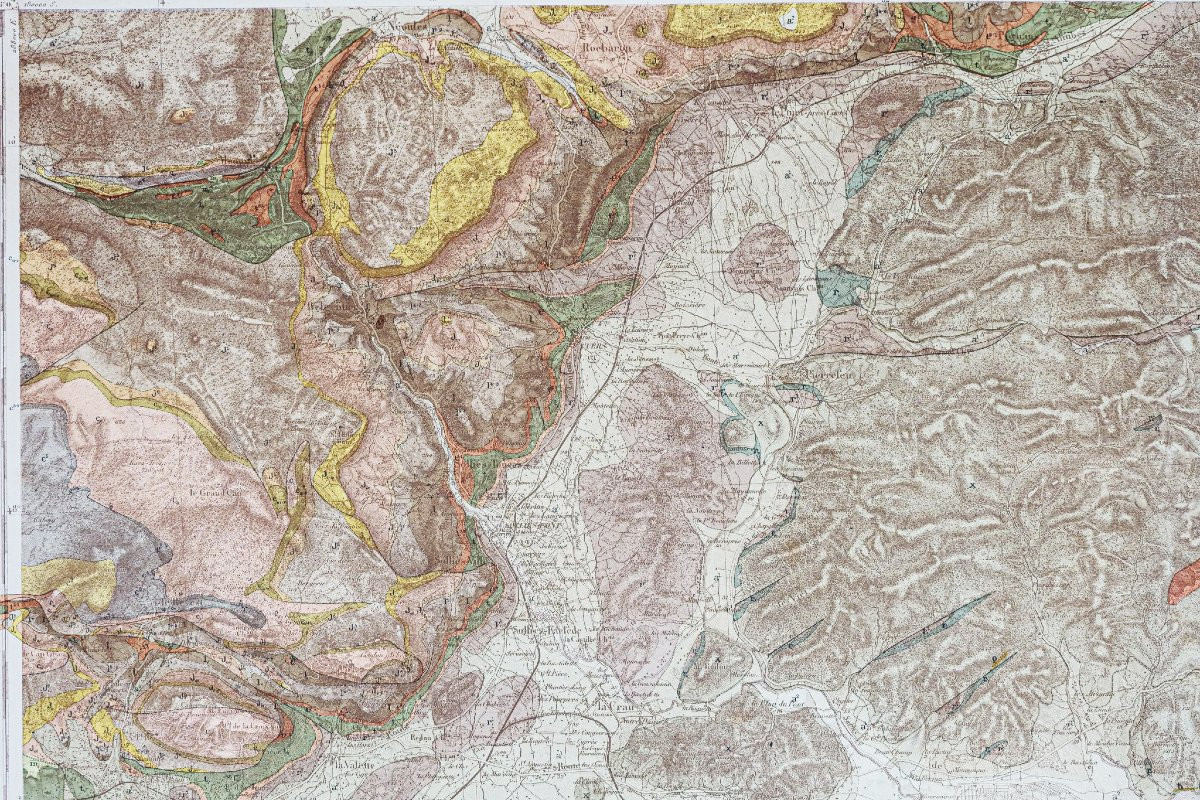
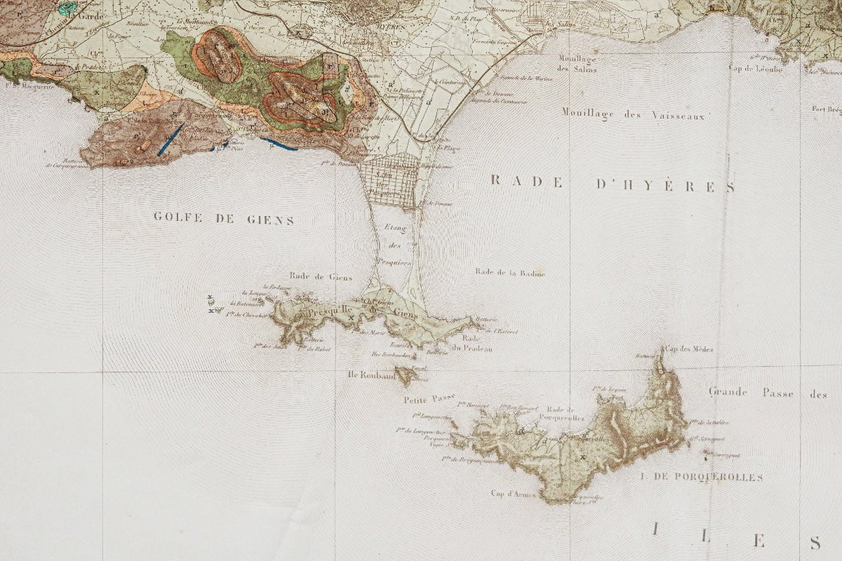
Carte géologique détaillée des environs de Toulon, exécutée sur la carte topographique d’Etat-Major par le service géologique des mines, publiée par le Ministère des Travaux Publics.
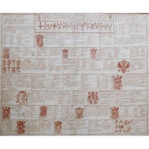
Notice explicative encadrant la carte, chaque étage des terrains est distingué par une couleur et par une lettre romaine simple avec exposant ou indice.
Vous pouvez consulter l’ensemble des cartes, livres et gravures disponibles sur votre région en cliquant sur le lien de notre site internet spécialisé en archives anciennes géographiques :
https://cartes-livres-anciens.com/categorie-produit/cartes-geographiques-anciennes-original-antique-maps/france/provence-cote-dazur/
Règlement sécurisé par carte bancaire sur notre site internet en cliquant sur le lien ci-dessous :
https://cartes-livres-anciens.com/produit/cartes-geographiques-anciennes-original-antique-maps/france/provence-cote-dazur/carte-geologique-des-environs-de-toulon/
Toutes nos cartes et gravures sont accompagnées d’un certificat d’authenticité.
Large original proof published in 1887.
Vintage chromolithographed and canvas map.
Dry stamp with edition date.
Very good condition.
Size: 113.5 x 61.5 cm
Original antique map of 1887.
Detailed geological map of the Toulon area, executed on the Etat-Major topographical map by the geological mining department, published by the Ministry of Public Works.
Explanatory note framing the map, each stage of the terrain is distinguished by a color and by a simple Roman letter with superscript or subscript.
You can consult all of themaps, books and engravings available for your region by clicking on thelink to our website specializing in old geographicarchives:
https://cartes-livres-anciens.com/categorie-produit/cartes-geographiques-anciennes-original-antique-maps/france/provence-cote-dazur/
Secure payment by credit cardon our website by clicking on the link below:
https://cartes-livres-anciens.com/produit/cartes-geographiques-anciennes-original-antique-maps/france/provence-cote-dazur/carte-geologique-des-environs-de-toulon/
All our maps and prints are accompanied by a credit card.cards and engravings are accompanied by a certificate of authenticity.
Carte chromolithographiée et entoilée d’époque.
Tampon à sec avec date d’édition.
Très bon état.
Format : 113,5 x 61,5 cm
Original antique map of 1887.
Carte géologique détaillée des environs de Toulon, exécutée sur la carte topographique d’Etat-Major par le service géologique des mines, publiée par le Ministère des Travaux Publics.
Notice explicative encadrant la carte, chaque étage des terrains est distingué par une couleur et par une lettre romaine simple avec exposant ou indice.
Vous pouvez consulter l’ensemble des cartes, livres et gravures disponibles sur votre région en cliquant sur le lien de notre site internet spécialisé en archives anciennes géographiques :
https://cartes-livres-anciens.com/categorie-produit/cartes-geographiques-anciennes-original-antique-maps/france/provence-cote-dazur/
Règlement sécurisé par carte bancaire sur notre site internet en cliquant sur le lien ci-dessous :
https://cartes-livres-anciens.com/produit/cartes-geographiques-anciennes-original-antique-maps/france/provence-cote-dazur/carte-geologique-des-environs-de-toulon/
Toutes nos cartes et gravures sont accompagnées d’un certificat d’authenticité.
Large original proof published in 1887.
Vintage chromolithographed and canvas map.
Dry stamp with edition date.
Very good condition.
Size: 113.5 x 61.5 cm
Original antique map of 1887.
Detailed geological map of the Toulon area, executed on the Etat-Major topographical map by the geological mining department, published by the Ministry of Public Works.
Explanatory note framing the map, each stage of the terrain is distinguished by a color and by a simple Roman letter with superscript or subscript.
You can consult all of themaps, books and engravings available for your region by clicking on thelink to our website specializing in old geographicarchives:
https://cartes-livres-anciens.com/categorie-produit/cartes-geographiques-anciennes-original-antique-maps/france/provence-cote-dazur/
Secure payment by credit cardon our website by clicking on the link below:
https://cartes-livres-anciens.com/produit/cartes-geographiques-anciennes-original-antique-maps/france/provence-cote-dazur/carte-geologique-des-environs-de-toulon/
All our maps and prints are accompanied by a credit card.cards and engravings are accompanied by a certificate of authenticity.
385 €
Period: 19th century
Style: Other Style
Condition: Excellent condition
Material: Paper
Reference (ID): 1755124
Availability: In stock
Print