THIS OBJECT WAS SOLD
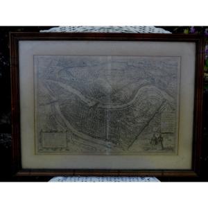
Road Map Of The City And Suburbs Of Paris, Louis-charles Desnos (1787)
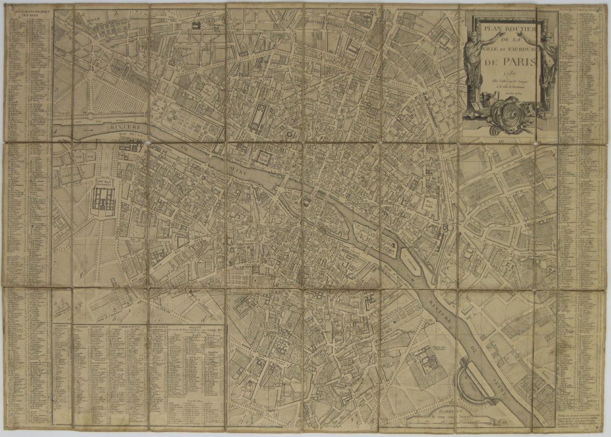
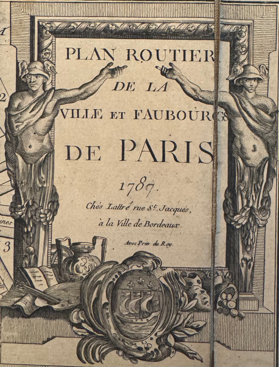


Map of the French capital Paris and its environs published by cartographer Louis-Charles Desnos in 1787.
Louis Charles Desnos (1725-1805) was the son of a cloth merchant from Pont-Sainte-Maxence and worked as a typographer at the age of 20. In 1769, he was appointed a geographical engineer by the Paris city hall. He became one of the leading producers of cartographic instruments and held the coveted position of royal globe maker to King Christian VII of Denmark. In this capacity, he received an annual allowance of 500 pounds sterling. In return, he sent the monarch dozens of maps, books, and atlases each year. He was also a publisher whose work was considerable. This brought him into conflict with other French cartographers who criticized him for a lack of professional ethics. In 1771, he published for the first time an atlas containing 158 copperplate engravings and color road maps.
This road map of the French capital, Paris, dates from 1787 and was printed in 24 parts and pasted on linen. The plan gives a good idea of the twenty arrondissements and fourteen suburbs that were delimited by the so-called Wall of the Farmers General. This was a twenty-three-kilometer-long wall built between 1784 and 1787. The city then had about half a million inhabitants, making it the second largest city on the European continent after London. Condition: This map is in good condition with normal signs of wear.
Explore similar pieces and discover your ideal find:
Old Maps